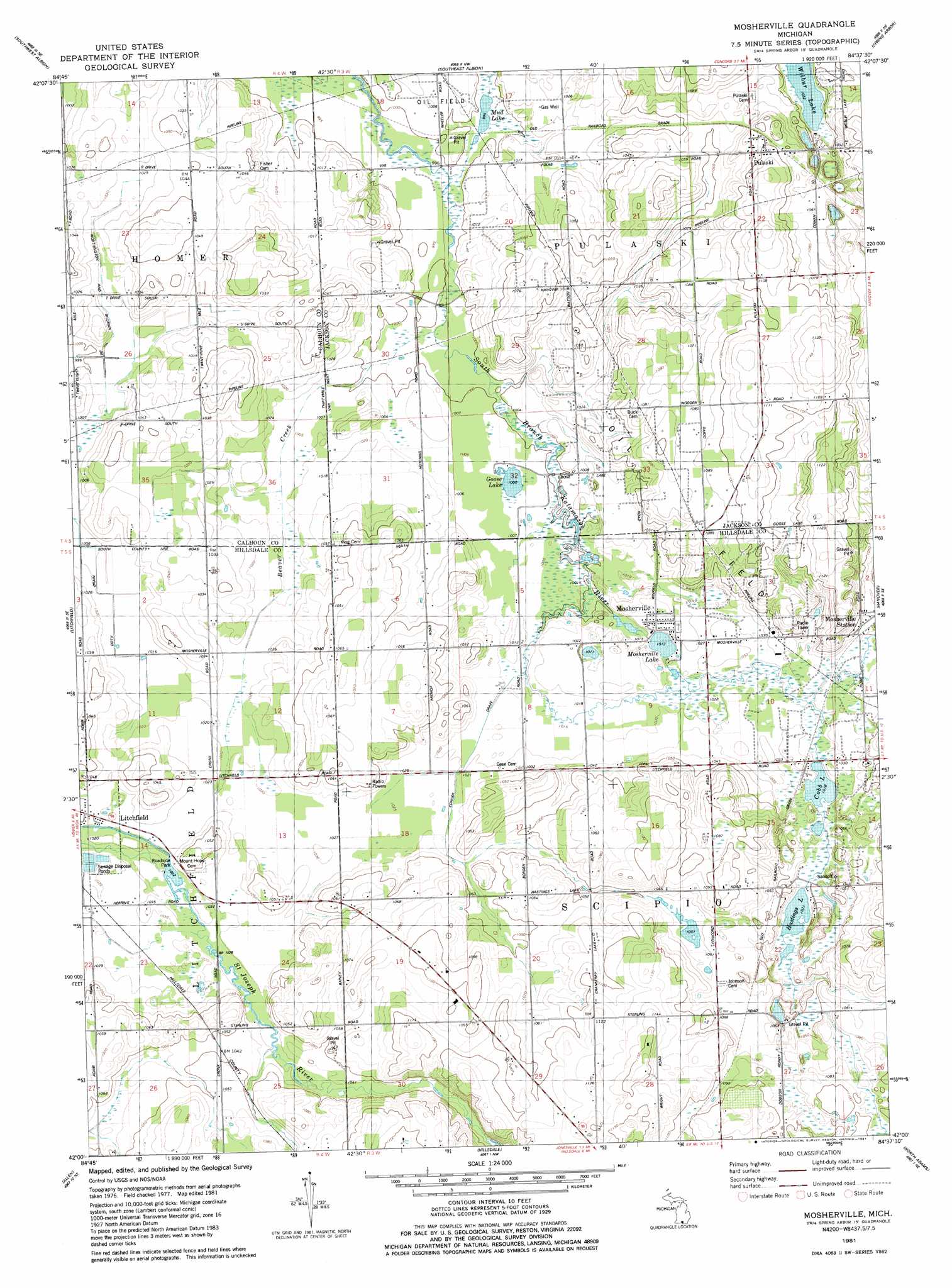
Mosherville Topo Map Michigan
To zoom in, hover over the map of Mosherville
USGS Topo Quad 42084a6 - 1:24,000 scale
| Topo Map Name: | Mosherville |
| USGS Topo Quad ID: | 42084a6 |
| Print Size: | ca. 21 1/4" wide x 27" high |
| Southeast Coordinates: | 42° N latitude / 84.625° W longitude |
| Map Center Coordinates: | 42.0625° N latitude / 84.6875° W longitude |
| U.S. State: | MI |
| Filename: | o42084a6.jpg |
| Download Map JPG Image: | Mosherville topo map 1:24,000 scale |
| Map Type: | Topographic |
| Topo Series: | 7.5´ |
| Map Scale: | 1:24,000 |
| Source of Map Images: | United States Geological Survey (USGS) |
| Alternate Map Versions: |
Mosherville MI 1981, updated 1981 Download PDF Buy paper map Mosherville MI 2011 Download PDF Buy paper map Mosherville MI 2014 Download PDF Buy paper map Mosherville MI 2017 Download PDF Buy paper map |
1:24,000 Topo Quads surrounding Mosherville
Marshall |
Northwest Albion |
Northeast Albion |
Parma |
Jackson North |
Lyon Lake |
Southwest Albion |
Southeast Albion |
Spring Arbor |
Jackson South |
Tekonsha |
Litchfield |
Mosherville |
Hanover |
Somerset Center |
Coldwater East |
Allen |
Hillsdale |
North Adams |
Wheatland |
California |
Camden |
Reading |
Frontier |
Pittsford |
> Back to 42084a1 at 1:100,000 scale
> Back to 42084a1 at 1:250,000 scale
> Back to U.S. Topo Maps home
Mosherville topo map: Gazetteer
Mosherville: Canals
Conger Drain elevation 310m 1017′Mosherville: Lakes
Cobb Lake elevation 310m 1017′Goose Lake elevation 305m 1000′
Hastings Lake elevation 311m 1020′
Mosherville Lake elevation 309m 1013′
Mud Lake elevation 303m 994′
Wilbur Lake elevation 314m 1030′
Mosherville: Parks
Mosherville Church Historical Marker elevation 314m 1030′Mosherville School Historical Marker elevation 314m 1030′
Mosherville: Populated Places
Mosherville elevation 314m 1030′Pulaski elevation 331m 1085′
Mosherville: Post Offices
Mosherville Post Office elevation 314m 1030′Mosherville: Streams
Beaver Creek elevation 303m 994′Mosherville digital topo map on disk
Buy this Mosherville topo map showing relief, roads, GPS coordinates and other geographical features, as a high-resolution digital map file on DVD:
Northern Illinois, Northern Indiana & Southwestern Michigan
Buy digital topo maps: Northern Illinois, Northern Indiana & Southwestern Michigan