Parma Topo Map Michigan
To zoom in, hover over the map of Parma
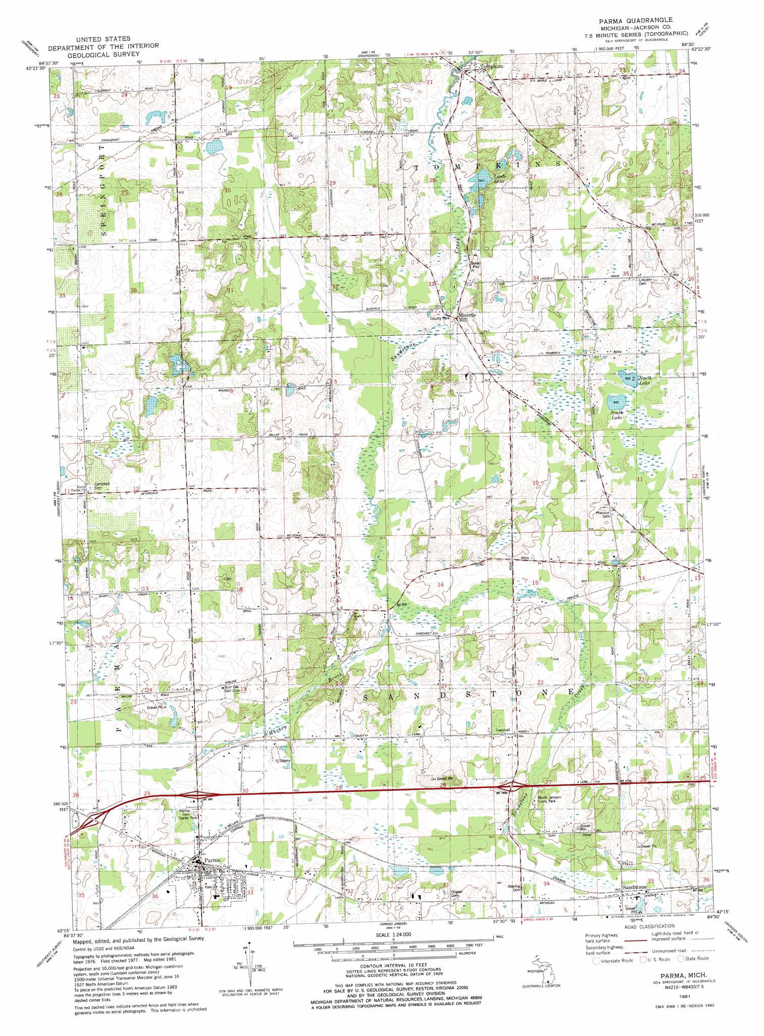
USGS Topo Quad 42084c5 - 1:24,000 scale
| Topo Map Name: | Parma |
| USGS Topo Quad ID: | 42084c5 |
| Print Size: | ca. 21 1/4" wide x 27" high |
| Southeast Coordinates: | 42.25° N latitude / 84.5° W longitude |
| Map Center Coordinates: | 42.3125° N latitude / 84.5625° W longitude |
| U.S. State: | MI |
| Filename: | o42084c5.jpg |
| Download Map JPG Image: | Parma topo map 1:24,000 scale |
| Map Type: | Topographic |
| Topo Series: | 7.5´ |
| Map Scale: | 1:24,000 |
| Source of Map Images: | United States Geological Survey (USGS) |
| Alternate Map Versions: |
Parma MI 1981, updated 1981 Download PDF Buy paper map Parma MI 2011 Download PDF Buy paper map Parma MI 2014 Download PDF Buy paper map Parma MI 2017 Download PDF Buy paper map |
1:24,000 Topo Quads surrounding Parma
Charlotte |
Eaton Rapids |
Aurelius |
Mason |
Dansville |
Duck Lake |
Springport |
Onondaga |
Leslie |
Pleasant Lake |
Northwest Albion |
Northeast Albion |
Parma |
Jackson North |
Gilletts Lake |
Southwest Albion |
Southeast Albion |
Spring Arbor |
Jackson South |
Michigan Center |
Litchfield |
Mosherville |
Hanover |
Somerset Center |
Cement City |
> Back to 42084a1 at 1:100,000 scale
> Back to 42084a1 at 1:250,000 scale
> Back to U.S. Topo Maps home
Parma topo map: Gazetteer
Parma: Lakes
Lords Lake elevation 285m 935′North Lake elevation 291m 954′
South Lake elevation 291m 954′
Parma: Parks
Jackson County Park elevation 277m 908′North Jackson Lions Park elevation 292m 958′
Parma: Populated Places
Minards Mill elevation 286m 938′Parma elevation 305m 1000′
Sandstone elevation 296m 971′
Tompkins elevation 279m 915′
Parma: Streams
Indian Brook elevation 289m 948′Mackey Brook elevation 282m 925′
Parma digital topo map on disk
Buy this Parma topo map showing relief, roads, GPS coordinates and other geographical features, as a high-resolution digital map file on DVD:
Northern Illinois, Northern Indiana & Southwestern Michigan
Buy digital topo maps: Northern Illinois, Northern Indiana & Southwestern Michigan