Pleasant Lake Topo Map Michigan
To zoom in, hover over the map of Pleasant Lake
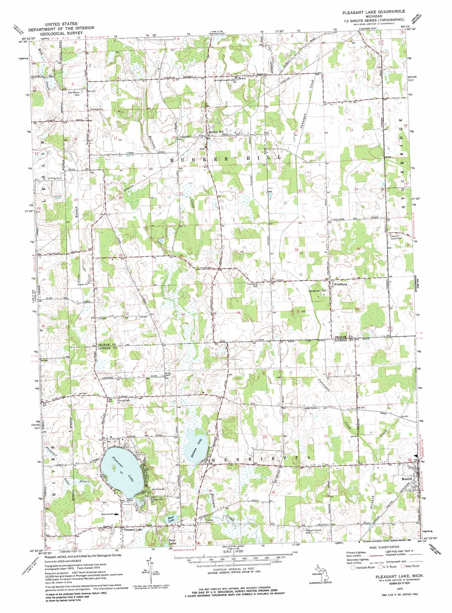
USGS Topo Quad 42084d3 - 1:24,000 scale
| Topo Map Name: | Pleasant Lake |
| USGS Topo Quad ID: | 42084d3 |
| Print Size: | ca. 21 1/4" wide x 27" high |
| Southeast Coordinates: | 42.375° N latitude / 84.25° W longitude |
| Map Center Coordinates: | 42.4375° N latitude / 84.3125° W longitude |
| U.S. State: | MI |
| Filename: | o42084d3.jpg |
| Download Map JPG Image: | Pleasant Lake topo map 1:24,000 scale |
| Map Type: | Topographic |
| Topo Series: | 7.5´ |
| Map Scale: | 1:24,000 |
| Source of Map Images: | United States Geological Survey (USGS) |
| Alternate Map Versions: |
Pleasant Lake MI 1970, updated 1973 Download PDF Buy paper map Pleasant Lake MI 1970, updated 1986 Download PDF Buy paper map Pleasant Lake MI 2011 Download PDF Buy paper map Pleasant Lake MI 2014 Download PDF Buy paper map Pleasant Lake MI 2017 Download PDF Buy paper map |
1:24,000 Topo Quads surrounding Pleasant Lake
Lansing South |
East Lansing |
Williamston |
Webberville |
Fowlerville |
Aurelius |
Mason |
Dansville |
Millville |
Parkers Corners |
Onondaga |
Leslie |
Pleasant Lake |
Stockbridge |
Gregory |
Parma |
Jackson North |
Gilletts Lake |
Grass Lake |
Chelsea |
Spring Arbor |
Jackson South |
Michigan Center |
Norvell |
Manchester |
> Back to 42084a1 at 1:100,000 scale
> Back to 42084a1 at 1:250,000 scale
> Back to U.S. Topo Maps home
Pleasant Lake topo map: Gazetteer
Pleasant Lake: Lakes
Batteese Lake elevation 279m 915′Mud Lake elevation 282m 925′
Pleasant Lake elevation 281m 921′
Pleasant Lake: Parks
Wilderness Park elevation 283m 928′Pleasant Lake: Populated Places
Bunker Hill elevation 287m 941′Fitchburg elevation 287m 941′
Munith elevation 286m 938′
Pleasant Lake elevation 291m 954′
Pleasant Lake: Streams
Cahaogan Creek elevation 277m 908′Pleasant Lake digital topo map on disk
Buy this Pleasant Lake topo map showing relief, roads, GPS coordinates and other geographical features, as a high-resolution digital map file on DVD:
Northern Illinois, Northern Indiana & Southwestern Michigan
Buy digital topo maps: Northern Illinois, Northern Indiana & Southwestern Michigan