Leslie Topo Map Michigan
To zoom in, hover over the map of Leslie
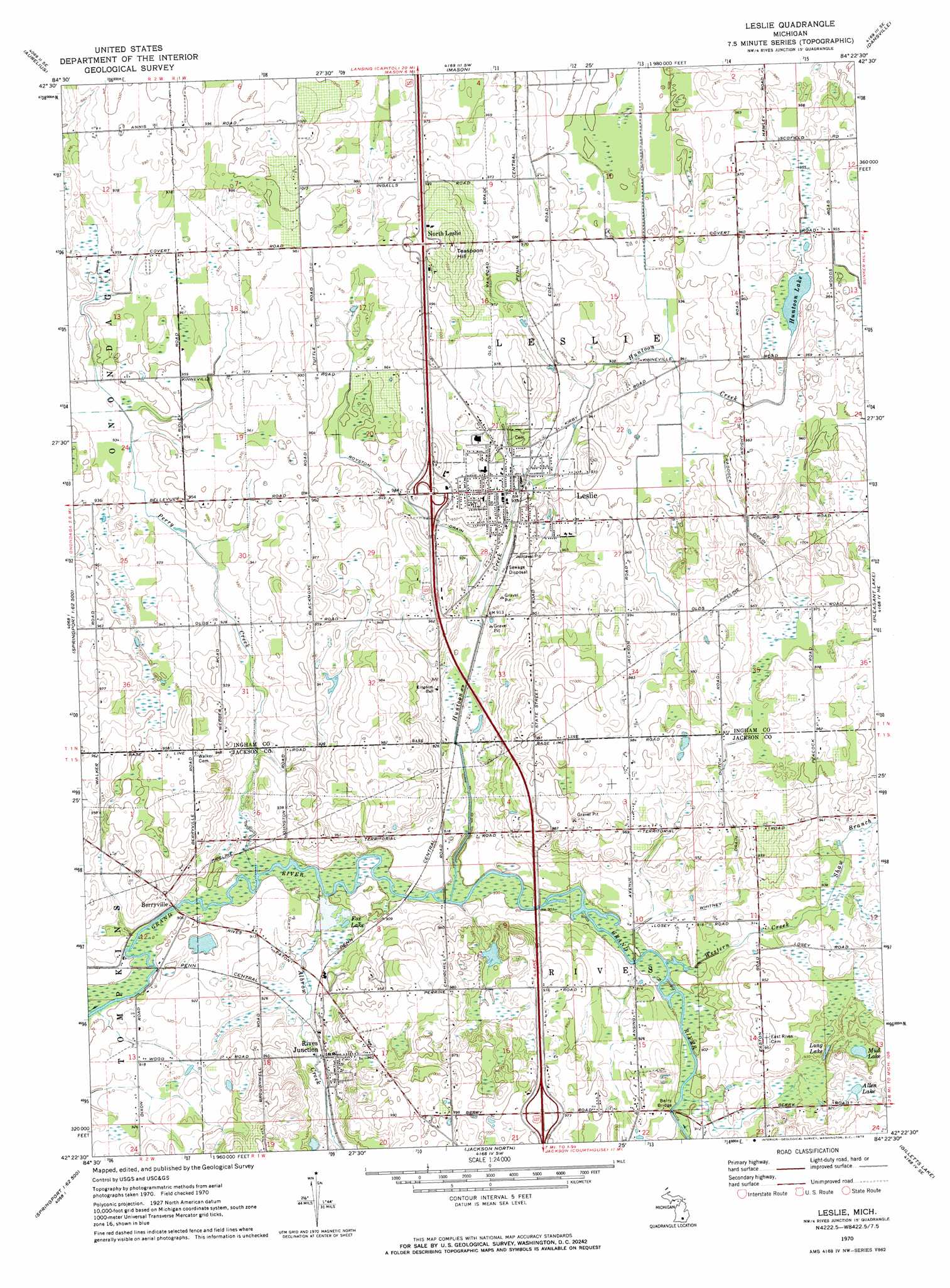
USGS Topo Quad 42084d4 - 1:24,000 scale
| Topo Map Name: | Leslie |
| USGS Topo Quad ID: | 42084d4 |
| Print Size: | ca. 21 1/4" wide x 27" high |
| Southeast Coordinates: | 42.375° N latitude / 84.375° W longitude |
| Map Center Coordinates: | 42.4375° N latitude / 84.4375° W longitude |
| U.S. State: | MI |
| Filename: | o42084d4.jpg |
| Download Map JPG Image: | Leslie topo map 1:24,000 scale |
| Map Type: | Topographic |
| Topo Series: | 7.5´ |
| Map Scale: | 1:24,000 |
| Source of Map Images: | United States Geological Survey (USGS) |
| Alternate Map Versions: |
Leslie MI 1970, updated 1973 Download PDF Buy paper map Leslie MI 2011 Download PDF Buy paper map Leslie MI 2014 Download PDF Buy paper map Leslie MI 2017 Download PDF Buy paper map |
1:24,000 Topo Quads surrounding Leslie
Dimondale |
Lansing South |
East Lansing |
Williamston |
Webberville |
Eaton Rapids |
Aurelius |
Mason |
Dansville |
Millville |
Springport |
Onondaga |
Leslie |
Pleasant Lake |
Stockbridge |
Northeast Albion |
Parma |
Jackson North |
Gilletts Lake |
Grass Lake |
Southeast Albion |
Spring Arbor |
Jackson South |
Michigan Center |
Norvell |
> Back to 42084a1 at 1:100,000 scale
> Back to 42084a1 at 1:250,000 scale
> Back to U.S. Topo Maps home
Leslie topo map: Gazetteer
Leslie: Bridges
Berry Bridge elevation 274m 898′Leslie: Canals
Craddock Drain elevation 289m 948′Royston Drain elevation 284m 931′
Leslie: Lakes
Allen Lake elevation 280m 918′Fox Lake elevation 274m 898′
Hunton Lake elevation 288m 944′
Long Lake elevation 281m 921′
Mud Lake elevation 280m 918′
Leslie: Populated Places
Berryville elevation 284m 931′Leslie elevation 285m 935′
North Leslie elevation 310m 1017′
Rives Junction elevation 283m 928′
Leslie: Streams
Albrow Creek elevation 274m 898′Hunton Creek elevation 274m 898′
Perry Creek elevation 274m 898′
Pleasant Lake Drain elevation 277m 908′
Shaw Branch elevation 277m 908′
Western Creek elevation 274m 898′
Whitney Drain elevation 274m 898′
Leslie: Summits
Teaspoon Hill elevation 319m 1046′Leslie digital topo map on disk
Buy this Leslie topo map showing relief, roads, GPS coordinates and other geographical features, as a high-resolution digital map file on DVD:
Northern Illinois, Northern Indiana & Southwestern Michigan
Buy digital topo maps: Northern Illinois, Northern Indiana & Southwestern Michigan