East Lansing Topo Map Michigan
To zoom in, hover over the map of East Lansing
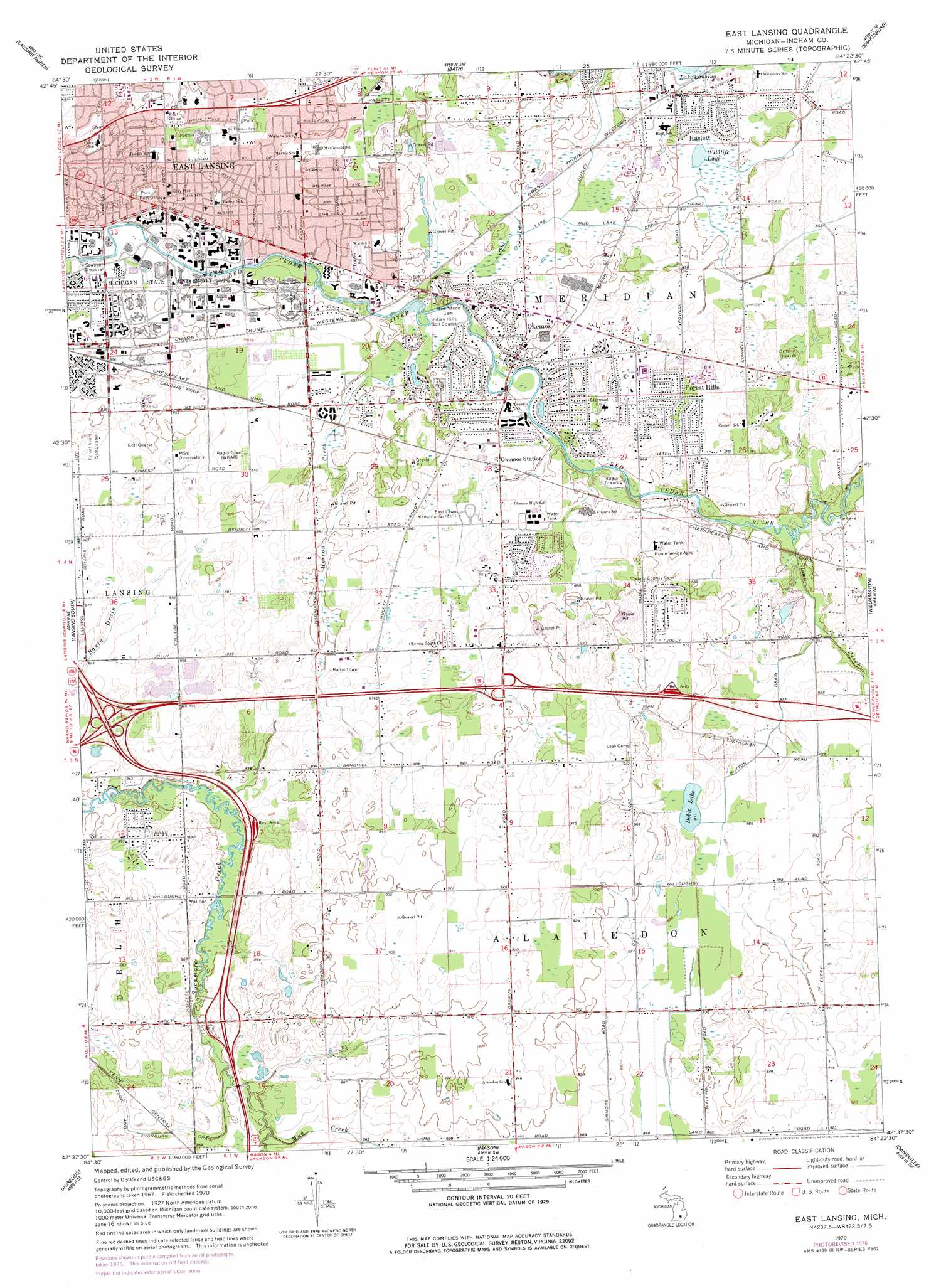
USGS Topo Quad 42084f4 - 1:24,000 scale
| Topo Map Name: | East Lansing |
| USGS Topo Quad ID: | 42084f4 |
| Print Size: | ca. 21 1/4" wide x 27" high |
| Southeast Coordinates: | 42.625° N latitude / 84.375° W longitude |
| Map Center Coordinates: | 42.6875° N latitude / 84.4375° W longitude |
| U.S. State: | MI |
| Filename: | o42084f4.jpg |
| Download Map JPG Image: | East Lansing topo map 1:24,000 scale |
| Map Type: | Topographic |
| Topo Series: | 7.5´ |
| Map Scale: | 1:24,000 |
| Source of Map Images: | United States Geological Survey (USGS) |
| Alternate Map Versions: |
East Lansing MI 1970, updated 1973 Download PDF Buy paper map East Lansing MI 1970, updated 1978 Download PDF Buy paper map East Lansing MI 1970, updated 1978 Download PDF Buy paper map East Lansing MI 2011 Download PDF Buy paper map East Lansing MI 2014 Download PDF Buy paper map East Lansing MI 2017 Download PDF Buy paper map |
1:24,000 Topo Quads surrounding East Lansing
Riley |
Saint Johns South |
Price |
Laingsburg |
Owosso South |
Wacousta |
Lansing North |
Bath |
Shaftsburg |
Perry |
Dimondale |
Lansing South |
East Lansing |
Williamston |
Webberville |
Eaton Rapids |
Aurelius |
Mason |
Dansville |
Millville |
Springport |
Onondaga |
Leslie |
Pleasant Lake |
Stockbridge |
> Back to 42084e1 at 1:100,000 scale
> Back to 42084a1 at 1:250,000 scale
> Back to U.S. Topo Maps home
East Lansing topo map: Gazetteer
East Lansing: Airports
Lakeside Airport elevation 264m 866′State Police Headquarters Heliport elevation 258m 846′
East Lansing: Canals
Button Drain elevation 265m 869′Mud Lake Drain elevation 256m 839′
East Lansing: Lakes
Dobie Lake elevation 265m 869′Wildlife Lake elevation 256m 839′
East Lansing: Populated Places
East Lansing elevation 260m 853′Forest Hills elevation 268m 879′
Haslett elevation 264m 866′
Okemos elevation 256m 839′
East Lansing: Streams
Cook and Thorburn Drain elevation 259m 849′Herron Creek elevation 256m 839′
Mud Creek elevation 259m 849′
Pine Lake Outlet elevation 253m 830′
Sloan Creek elevation 256m 839′
East Lansing digital topo map on disk
Buy this East Lansing topo map showing relief, roads, GPS coordinates and other geographical features, as a high-resolution digital map file on DVD:
Northern Illinois, Northern Indiana & Southwestern Michigan
Buy digital topo maps: Northern Illinois, Northern Indiana & Southwestern Michigan