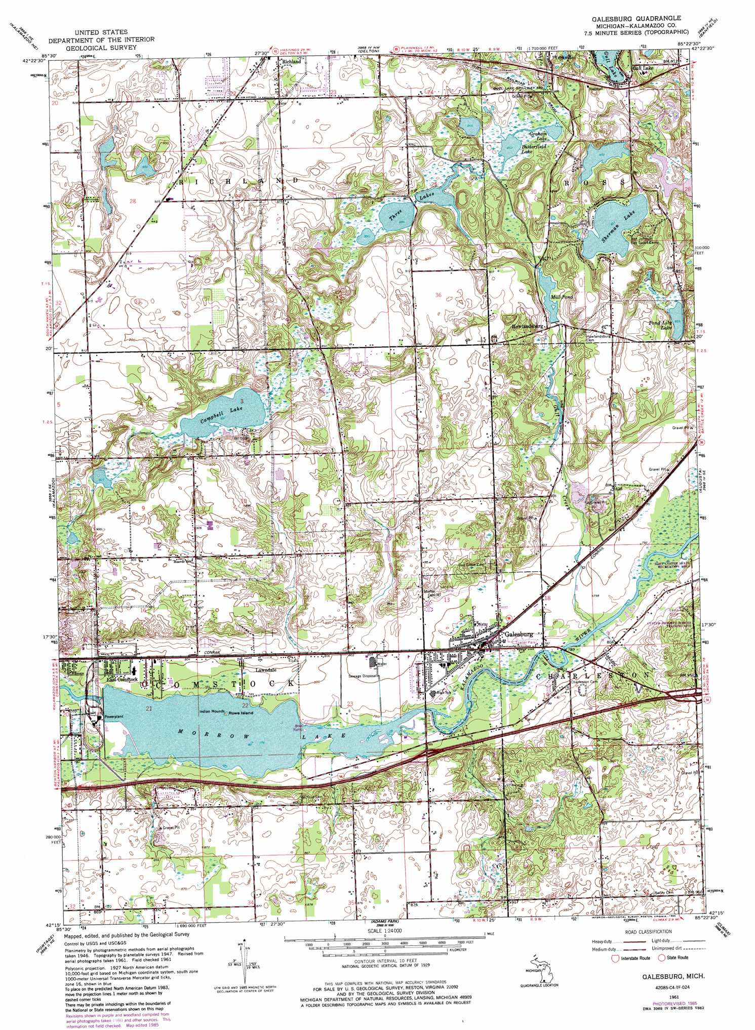
Galesburg Topo Map Michigan
To zoom in, hover over the map of Galesburg
USGS Topo Quad 42085c4 - 1:24,000 scale
| Topo Map Name: | Galesburg |
| USGS Topo Quad ID: | 42085c4 |
| Print Size: | ca. 21 1/4" wide x 27" high |
| Southeast Coordinates: | 42.25° N latitude / 85.375° W longitude |
| Map Center Coordinates: | 42.3125° N latitude / 85.4375° W longitude |
| U.S. State: | MI |
| Filename: | o42085c4.jpg |
| Download Map JPG Image: | Galesburg topo map 1:24,000 scale |
| Map Type: | Topographic |
| Topo Series: | 7.5´ |
| Map Scale: | 1:24,000 |
| Source of Map Images: | United States Geological Survey (USGS) |
| Alternate Map Versions: |
Galesburg MI 1947, updated 1955 Download PDF Buy paper map Galesburg MI 1961, updated 1962 Download PDF Buy paper map Galesburg MI 1961, updated 1973 Download PDF Buy paper map Galesburg MI 1961, updated 1982 Download PDF Buy paper map Galesburg MI 1961, updated 1985 Download PDF Buy paper map Galesburg MI 1961, updated 1985 Download PDF Buy paper map Galesburg MI 2011 Download PDF Buy paper map Galesburg MI 2014 Download PDF Buy paper map Galesburg MI 2016 Download PDF Buy paper map |
1:24,000 Topo Quads surrounding Galesburg
Martin |
Orangeville |
Cloverdale |
Dowling |
Maple Grove |
Otsego |
Kalamazoo Ne |
Delton |
Banfield |
Bedford |
Kalamazoo Sw |
Kalamazoo |
Galesburg |
Augusta |
Battle Creek |
Schoolcraft Nw |
Portage |
Adams Park |
Climax |
East Leroy |
Schoolcraft |
Vicksburg |
Mendon |
Leonidas |
Union City |
> Back to 42085a1 at 1:100,000 scale
> Back to 42084a1 at 1:250,000 scale
> Back to U.S. Topo Maps home
Galesburg topo map: Gazetteer
Galesburg: Airports
Larry D Boven Airport elevation 261m 856′Shafter Airport elevation 250m 820′
Galesburg: Crossings
Interchange 85 elevation 251m 823′Interchange 88 elevation 289m 948′
Galesburg: Islands
Rowe Island elevation 236m 774′Galesburg: Lakes
Butterfield Lake elevation 259m 849′Campbell Lake elevation 253m 830′
Graham Lake elevation 259m 849′
Pond Lily Lake elevation 254m 833′
Sherman Lake elevation 259m 849′
Three Lakes elevation 259m 849′
Galesburg: Parks
Congregational United Church of Christ Historical Marker elevation 242m 793′Crum Park elevation 256m 839′
Kalamazoo Region Historical Marker elevation 242m 793′
Galesburg: Populated Places
East Comstock elevation 241m 790′Galesburg elevation 241m 790′
Gull Lake elevation 275m 902′
Howlandsburg elevation 260m 853′
Lawndale elevation 242m 793′
Galesburg: Reservoirs
Mill Pond elevation 256m 839′Morrow Lake elevation 236m 774′
Galesburg: Streams
Gull Creek elevation 238m 780′Galesburg digital topo map on disk
Buy this Galesburg topo map showing relief, roads, GPS coordinates and other geographical features, as a high-resolution digital map file on DVD:
Northern Illinois, Northern Indiana & Southwestern Michigan
Buy digital topo maps: Northern Illinois, Northern Indiana & Southwestern Michigan