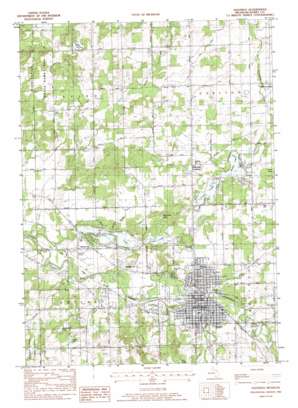
Hastings Topo Map Michigan
To zoom in, hover over the map of Hastings
USGS Topo Quad 42085f3 - 1:24,000 scale
| Topo Map Name: | Hastings |
| USGS Topo Quad ID: | 42085f3 |
| Print Size: | ca. 21 1/4" wide x 27" high |
| Southeast Coordinates: | 42.625° N latitude / 85.25° W longitude |
| Map Center Coordinates: | 42.6875° N latitude / 85.3125° W longitude |
| U.S. State: | MI |
| Filename: | o42085f3.jpg |
| Download Map JPG Image: | Hastings topo map 1:24,000 scale |
| Map Type: | Topographic |
| Topo Series: | 7.5´ |
| Map Scale: | 1:24,000 |
| Source of Map Images: | United States Geological Survey (USGS) |
| Alternate Map Versions: |
Hastings MI 1982, updated 1982 Download PDF Buy paper map Hastings MI 2011 Download PDF Buy paper map Hastings MI 2014 Download PDF Buy paper map Hastings MI 2016 Download PDF Buy paper map |
1:24,000 Topo Quads surrounding Hastings
> Back to 42085e1 at 1:100,000 scale
> Back to 42084a1 at 1:250,000 scale
> Back to U.S. Topo Maps home
Hastings topo map: Gazetteer
Hastings: Airports
Hastings Airport elevation 244m 800′Hastings: Canals
Bird Drain elevation 250m 820′Bullhead Drain elevation 257m 843′
Willow Marsh Drain elevation 251m 823′
Hastings: Lakes
Algonquin Lake elevation 235m 770′Bear Hole Lake elevation 243m 797′
Carter Lake elevation 235m 770′
Laubaugh Lake elevation 272m 892′
Leach Lake elevation 243m 797′
Middle Lake elevation 243m 797′
Purdy Lake elevation 267m 875′
Sugarbush Lake elevation 264m 866′
Hastings: Parks
Bob King Park elevation 263m 862′Carlton Township Hall Historical Marker elevation 253m 830′
Central School Auditorium Historical Marker elevation 251m 823′
Central School Historical Marker elevation 251m 823′
Early Hastings Historical Marker elevation 244m 800′
First Ward Park elevation 243m 797′
Fish Hatchery Park elevation 244m 800′
George W Lowry House Historical Marker elevation 242m 793′
Governor Kim Sigler Historical Marker elevation 244m 800′
Hastings Mutual Insurance Company Historical Marker elevation 263m 862′
Methodist Episcopal Church Historical Marker elevation 245m 803′
Railroad Depot Historical Marker elevation 240m 787′
Second Ward Park elevation 255m 836′
Striker House Historical Marker elevation 242m 793′
Tyden Park elevation 238m 780′
Hastings: Populated Places
Algonquin Lake Trailer Court elevation 240m 787′Carlton elevation 253m 830′
Hanover Village Apartments Mobile Home Park elevation 256m 839′
Hastings elevation 247m 810′
Merlino's Hidden Valley Estates Mobile Home Park elevation 250m 820′
Welcome Corner elevation 258m 846′
Hastings: Post Offices
Carlton Center Post Office (historical) elevation 253m 830′Hastings Post Office elevation 239m 784′
North Irving Post Office (historical) elevation 257m 843′
Hastings: Streams
Butler Creek elevation 237m 777′Fall Creek elevation 238m 780′
Hastings digital topo map on disk
Buy this Hastings topo map showing relief, roads, GPS coordinates and other geographical features, as a high-resolution digital map file on DVD:
Northern Illinois, Northern Indiana & Southwestern Michigan
Buy digital topo maps: Northern Illinois, Northern Indiana & Southwestern Michigan


