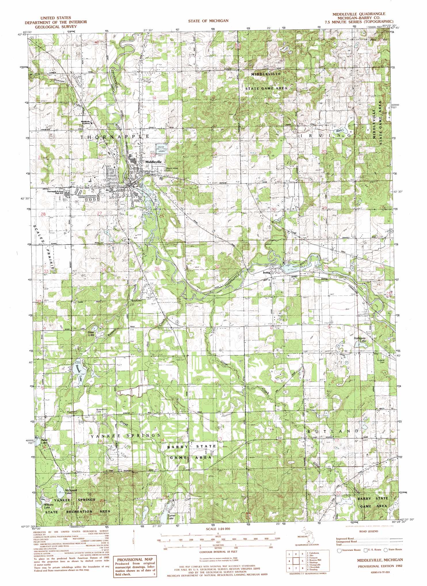
Middleville Topo Map Michigan
To zoom in, hover over the map of Middleville
USGS Topo Quad 42085f4 - 1:24,000 scale
| Topo Map Name: | Middleville |
| USGS Topo Quad ID: | 42085f4 |
| Print Size: | ca. 21 1/4" wide x 27" high |
| Southeast Coordinates: | 42.625° N latitude / 85.375° W longitude |
| Map Center Coordinates: | 42.6875° N latitude / 85.4375° W longitude |
| U.S. State: | MI |
| Filename: | o42085f4.jpg |
| Download Map JPG Image: | Middleville topo map 1:24,000 scale |
| Map Type: | Topographic |
| Topo Series: | 7.5´ |
| Map Scale: | 1:24,000 |
| Source of Map Images: | United States Geological Survey (USGS) |
| Alternate Map Versions: |
Middleville MI 1982, updated 1982 Download PDF Buy paper map Middleville MI 1982, updated 1982 Download PDF Buy paper map Middleville MI 2011 Download PDF Buy paper map Middleville MI 2014 Download PDF Buy paper map Middleville MI 2016 Download PDF Buy paper map |
1:24,000 Topo Quads surrounding Middleville
Grand Rapids West |
Grand Rapids East |
Cascade |
Lowell |
Saranac |
Cutlerville |
Caledonia |
Alto |
Freeport |
Lake Odessa |
Wayland |
Bowens Mill |
Middleville |
Hastings |
Woodland |
Martin |
Orangeville |
Cloverdale |
Dowling |
Maple Grove |
Otsego |
Kalamazoo Ne |
Delton |
Banfield |
Bedford |
> Back to 42085e1 at 1:100,000 scale
> Back to 42084a1 at 1:250,000 scale
> Back to U.S. Topo Maps home
Middleville topo map: Gazetteer
Middleville: Lakes
Bassett Lake elevation 224m 734′Black Lake elevation 260m 853′
Hathaway Lake elevation 241m 790′
McDonald Lake elevation 229m 751′
Shaw Lake elevation 224m 734′
Turner Lake elevation 244m 800′
Williams Lake elevation 226m 741′
Middleville: Parks
John Carveth House Historical Marker elevation 235m 770′Scale's Prairie Historical Marker elevation 252m 826′
Middleville: Populated Places
Cider Mill Village Mobile Home Community elevation 230m 754′Irving elevation 229m 751′
Middleville elevation 233m 764′
Middleville: Post Offices
Irving Post Office (historical) elevation 229m 751′Middleville Post Office elevation 235m 770′
Middleville: Streams
Bassett Creek elevation 219m 718′Duncan Creek elevation 215m 705′
Glass Creek elevation 219m 718′
Hill Creek elevation 218m 715′
Turner Creek elevation 224m 734′
Middleville digital topo map on disk
Buy this Middleville topo map showing relief, roads, GPS coordinates and other geographical features, as a high-resolution digital map file on DVD:
Northern Illinois, Northern Indiana & Southwestern Michigan
Buy digital topo maps: Northern Illinois, Northern Indiana & Southwestern Michigan