Lake Odessa Topo Map Michigan
To zoom in, hover over the map of Lake Odessa
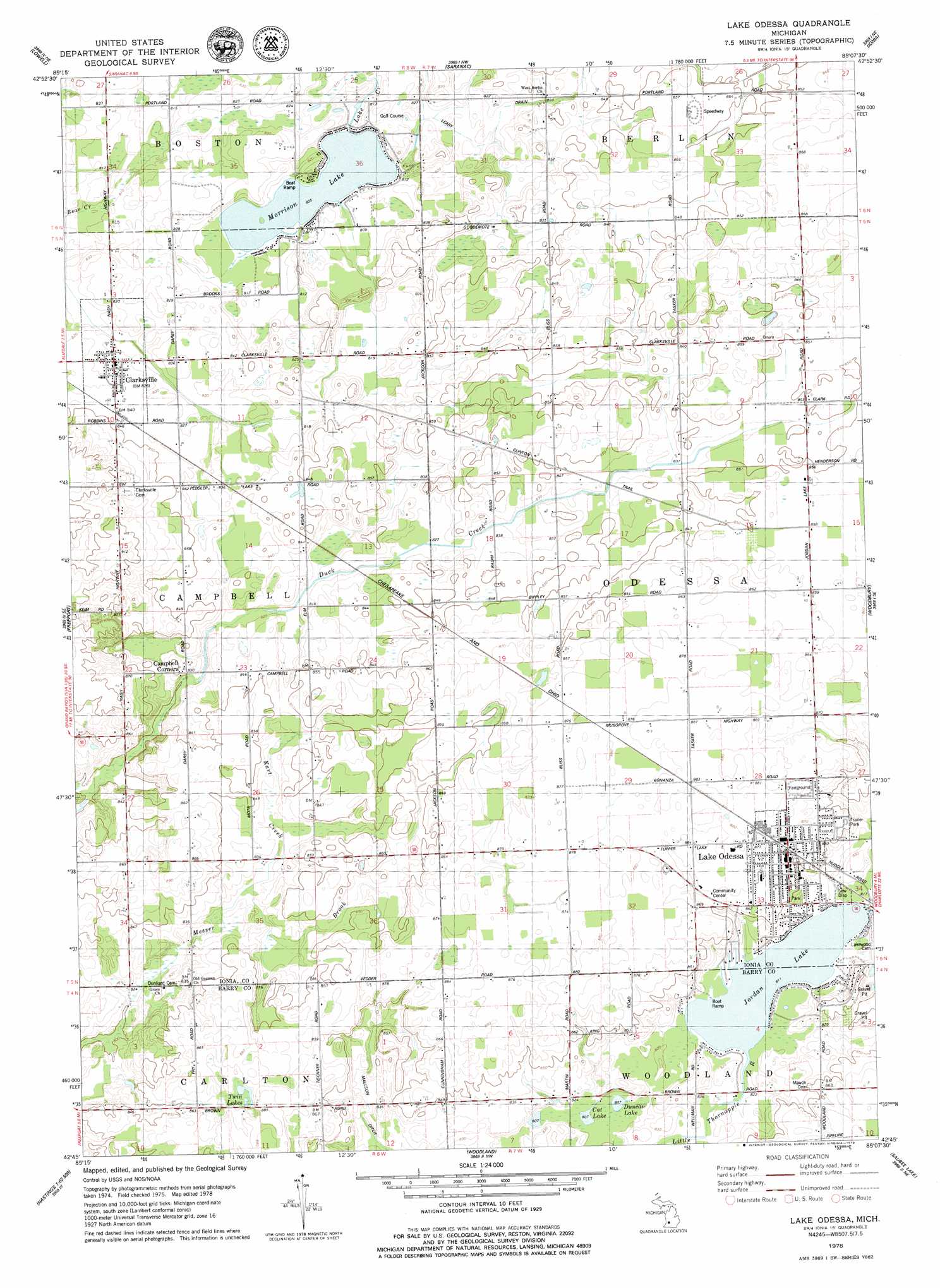
USGS Topo Quad 42085g2 - 1:24,000 scale
| Topo Map Name: | Lake Odessa |
| USGS Topo Quad ID: | 42085g2 |
| Print Size: | ca. 21 1/4" wide x 27" high |
| Southeast Coordinates: | 42.75° N latitude / 85.125° W longitude |
| Map Center Coordinates: | 42.8125° N latitude / 85.1875° W longitude |
| U.S. State: | MI |
| Filename: | o42085g2.jpg |
| Download Map JPG Image: | Lake Odessa topo map 1:24,000 scale |
| Map Type: | Topographic |
| Topo Series: | 7.5´ |
| Map Scale: | 1:24,000 |
| Source of Map Images: | United States Geological Survey (USGS) |
| Alternate Map Versions: |
Lake Odessa MI 1978, updated 1979 Download PDF Buy paper map Lake Odessa MI 2011 Download PDF Buy paper map Lake Odessa MI 2014 Download PDF Buy paper map Lake Odessa MI 2016 Download PDF Buy paper map |
1:24,000 Topo Quads surrounding Lake Odessa
Cannonsburg |
Smyrna |
Belding |
Shiloh |
Palo |
Cascade |
Lowell |
Saranac |
Ionia |
Portland North |
Alto |
Freeport |
Lake Odessa |
Woodbury |
Portland South |
Middleville |
Hastings |
Woodland |
Saubee Lake |
Hoytville |
Cloverdale |
Dowling |
Maple Grove |
Nashville |
Chester |
> Back to 42085e1 at 1:100,000 scale
> Back to 42084a1 at 1:250,000 scale
> Back to U.S. Topo Maps home
Lake Odessa topo map: Gazetteer
Lake Odessa: Canals
Mallson Ditch elevation 249m 816′Lake Odessa: Lakes
Cat Lake elevation 246m 807′Duncan Lake elevation 246m 807′
Jordan Lake elevation 247m 810′
Morrison Lake elevation 245m 803′
Twin Lakes elevation 262m 859′
Lake Odessa: Parks
Roadside Table Historical Marker elevation 255m 836′Lake Odessa: Populated Places
Campbell Corners elevation 253m 830′Clarksville elevation 251m 823′
Lake Odessa elevation 263m 862′
Lake Odessa: Post Offices
Algodon Post Office (historical) elevation 260m 853′Campbell Post Office (historical) elevation 255m 836′
Clarksville Post Office elevation 251m 823′
Lake Odessa Post Office elevation 261m 856′
South Cass Post Office (historical) elevation 262m 859′
Lake Odessa: Streams
Kart Creek elevation 249m 816′Woodland Creek elevation 248m 813′
Lake Odessa digital topo map on disk
Buy this Lake Odessa topo map showing relief, roads, GPS coordinates and other geographical features, as a high-resolution digital map file on DVD:
Northern Illinois, Northern Indiana & Southwestern Michigan
Buy digital topo maps: Northern Illinois, Northern Indiana & Southwestern Michigan