Caledonia Topo Map Michigan
To zoom in, hover over the map of Caledonia
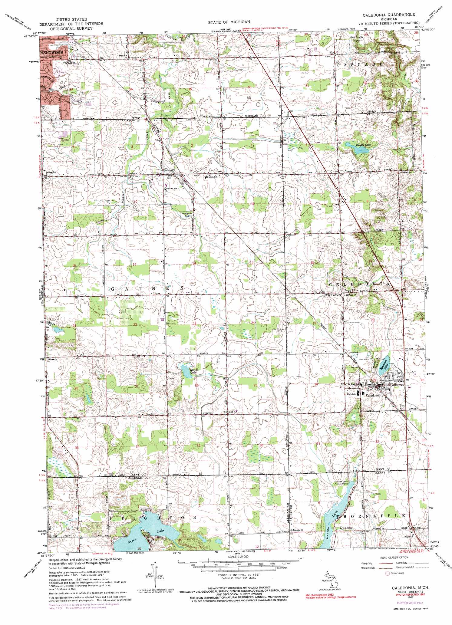
USGS Topo Quad 42085g5 - 1:24,000 scale
| Topo Map Name: | Caledonia |
| USGS Topo Quad ID: | 42085g5 |
| Print Size: | ca. 21 1/4" wide x 27" high |
| Southeast Coordinates: | 42.75° N latitude / 85.5° W longitude |
| Map Center Coordinates: | 42.8125° N latitude / 85.5625° W longitude |
| U.S. State: | MI |
| Filename: | o42085g5.jpg |
| Download Map JPG Image: | Caledonia topo map 1:24,000 scale |
| Map Type: | Topographic |
| Topo Series: | 7.5´ |
| Map Scale: | 1:24,000 |
| Source of Map Images: | United States Geological Survey (USGS) |
| Alternate Map Versions: |
Caledonia MI 1967, updated 1969 Download PDF Buy paper map Caledonia MI 1967, updated 1973 Download PDF Buy paper map Caledonia MI 1967, updated 1973 Download PDF Buy paper map Caledonia MI 2011 Download PDF Buy paper map Caledonia MI 2014 Download PDF Buy paper map Caledonia MI 2016 Download PDF Buy paper map |
1:24,000 Topo Quads surrounding Caledonia
Marne |
Cedar Springs Sw |
Rockford |
Cannonsburg |
Smyrna |
Grandville |
Grand Rapids West |
Grand Rapids East |
Cascade |
Lowell |
Hudsonville East |
Cutlerville |
Caledonia |
Alto |
Freeport |
Burnips |
Wayland |
Bowens Mill |
Middleville |
Hastings |
Allegan |
Martin |
Orangeville |
Cloverdale |
Dowling |
> Back to 42085e1 at 1:100,000 scale
> Back to 42084a1 at 1:250,000 scale
> Back to U.S. Topo Maps home
Caledonia topo map: Gazetteer
Caledonia: Airports
East-West Paris Airport elevation 227m 744′Caledonia: Crossings
Interchange 11 elevation 224m 734′Interchange 15 elevation 232m 761′
Caledonia: Lakes
Duncan Lake elevation 233m 764′Emmons Lake elevation 233m 764′
Green Lake elevation 240m 787′
Hanna Lake elevation 242m 793′
Krafts Lake elevation 230m 754′
Caledonia: Parks
Bailey's Grove Park elevation 231m 757′David Kinsey Home Historical Marker elevation 240m 787′
Lakeside Park elevation 242m 793′
Muuse Park elevation 226m 741′
Paris County Park elevation 222m 728′
Pinewood Park elevation 240m 787′
Princeton Park elevation 223m 731′
Shadyside Park elevation 231m 757′
Caledonia: Populated Places
Caledonia elevation 248m 813′Country Meadows Village Mobile Home Park elevation 250m 820′
Dutton elevation 232m 761′
Dutton Mill Village Mobile Home Park elevation 232m 761′
Holiday Gardens Mobile Home Park elevation 247m 810′
Holy Corners elevation 244m 800′
Caledonia: Post Offices
Caledonia Post Office elevation 235m 770′Dutton Post Office (historical) elevation 232m 761′
Caledonia digital topo map on disk
Buy this Caledonia topo map showing relief, roads, GPS coordinates and other geographical features, as a high-resolution digital map file on DVD:
Northern Illinois, Northern Indiana & Southwestern Michigan
Buy digital topo maps: Northern Illinois, Northern Indiana & Southwestern Michigan