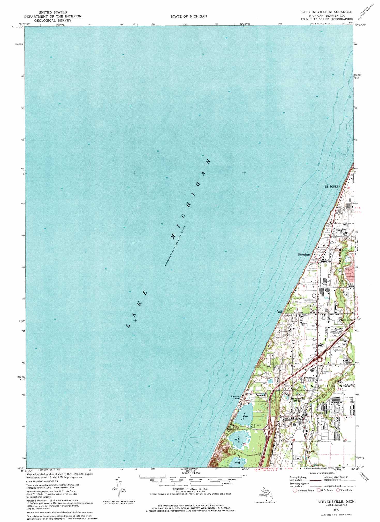
Stevensville Topo Map Michigan
To zoom in, hover over the map of Stevensville
USGS Topo Quad 42086a5 - 1:24,000 scale
| Topo Map Name: | Stevensville |
| USGS Topo Quad ID: | 42086a5 |
| Print Size: | ca. 21 1/4" wide x 27" high |
| Southeast Coordinates: | 42° N latitude / 86.5° W longitude |
| Map Center Coordinates: | 42.0625° N latitude / 86.5625° W longitude |
| U.S. State: | MI |
| Filename: | o42086a5.jpg |
| Download Map JPG Image: | Stevensville topo map 1:24,000 scale |
| Map Type: | Topographic |
| Topo Series: | 7.5´ |
| Map Scale: | 1:24,000 |
| Source of Map Images: | United States Geological Survey (USGS) |
| Alternate Map Versions: |
Stevensville MI 1970, updated 1973 Download PDF Buy paper map Stevensville MI 2011 Download PDF Buy paper map Stevensville MI 2014 Download PDF Buy paper map Stevensville MI 2017 Download PDF Buy paper map |
1:24,000 Topo Quads surrounding Stevensville
Covert |
||||
Benton Heights |
Coloma |
|||
Stevensville |
Benton Harbor |
Sodus |
||
Bridgman |
Baroda |
Berrien Springs |
||
New Buffalo West |
New Buffalo East |
Three Oaks |
Galien |
Niles West |
> Back to 42086a1 at 1:100,000 scale
> Back to 42086a1 at 1:250,000 scale
> Back to U.S. Topo Maps home
Stevensville topo map: Gazetteer
Stevensville: Crossings
Interchange 22 elevation 185m 606′Interchange 23 elevation 199m 652′
Stevensville: Lakes
Grand Mere Lakes elevation 177m 580′Stevensville: Parks
Center Park elevation 196m 643′Grand Mere State Park elevation 183m 600′
Lion Park elevation 193m 633′
North Lake Park elevation 177m 580′
Rudnick Park elevation 177m 580′
Township Park elevation 180m 590′
Stevensville: Populated Places
Glen Lord elevation 189m 620′Lakeshore Mobile Estates Park elevation 197m 646′
Mobile Village Trailer Park elevation 192m 629′
Shoreham elevation 177m 580′
Stevensville elevation 194m 636′
Stevensville: Post Offices
Glen Lord Post Office (historical) elevation 189m 620′Stevensville: Streams
Keelo Creek elevation 188m 616′Stevensville digital topo map on disk
Buy this Stevensville topo map showing relief, roads, GPS coordinates and other geographical features, as a high-resolution digital map file on DVD:
Northern Illinois, Northern Indiana & Southwestern Michigan
Buy digital topo maps: Northern Illinois, Northern Indiana & Southwestern Michigan