Borculo Topo Map Michigan
To zoom in, hover over the map of Borculo
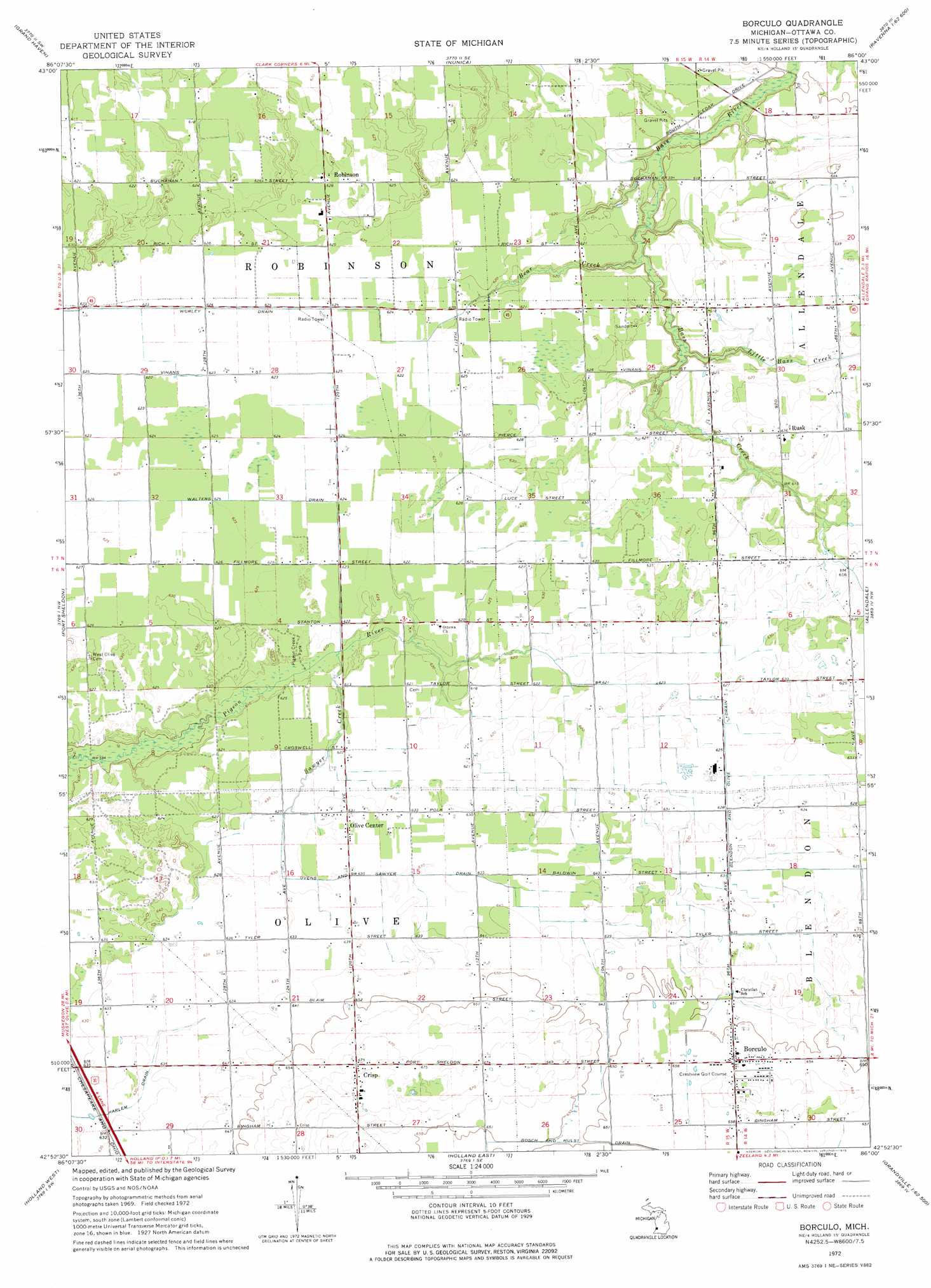
USGS Topo Quad 42086h1 - 1:24,000 scale
| Topo Map Name: | Borculo |
| USGS Topo Quad ID: | 42086h1 |
| Print Size: | ca. 21 1/4" wide x 27" high |
| Southeast Coordinates: | 42.875° N latitude / 86° W longitude |
| Map Center Coordinates: | 42.9375° N latitude / 86.0625° W longitude |
| U.S. State: | MI |
| Filename: | o42086h1.jpg |
| Download Map JPG Image: | Borculo topo map 1:24,000 scale |
| Map Type: | Topographic |
| Topo Series: | 7.5´ |
| Map Scale: | 1:24,000 |
| Source of Map Images: | United States Geological Survey (USGS) |
| Alternate Map Versions: |
Borculo MI 1972, updated 1975 Download PDF Buy paper map Borculo MI 2011 Download PDF Buy paper map Borculo MI 2014 Download PDF Buy paper map Borculo MI 2017 Download PDF Buy paper map |
1:24,000 Topo Quads surrounding Borculo
Muskegon West |
Muskegon East |
Sullivan |
Ravenna |
Casnovia |
Grand Haven |
Nunica |
Coopersville |
Marne |
|
Port Sheldon |
Borculo |
Allendale |
Grandville |
|
Holland West |
Holland East |
Hudsonville West |
Hudsonville East |
|
Saugatuck |
Hamilton West |
Hamilton East |
Burnips |
> Back to 42086e1 at 1:100,000 scale
> Back to 42086a1 at 1:250,000 scale
> Back to U.S. Topo Maps home
Borculo topo map: Gazetteer
Borculo: Canals
Blendon and Olive Drain elevation 190m 623′Ovens and Sawyer Drain elevation 192m 629′
Walters Drain elevation 191m 626′
Worley Drain elevation 189m 620′
Borculo: Parks
Pigeon Creek Park elevation 189m 620′South Olive Christian Reformed Church Historical Marker elevation 209m 685′
Borculo: Populated Places
Borculo elevation 200m 656′Crisp elevation 206m 675′
Olive Center elevation 192m 629′
Robinson elevation 191m 626′
Rusk elevation 194m 636′
Borculo: Post Offices
Borculo Post Office (historical) elevation 200m 656′Crisp Post Office (historical) elevation 206m 675′
Olive Center Post Office (historical) elevation 192m 629′
Ottawa Station Post Office (historical) elevation 190m 623′
Robinson Post Office (historical) elevation 191m 626′
Rusk Post Office (historical) elevation 194m 636′
Borculo: Streams
Bass Creek elevation 181m 593′Bear Creek elevation 181m 593′
Little Bass Creek elevation 181m 593′
Sawyer Creek elevation 186m 610′
Borculo digital topo map on disk
Buy this Borculo topo map showing relief, roads, GPS coordinates and other geographical features, as a high-resolution digital map file on DVD:
Northern Illinois, Northern Indiana & Southwestern Michigan
Buy digital topo maps: Northern Illinois, Northern Indiana & Southwestern Michigan