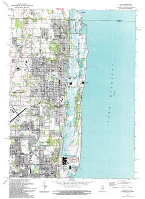
Zion Topo Map Illinois
To zoom in, hover over the map of Zion
USGS Topo Quad 42087d7 - 1:24,000 scale
| Topo Map Name: | Zion |
| USGS Topo Quad ID: | 42087d7 |
| Print Size: | ca. 21 1/4" wide x 27" high |
| Southeast Coordinates: | 42.375° N latitude / 87.75° W longitude |
| Map Center Coordinates: | 42.4375° N latitude / 87.8125° W longitude |
| U.S. States: | IL, WI |
| Filename: | o42087d7.jpg |
| Download Map JPG Image: | Zion topo map 1:24,000 scale |
| Map Type: | Topographic |
| Topo Series: | 7.5´ |
| Map Scale: | 1:24,000 |
| Source of Map Images: | United States Geological Survey (USGS) |
| Alternate Map Versions: |
Zion IL 1960, updated 1962 Download PDF Buy paper map Zion IL 1960, updated 1973 Download PDF Buy paper map Zion IL 1960, updated 1981 Download PDF Buy paper map Zion IL 1993, updated 1993 Download PDF Buy paper map Zion IL 2012 Download PDF Buy paper map Zion IL 2015 Download PDF Buy paper map |
1:24,000 Topo Quads surrounding Zion
Union Grove |
Sturtevant |
Racine South |
||
Paddock Lake |
Pleasant Prairie |
Kenosha |
||
Antioch |
Wadsworth |
Zion |
||
Grayslake |
Libertyville |
Waukegan |
||
Lake Zurich |
Wheeling |
Highland Park |
> Back to 42087a1 at 1:100,000 scale
> Back to 42086a1 at 1:250,000 scale
> Back to U.S. Topo Maps home
Zion topo map: Gazetteer
Zion: Airports
Victory Memorial Hospital Off Heliport elevation 194m 636′Waukegan Regional Airport elevation 218m 715′
Zion: Bays
Runaway Bay elevation 177m 580′Zion: Capes
Farnum Point elevation 179m 587′Zion: Lakes
Dead Lake elevation 180m 590′Sand Pond elevation 178m 583′
Zion: Parks
Aaron Park elevation 200m 656′Al Grosche Field elevation 192m 629′
Armory Park elevation 198m 649′
Ben Diamond Memorial Park elevation 205m 672′
Bethel Boulevard Park elevation 198m 649′
Bethel Park elevation 196m 643′
Beulah Park elevation 197m 646′
Bevier Park elevation 210m 688′
Bowen Formal Garden elevation 196m 643′
Bowen Park elevation 193m 633′
Canaan Park elevation 196m 643′
Carmel Park elevation 188m 616′
Clark Park elevation 201m 659′
Daniel Park elevation 199m 652′
David Park elevation 217m 711′
Edina Park elevation 182m 597′
Elizabeth Park elevation 189m 620′
Galilee Park elevation 206m 675′
Gilboa Park elevation 200m 656′
Hermon Park elevation 208m 682′
Horizon Village Park elevation 212m 695′
Hosah Park elevation 177m 580′
Illinois Beach Nature Preserve elevation 180m 590′
Illinois Beach State Park elevation 180m 590′
Joanna Park elevation 211m 692′
Larsen Park elevation 198m 649′
Lebanon Park elevation 206m 675′
Lorelei Acres Park elevation 219m 718′
Lyons Woods Forest Preserve elevation 200m 656′
Meadow Creek Park elevation 201m 659′
North Dunes Nature Preserve elevation 180m 590′
Ophir Park elevation 188m 616′
Sharon Park elevation 195m 639′
Shiloh Park elevation 200m 656′
Spring Bluff Forest Preserve elevation 180m 590′
Timothy Park elevation 222m 728′
Victory Park elevation 199m 652′
Village Park elevation 199m 652′
Waukegan Skate Park elevation 197m 646′
Zion: Populated Places
Bancroft Corners elevation 217m 711′Beach Park elevation 213m 698′
Beach Station elevation 203m 666′
Camp Logan elevation 182m 597′
Dunes Park elevation 193m 633′
State Line elevation 191m 626′
Winthrop Harbor elevation 194m 636′
Winthrop Harbor Station elevation 208m 682′
Zion elevation 198m 649′
Zion: Post Offices
Winthrop Harbor Post Office elevation 193m 633′Zion Post Office elevation 192m 629′
Zion: Streams
Bull Creek elevation 177m 580′Dead River elevation 175m 574′
Kellogg Creek elevation 177m 580′
Zion: Valleys
Kellogg Ravine elevation 181m 593′Zion digital topo map on disk
Buy this Zion topo map showing relief, roads, GPS coordinates and other geographical features, as a high-resolution digital map file on DVD:
Northern Illinois, Northern Indiana & Southwestern Michigan
Buy digital topo maps: Northern Illinois, Northern Indiana & Southwestern Michigan


