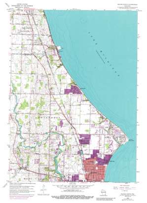
Racine North Topo Map Wisconsin
To zoom in, hover over the map of Racine North
USGS Topo Quad 42087g7 - 1:24,000 scale
| Topo Map Name: | Racine North |
| USGS Topo Quad ID: | 42087g7 |
| Print Size: | ca. 21 1/4" wide x 27" high |
| Southeast Coordinates: | 42.75° N latitude / 87.75° W longitude |
| Map Center Coordinates: | 42.8125° N latitude / 87.8125° W longitude |
| U.S. State: | WI |
| Filename: | o42087g7.jpg |
| Download Map JPG Image: | Racine North topo map 1:24,000 scale |
| Map Type: | Topographic |
| Topo Series: | 7.5´ |
| Map Scale: | 1:24,000 |
| Source of Map Images: | United States Geological Survey (USGS) |
| Alternate Map Versions: |
Racine North WI 1958, updated 1960 Download PDF Buy paper map Racine North WI 1958, updated 1973 Download PDF Buy paper map Racine North WI 1958, updated 1989 Download PDF Buy paper map Racine North WI 2010 Download PDF Buy paper map Racine North WI 2013 Download PDF Buy paper map Racine North WI 2016 Download PDF Buy paper map |
1:24,000 Topo Quads surrounding Racine North
Wauwatosa |
Milwaukee |
|||
Hales Corners |
Greendale |
South Milwaukee |
||
North Cape |
Franksville |
Racine North |
||
Union Grove |
Sturtevant |
Racine South |
||
Paddock Lake |
Pleasant Prairie |
Kenosha |
> Back to 42087e1 at 1:100,000 scale
> Back to 42086a1 at 1:250,000 scale
> Back to U.S. Topo Maps home
Racine North topo map: Gazetteer
Racine North: Airports
Horlick-Racine Airport elevation 202m 662′John H Batten Field elevation 201m 659′
Racine North: Capes
Wind Point elevation 177m 580′Racine North: Dams
Horlicks 3WR1874 Dam elevation 191m 626′Racine North: Mines
Racine Quarry elevation 193m 633′Racine North: Parks
Armstrong Park elevation 203m 666′Johnson Park elevation 206m 675′
Renak-Polak Maple-Beech Woods State Natural Area elevation 205m 672′
Shoop Park elevation 184m 603′
Racine North: Populated Places
Crestview elevation 196m 643′Ives elevation 197m 646′
North Bay elevation 185m 606′
Tabor elevation 213m 698′
Wind Point elevation 187m 613′
Racine North: Reservoirs
Horlicks Pond 178 elevation 191m 626′Racine North: Streams
Hoods Creek elevation 198m 649′Racine North digital topo map on disk
Buy this Racine North topo map showing relief, roads, GPS coordinates and other geographical features, as a high-resolution digital map file on DVD:
Northern Illinois, Northern Indiana & Southwestern Michigan
Buy digital topo maps: Northern Illinois, Northern Indiana & Southwestern Michigan


