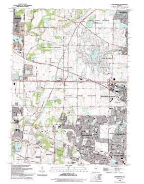
Streamwood Topo Map Illinois
To zoom in, hover over the map of Streamwood
USGS Topo Quad 42088a2 - 1:24,000 scale
| Topo Map Name: | Streamwood |
| USGS Topo Quad ID: | 42088a2 |
| Print Size: | ca. 21 1/4" wide x 27" high |
| Southeast Coordinates: | 42° N latitude / 88.125° W longitude |
| Map Center Coordinates: | 42.0625° N latitude / 88.1875° W longitude |
| U.S. State: | IL |
| Filename: | o42088a2.jpg |
| Download Map JPG Image: | Streamwood topo map 1:24,000 scale |
| Map Type: | Topographic |
| Topo Series: | 7.5´ |
| Map Scale: | 1:24,000 |
| Source of Map Images: | United States Geological Survey (USGS) |
| Alternate Map Versions: |
Streamwood IL 1961, updated 1962 Download PDF Buy paper map Streamwood IL 1961, updated 1973 Download PDF Buy paper map Streamwood IL 1961, updated 1981 Download PDF Buy paper map Streamwood IL 1961, updated 1989 Download PDF Buy paper map Streamwood IL 1993, updated 1994 Download PDF Buy paper map Streamwood IL 2012 Download PDF Buy paper map Streamwood IL 2015 Download PDF Buy paper map |
1:24,000 Topo Quads surrounding Streamwood
> Back to 42088a1 at 1:100,000 scale
> Back to 42088a1 at 1:250,000 scale
> Back to U.S. Topo Maps home
Streamwood topo map: Gazetteer
Streamwood: Airports
Allstate Commercial Plaza Heliport elevation 262m 859′Mill Rose Farm RLA Airport elevation 260m 853′
Rose Number 2 Heliport elevation 253m 830′
Streamwood: Dams
Galvins Lake Dam elevation 241m 790′Lake of the Coves Dam elevation 258m 846′
North Lake Dam elevation 265m 869′
South Lake of the Coves Dam elevation 252m 826′
Streamwood: Lakes
Barrington Road Pond elevation 240m 787′Beverly Lake elevation 248m 813′
Bode Lakes elevation 236m 774′
Crabtree Lake elevation 263m 862′
Penny Road Pond elevation 245m 803′
Streamwood: Parks
Aquarius Park elevation 241m 790′Barrington Club Park elevation 257m 843′
Bartlett Park elevation 243m 797′
Berkley Park elevation 246m 807′
Brandenburg Park elevation 256m 839′
Challenger Park elevation 241m 790′
Countryside Park elevation 247m 810′
Crabtree Nature Center elevation 265m 869′
Deerfield Park elevation 241m 790′
Derda Park elevation 247m 810′
Dolphin Park elevation 241m 790′
Douglas Park elevation 258m 846′
Dunteman Park elevation 263m 862′
Fox Park elevation 242m 793′
Friendship Park elevation 247m 810′
George Georgen Memorial Baseball Fields elevation 244m 800′
Glenbrook Park elevation 241m 790′
Gray Farm Park elevation 252m 826′
Grow Park elevation 250m 820′
Helm Woods Forest Preserves elevation 284m 931′
Helm Woods Nature Preserve elevation 280m 918′
Kemper Park elevation 284m 931′
Kemper Park Nature Preserve elevation 283m 928′
Kiddie Corner Park elevation 252m 826′
Kollar Park elevation 243m 797′
Lacy Park elevation 247m 810′
Liberty Park elevation 242m 793′
Lincoln Park elevation 257m 843′
Meadow Park elevation 259m 849′
Memorial Stadium elevation 230m 754′
Oakhill Park elevation 238m 780′
Olde Salem Park elevation 244m 800′
Pebble Park elevation 262m 859′
Poplar Creek Forest Preserve elevation 247m 810′
Prairie Park elevation 251m 823′
Ranger Park elevation 243m 797′
Ridge Park elevation 246m 807′
Seminole Park elevation 259m 849′
Shady Oaks Park elevation 238m 780′
Sheffield Park elevation 247m 810′
Sheffield Ridge Park elevation 246m 807′
Shoe Factory Road Prairie Nature Preserve elevation 271m 889′
Stillman Park elevation 268m 879′
Streamwood Park elevation 247m 810′
Sunnydale Park elevation 246m 807′
Surrey Woods Park elevation 246m 807′
Veterans Park elevation 244m 800′
Vine Park elevation 248m 813′
Walnut Park elevation 251m 823′
Woodland Heights Park elevation 245m 803′
Streamwood: Populated Places
Barrington Center elevation 264m 866′Sherwood Oaks elevation 257m 843′
Spaulding elevation 235m 770′
Streamwood elevation 246m 807′
Sutton elevation 256m 839′
Streamwood: Reservoirs
Galvins Lake elevation 241m 790′Lake of the Coves elevation 258m 846′
North Lake elevation 265m 869′
South Lake of the Coves elevation 252m 826′
Streamwood: Streams
East Branch Poplar Creek elevation 237m 777′Streamwood: Woods
Shoe Factory Road Woods elevation 238m 780′Streamwood digital topo map on disk
Buy this Streamwood topo map showing relief, roads, GPS coordinates and other geographical features, as a high-resolution digital map file on DVD:
Northern Illinois, Northern Indiana & Southwestern Michigan
Buy digital topo maps: Northern Illinois, Northern Indiana & Southwestern Michigan


