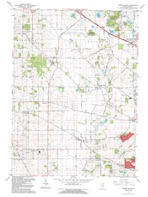
Pingree Grove Topo Map Illinois
To zoom in, hover over the map of Pingree Grove
USGS Topo Quad 42088a4 - 1:24,000 scale
| Topo Map Name: | Pingree Grove |
| USGS Topo Quad ID: | 42088a4 |
| Print Size: | ca. 21 1/4" wide x 27" high |
| Southeast Coordinates: | 42° N latitude / 88.375° W longitude |
| Map Center Coordinates: | 42.0625° N latitude / 88.4375° W longitude |
| U.S. State: | IL |
| Filename: | o42088a4.jpg |
| Download Map JPG Image: | Pingree Grove topo map 1:24,000 scale |
| Map Type: | Topographic |
| Topo Series: | 7.5´ |
| Map Scale: | 1:24,000 |
| Source of Map Images: | United States Geological Survey (USGS) |
| Alternate Map Versions: |
Pingree Grove IL 1962, updated 1964 Download PDF Buy paper map Pingree Grove IL 1962, updated 1973 Download PDF Buy paper map Pingree Grove IL 1992, updated 1992 Download PDF Buy paper map Pingree Grove IL 2012 Download PDF Buy paper map Pingree Grove IL 2015 Download PDF Buy paper map |
1:24,000 Topo Quads surrounding Pingree Grove
> Back to 42088a1 at 1:100,000 scale
> Back to 42088a1 at 1:250,000 scale
> Back to U.S. Topo Maps home
Pingree Grove topo map: Gazetteer
Pingree Grove: Airports
Koppie Airport elevation 271m 889′Olson Airport elevation 288m 944′
Reid RLA Airport elevation 282m 925′
Pingree Grove: Forests
Hampshire Forest Preserve elevation 305m 1000′Pingree Grove: Parks
Rutland Forest Preserve elevation 280m 918′Pingree Grove: Populated Places
Allens Corners elevation 303m 994′Bowes elevation 260m 853′
Bowes Bend elevation 270m 885′
Chippewa elevation 280m 918′
Freeman elevation 274m 898′
Hidden Lakes elevation 281m 921′
McQueen elevation 281m 921′
North Plato elevation 294m 964′
Pingree Grove elevation 278m 912′
Plato Center elevation 281m 921′
Salina elevation 292m 958′
Silent Meadow elevation 284m 931′
Starks elevation 279m 915′
Tamara Heights elevation 283m 928′
Udina elevation 275m 902′
Pingree Grove: Streams
Kendall Run elevation 280m 918′Pingree Grove digital topo map on disk
Buy this Pingree Grove topo map showing relief, roads, GPS coordinates and other geographical features, as a high-resolution digital map file on DVD:
Northern Illinois, Northern Indiana & Southwestern Michigan
Buy digital topo maps: Northern Illinois, Northern Indiana & Southwestern Michigan


