Marengo South Topo Map Illinois
To zoom in, hover over the map of Marengo South
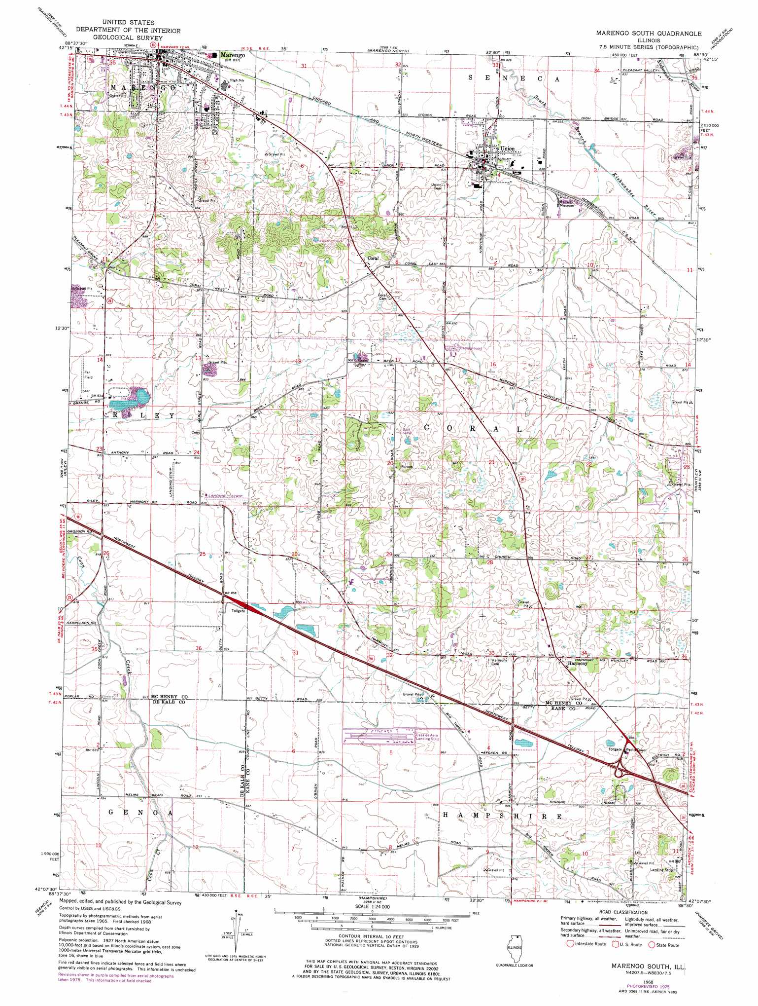
USGS Topo Quad 42088b5 - 1:24,000 scale
| Topo Map Name: | Marengo South |
| USGS Topo Quad ID: | 42088b5 |
| Print Size: | ca. 21 1/4" wide x 27" high |
| Southeast Coordinates: | 42.125° N latitude / 88.5° W longitude |
| Map Center Coordinates: | 42.1875° N latitude / 88.5625° W longitude |
| U.S. State: | IL |
| Filename: | o42088b5.jpg |
| Download Map JPG Image: | Marengo South topo map 1:24,000 scale |
| Map Type: | Topographic |
| Topo Series: | 7.5´ |
| Map Scale: | 1:24,000 |
| Source of Map Images: | United States Geological Survey (USGS) |
| Alternate Map Versions: |
Marengo South IL 1968, updated 1970 Download PDF Buy paper map Marengo South IL 1968, updated 1977 Download PDF Buy paper map Marengo South IL 2012 Download PDF Buy paper map Marengo South IL 2015 Download PDF Buy paper map |
1:24,000 Topo Quads surrounding Marengo South
Belvidere Ne |
Capron |
Harvard |
Hebron |
Richmond |
Belvidere North |
Garden Prairie |
Marengo North |
Woodstock |
Mchenry |
Belvidere South |
Riley |
Marengo South |
Huntley |
Crystal Lake |
Kirkland |
Genoa |
Hampshire |
Pingree Grove |
Elgin |
De Kalb |
Sycamore |
Maple Park |
Elburn |
Geneva |
> Back to 42088a1 at 1:100,000 scale
> Back to 42088a1 at 1:250,000 scale
> Back to U.S. Topo Maps home
Marengo South topo map: Gazetteer
Marengo South: Airports
Casa De Aero Park elevation 260m 853′Dr Joseph W Esser Airport elevation 298m 977′
Edward Getzelman Airport elevation 265m 869′
Far Field elevation 254m 833′
Flying B Airport elevation 258m 846′
Hilberts Funny Farm Airport elevation 262m 859′
Kessler Airport elevation 256m 839′
Sky Soaring Airport elevation 270m 885′
Marengo South: Populated Places
Coral elevation 278m 912′Harmony elevation 284m 931′
Marengo elevation 254m 833′
Union elevation 256m 839′
Marengo South digital topo map on disk
Buy this Marengo South topo map showing relief, roads, GPS coordinates and other geographical features, as a high-resolution digital map file on DVD:
Northern Illinois, Northern Indiana & Southwestern Michigan
Buy digital topo maps: Northern Illinois, Northern Indiana & Southwestern Michigan