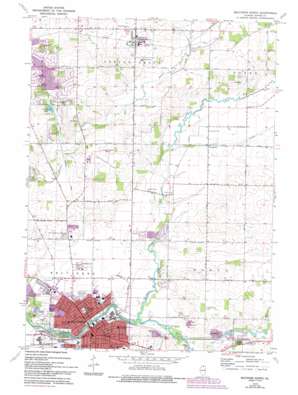
Belvidere North Topo Map Illinois
To zoom in, hover over the map of Belvidere North
USGS Topo Quad 42088c7 - 1:24,000 scale
| Topo Map Name: | Belvidere North |
| USGS Topo Quad ID: | 42088c7 |
| Print Size: | ca. 21 1/4" wide x 27" high |
| Southeast Coordinates: | 42.25° N latitude / 88.75° W longitude |
| Map Center Coordinates: | 42.3125° N latitude / 88.8125° W longitude |
| U.S. State: | IL |
| Filename: | o42088c7.jpg |
| Download Map JPG Image: | Belvidere North topo map 1:24,000 scale |
| Map Type: | Topographic |
| Topo Series: | 7.5´ |
| Map Scale: | 1:24,000 |
| Source of Map Images: | United States Geological Survey (USGS) |
| Alternate Map Versions: |
Belvidere North IL 1970, updated 1972 Download PDF Buy paper map Belvidere North IL 1970, updated 1977 Download PDF Buy paper map Belvidere North IL 1970, updated 1993 Download PDF Buy paper map Belvidere North IL 2012 Download PDF Buy paper map Belvidere North IL 2015 Download PDF Buy paper map |
1:24,000 Topo Quads surrounding Belvidere North
> Back to 42088a1 at 1:100,000 scale
> Back to 42088a1 at 1:250,000 scale
> Back to U.S. Topo Maps home
Belvidere North topo map: Gazetteer
Belvidere North: Airports
Belvidere Limited Airport elevation 261m 856′Bob Walberg Field elevation 255m 836′
Green Giant-Dillon Farm Heliport elevation 232m 761′
Belvidere North: Dams
Candlewick Lake Dam elevation 282m 925′Belvidere North: Lakes
County Lake elevation 261m 856′Belvidere North: Parks
Belvidere Municipal Park elevation 229m 751′Boone County Fair Grounds elevation 239m 784′
Spencer Park elevation 229m 751′
Belvidere North: Populated Places
Belvidere elevation 238m 780′Poplar Grove elevation 274m 898′
Russellville elevation 244m 800′
Timberlane elevation 257m 843′
Belvidere North: Post Offices
Belvidere Post Office elevation 232m 761′Belvidere North: Reservoirs
Candlewick Lake elevation 283m 928′Belvidere North: Streams
Coon Creek elevation 231m 757′Geryune Creek elevation 241m 790′
Mud Creek elevation 233m 764′
Piscasaw Creek elevation 230m 754′
Piscasaw Creek elevation 230m 754′
Belvidere North digital topo map on disk
Buy this Belvidere North topo map showing relief, roads, GPS coordinates and other geographical features, as a high-resolution digital map file on DVD:
Northern Illinois, Northern Indiana & Southwestern Michigan
Buy digital topo maps: Northern Illinois, Northern Indiana & Southwestern Michigan


