Hebron Topo Map Illinois
To zoom in, hover over the map of Hebron
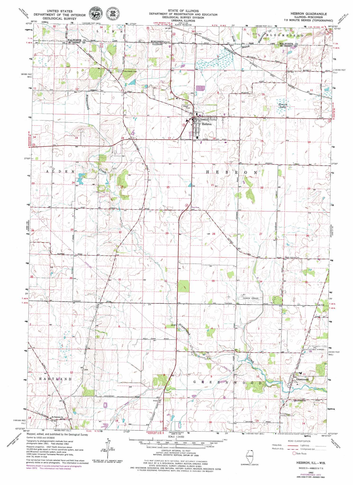
USGS Topo Quad 42088d4 - 1:24,000 scale
| Topo Map Name: | Hebron |
| USGS Topo Quad ID: | 42088d4 |
| Print Size: | ca. 21 1/4" wide x 27" high |
| Southeast Coordinates: | 42.375° N latitude / 88.375° W longitude |
| Map Center Coordinates: | 42.4375° N latitude / 88.4375° W longitude |
| U.S. States: | IL, WI |
| Filename: | o42088d4.jpg |
| Download Map JPG Image: | Hebron topo map 1:24,000 scale |
| Map Type: | Topographic |
| Topo Series: | 7.5´ |
| Map Scale: | 1:24,000 |
| Source of Map Images: | United States Geological Survey (USGS) |
| Alternate Map Versions: |
Hebron IL 1963, updated 1964 Download PDF Buy paper map Hebron IL 1963, updated 1973 Download PDF Buy paper map Hebron IL 1992, updated 1992 Download PDF Buy paper map Hebron IL 1992, updated 1992 Download PDF Buy paper map Hebron IL 2012 Download PDF Buy paper map Hebron IL 2015 Download PDF Buy paper map |
1:24,000 Topo Quads surrounding Hebron
Delavan |
Elkhorn |
Springfield |
Burlington |
Rochester |
Sharon |
Walworth |
Lake Geneva |
Genoa City |
Silver Lake |
Capron |
Harvard |
Hebron |
Richmond |
Fox Lake |
Garden Prairie |
Marengo North |
Woodstock |
Mchenry |
Wauconda |
Riley |
Marengo South |
Huntley |
Crystal Lake |
Barrington |
> Back to 42088a1 at 1:100,000 scale
> Back to 42088a1 at 1:250,000 scale
> Back to U.S. Topo Maps home
Hebron topo map: Gazetteer
Hebron: Airports
Galt Airport elevation 265m 869′Hebron Airport elevation 265m 869′
Killoy Airport elevation 299m 980′
Hebron: Populated Places
Armsby (historical) elevation 277m 908′Greenwood elevation 261m 856′
Hebron elevation 283m 928′
Hebron: Swamps
Streets Lake elevation 270m 885′Hebron digital topo map on disk
Buy this Hebron topo map showing relief, roads, GPS coordinates and other geographical features, as a high-resolution digital map file on DVD:
Northern Illinois, Northern Indiana & Southwestern Michigan
Buy digital topo maps: Northern Illinois, Northern Indiana & Southwestern Michigan