Belvidere Nw Topo Map Illinois
To zoom in, hover over the map of Belvidere Nw
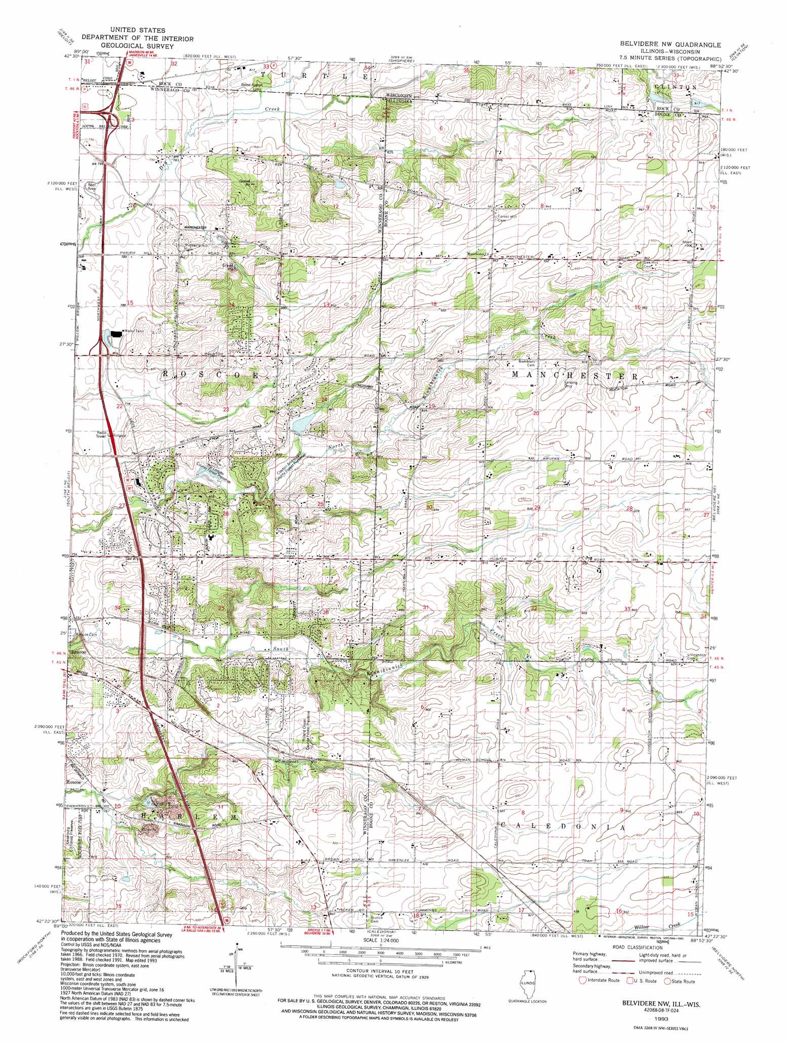
USGS Topo Quad 42088d8 - 1:24,000 scale
| Topo Map Name: | Belvidere Nw |
| USGS Topo Quad ID: | 42088d8 |
| Print Size: | ca. 21 1/4" wide x 27" high |
| Southeast Coordinates: | 42.375° N latitude / 88.875° W longitude |
| Map Center Coordinates: | 42.4375° N latitude / 88.9375° W longitude |
| U.S. States: | IL, WI |
| Filename: | o42088d8.jpg |
| Download Map JPG Image: | Belvidere Nw topo map 1:24,000 scale |
| Map Type: | Topographic |
| Topo Series: | 7.5´ |
| Map Scale: | 1:24,000 |
| Source of Map Images: | United States Geological Survey (USGS) |
| Alternate Map Versions: |
Belvidere NW IL 1970, updated 1972 Download PDF Buy paper map Belvidere NW IL 1970, updated 1977 Download PDF Buy paper map Belvidere NW IL 1993, updated 1993 Download PDF Buy paper map Belvidere NW IL 2012 Download PDF Buy paper map Belvidere NW IL 2015 Download PDF Buy paper map |
1:24,000 Topo Quads surrounding Belvidere Nw
Footville |
Janesville West |
Janesville East |
Avalon |
Delavan |
Newark |
Beloit |
Shopiere |
Clinton |
Sharon |
Shirland |
South Beloit |
Belvidere Nw |
Belvidere Ne |
Capron |
Winnebago |
Rockford North |
Caledonia |
Belvidere North |
Garden Prairie |
Kishwaukee |
Rockford South |
Cherry Valley |
Belvidere South |
Riley |
> Back to 42088a1 at 1:100,000 scale
> Back to 42088a1 at 1:250,000 scale
> Back to U.S. Topo Maps home
Belvidere Nw topo map: Gazetteer
Belvidere Nw: Airports
Beloit Airport elevation 248m 813′Compass Rose Airport elevation 289m 948′
Floyd McCurdy Airport elevation 228m 748′
McCurdy Strip elevation 290m 951′
Belvidere Nw: Crossings
Interchange 1 elevation 248m 813′Interchange 3 elevation 238m 780′
Belvidere Nw: Mines
Porter Quarry elevation 257m 843′Porter Quarry elevation 256m 839′
Roscoe Quarry elevation 245m 803′
Belvidere Nw: Parks
Kinnikinnick Creek Nature Preserve elevation 267m 875′Belvidere Nw: Populated Places
Stagecoach Hills elevation 248m 813′Belvidere Nw: Post Offices
Hunter Post Office (historical) elevation 298m 977′Belvidere Nw digital topo map on disk
Buy this Belvidere Nw topo map showing relief, roads, GPS coordinates and other geographical features, as a high-resolution digital map file on DVD:
Northern Illinois, Northern Indiana & Southwestern Michigan
Buy digital topo maps: Northern Illinois, Northern Indiana & Southwestern Michigan