Avalon Topo Map Wisconsin
To zoom in, hover over the map of Avalon
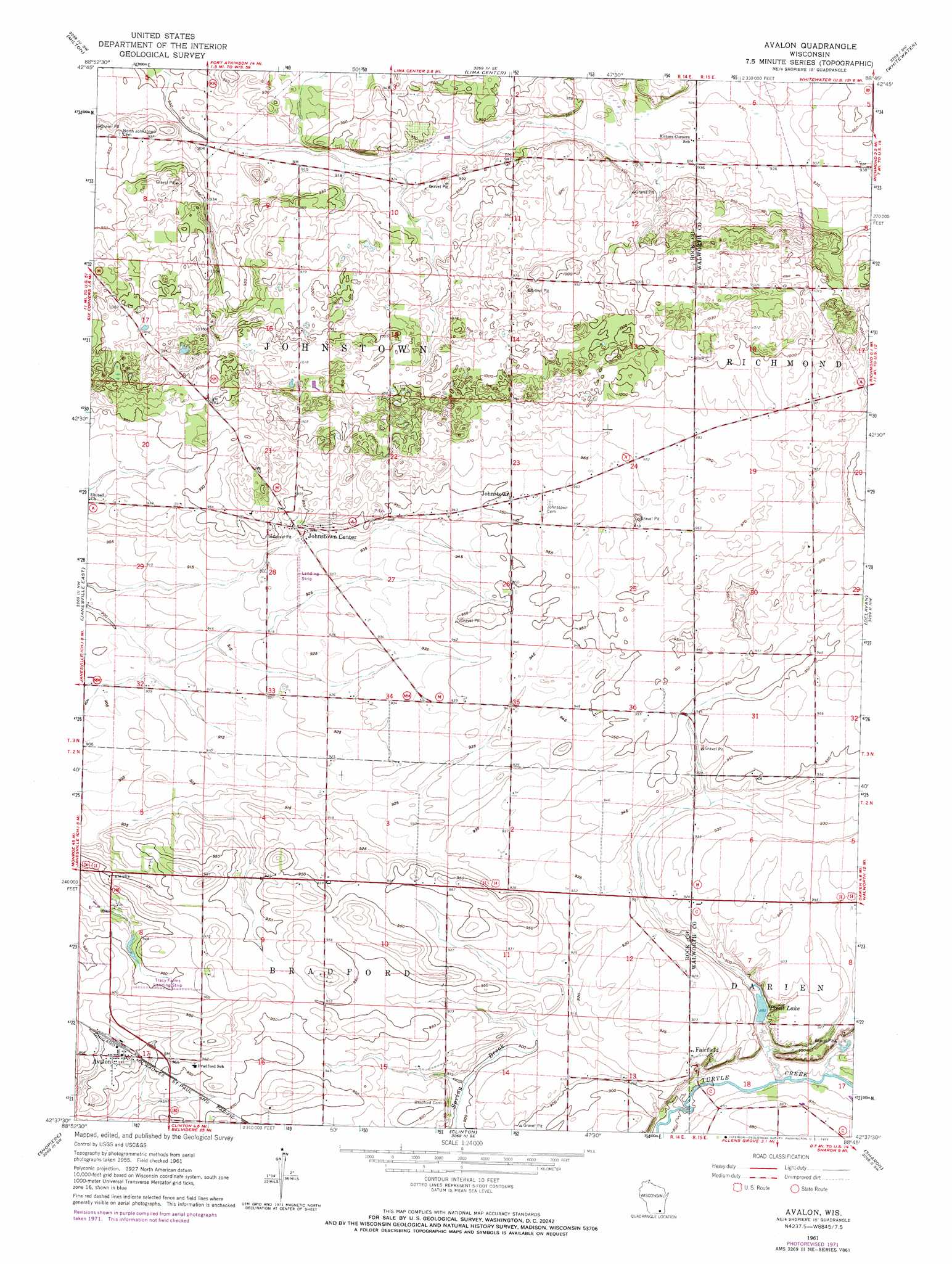
USGS Topo Quad 42088f7 - 1:24,000 scale
| Topo Map Name: | Avalon |
| USGS Topo Quad ID: | 42088f7 |
| Print Size: | ca. 21 1/4" wide x 27" high |
| Southeast Coordinates: | 42.625° N latitude / 88.75° W longitude |
| Map Center Coordinates: | 42.6875° N latitude / 88.8125° W longitude |
| U.S. State: | WI |
| Filename: | o42088f7.jpg |
| Download Map JPG Image: | Avalon topo map 1:24,000 scale |
| Map Type: | Topographic |
| Topo Series: | 7.5´ |
| Map Scale: | 1:24,000 |
| Source of Map Images: | United States Geological Survey (USGS) |
| Alternate Map Versions: |
Avalon WI 1961, updated 1964 Download PDF Buy paper map Avalon WI 1961, updated 1972 Download PDF Buy paper map Avalon WI 2010 Download PDF Buy paper map Avalon WI 2013 Download PDF Buy paper map Avalon WI 2016 Download PDF Buy paper map |
1:24,000 Topo Quads surrounding Avalon
Rockdale |
Busseyville |
Fort Atkinson |
Rome |
Palmyra |
Edgerton |
Milton |
Lima Center |
Whitewater |
Little Prairie |
Janesville West |
Janesville East |
Avalon |
Delavan |
Elkhorn |
Beloit |
Shopiere |
Clinton |
Sharon |
Walworth |
South Beloit |
Belvidere Nw |
Belvidere Ne |
Capron |
Harvard |
> Back to 42088e1 at 1:100,000 scale
> Back to 42088a1 at 1:250,000 scale
> Back to U.S. Topo Maps home
Avalon topo map: Gazetteer
Avalon: Airports
Johnstown Center Airport elevation 282m 925′Avalon: Populated Places
Avalon elevation 292m 958′Fairfield elevation 279m 915′
Johnstown elevation 290m 951′
Johnstown Center elevation 285m 935′
Avalon: Reservoirs
Trout Lake elevation 269m 882′Avalon digital topo map on disk
Buy this Avalon topo map showing relief, roads, GPS coordinates and other geographical features, as a high-resolution digital map file on DVD:
Northern Illinois, Northern Indiana & Southwestern Michigan
Buy digital topo maps: Northern Illinois, Northern Indiana & Southwestern Michigan