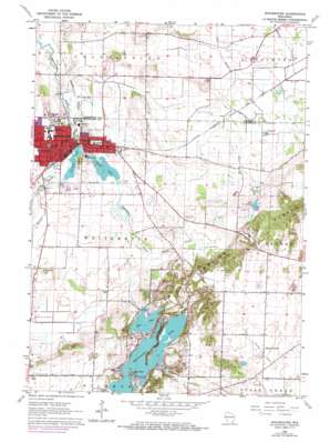
Whitewater Topo Map Wisconsin
To zoom in, hover over the map of Whitewater
USGS Topo Quad 42088g6 - 1:24,000 scale
| Topo Map Name: | Whitewater |
| USGS Topo Quad ID: | 42088g6 |
| Print Size: | ca. 21 1/4" wide x 27" high |
| Southeast Coordinates: | 42.75° N latitude / 88.625° W longitude |
| Map Center Coordinates: | 42.8125° N latitude / 88.6875° W longitude |
| U.S. State: | WI |
| Filename: | o42088g6.jpg |
| Download Map JPG Image: | Whitewater topo map 1:24,000 scale |
| Map Type: | Topographic |
| Topo Series: | 7.5´ |
| Map Scale: | 1:24,000 |
| Source of Map Images: | United States Geological Survey (USGS) |
| Alternate Map Versions: |
Whitewater WI 1960, updated 1964 Download PDF Buy paper map Whitewater WI 1960, updated 1970 Download PDF Buy paper map Whitewater WI 1960, updated 1972 Download PDF Buy paper map Whitewater WI 2010 Download PDF Buy paper map Whitewater WI 2013 Download PDF Buy paper map Whitewater WI 2016 Download PDF Buy paper map |
1:24,000 Topo Quads surrounding Whitewater
> Back to 42088e1 at 1:100,000 scale
> Back to 42088a1 at 1:250,000 scale
> Back to U.S. Topo Maps home
Whitewater topo map: Gazetteer
Whitewater: Airports
Clover Valley Airport elevation 255m 836′Whitewater: Dams
Old Paper Mill Dam elevation 254m 833′Old Stone Mill 3SE470 Dam elevation 250m 820′
Rice Lake Dam elevation 265m 869′
Whitewater Lake 2-Wp-651 Dam elevation 265m 869′
Whitewater: Lakes
Rice Lake elevation 263m 862′Whitewater Lake elevation 265m 869′
Whitewater: Parks
Bluff Creek State Natural Area elevation 263m 862′Clover Valley Fen State Natural Area elevation 256m 839′
Perkins Stadium elevation 262m 859′
Starin Park elevation 254m 833′
Trippe Lake Park elevation 251m 823′
Young Prairie State Natural Area elevation 248m 813′
Whitewater: Populated Places
Heart Prairie elevation 290m 951′Whitewater elevation 251m 823′
Whitewater: Post Offices
Whitewater Post Office elevation 251m 823′Whitewater: Reservoirs
Cravath Lake elevation 248m 813′Cravath Lake 27.5 elevation 250m 820′
Lake La Grange elevation 261m 856′
Rice Lake elevation 265m 869′
Tripp Lake elevation 250m 820′
Tripp Lake 12.0 elevation 254m 833′
Whitewater Lake 70 elevation 265m 869′
Whitewater: Streams
Bluff Creek elevation 256m 839′Spring Brook elevation 247m 810′
Whitewater digital topo map on disk
Buy this Whitewater topo map showing relief, roads, GPS coordinates and other geographical features, as a high-resolution digital map file on DVD:
Northern Illinois, Northern Indiana & Southwestern Michigan
Buy digital topo maps: Northern Illinois, Northern Indiana & Southwestern Michigan


