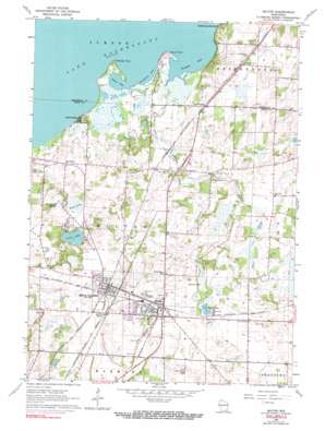
Milton Topo Map Wisconsin
To zoom in, hover over the map of Milton
USGS Topo Quad 42088g8 - 1:24,000 scale
| Topo Map Name: | Milton |
| USGS Topo Quad ID: | 42088g8 |
| Print Size: | ca. 21 1/4" wide x 27" high |
| Southeast Coordinates: | 42.75° N latitude / 88.875° W longitude |
| Map Center Coordinates: | 42.8125° N latitude / 88.9375° W longitude |
| U.S. State: | WI |
| Filename: | o42088g8.jpg |
| Download Map JPG Image: | Milton topo map 1:24,000 scale |
| Map Type: | Topographic |
| Topo Series: | 7.5´ |
| Map Scale: | 1:24,000 |
| Source of Map Images: | United States Geological Survey (USGS) |
| Alternate Map Versions: |
Milton WI 1961, updated 1964 Download PDF Buy paper map Milton WI 1961, updated 1972 Download PDF Buy paper map Milton WI 1961, updated 1991 Download PDF Buy paper map Milton WI 2010 Download PDF Buy paper map Milton WI 2013 Download PDF Buy paper map Milton WI 2016 Download PDF Buy paper map |
1:24,000 Topo Quads surrounding Milton
> Back to 42088e1 at 1:100,000 scale
> Back to 42088a1 at 1:250,000 scale
> Back to U.S. Topo Maps home
Milton topo map: Gazetteer
Milton: Airports
Meier Airport elevation 263m 862′Milton: Bays
Binghams Bay elevation 236m 774′Haights Bay elevation 236m 774′
Lautz Bay elevation 236m 774′
Milton: Capes
Stony Point elevation 239m 784′Thiebeau Point elevation 238m 780′
Milton: Lakes
Clear Lake elevation 245m 803′Lake Koshkonong elevation 236m 774′
Storrs Lake elevation 259m 849′
Milton: Parks
Central Park elevation 268m 879′Goodrich Park elevation 268m 879′
Hilltop Park elevation 280m 918′
La Mar Park elevation 268m 879′
Liberty Park elevation 268m 879′
Milton College Historic District elevation 275m 902′
North Park elevation 267m 875′
Milton: Populated Places
Charlie Bluff elevation 242m 793′Koshkonong elevation 251m 823′
Koshkonong Mounds elevation 255m 836′
Milton elevation 271m 889′
Milton Junction elevation 269m 882′
Milton: Post Offices
Milton Junction Post Office (historical) elevation 268m 879′Milton Post Office elevation 268m 879′
Milton: Streams
Otter Creek elevation 236m 774′Milton: Swamps
Bowers Lake elevation 260m 853′Cranberry Marsh elevation 248m 813′
Grass Lake elevation 245m 803′
Milton digital topo map on disk
Buy this Milton topo map showing relief, roads, GPS coordinates and other geographical features, as a high-resolution digital map file on DVD:
Northern Illinois, Northern Indiana & Southwestern Michigan
Buy digital topo maps: Northern Illinois, Northern Indiana & Southwestern Michigan


