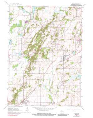
Eagle Topo Map Wisconsin
To zoom in, hover over the map of Eagle
USGS Topo Quad 42088h4 - 1:24,000 scale
| Topo Map Name: | Eagle |
| USGS Topo Quad ID: | 42088h4 |
| Print Size: | ca. 21 1/4" wide x 27" high |
| Southeast Coordinates: | 42.875° N latitude / 88.375° W longitude |
| Map Center Coordinates: | 42.9375° N latitude / 88.4375° W longitude |
| U.S. State: | WI |
| Filename: | o42088h4.jpg |
| Download Map JPG Image: | Eagle topo map 1:24,000 scale |
| Map Type: | Topographic |
| Topo Series: | 7.5´ |
| Map Scale: | 1:24,000 |
| Source of Map Images: | United States Geological Survey (USGS) |
| Alternate Map Versions: |
Eagle WI 1960, updated 1964 Download PDF Buy paper map Eagle WI 1960, updated 1972 Download PDF Buy paper map Eagle WI 1960, updated 1990 Download PDF Buy paper map Eagle WI 2010 Download PDF Buy paper map Eagle WI 2013 Download PDF Buy paper map Eagle WI 2016 Download PDF Buy paper map |
1:24,000 Topo Quads surrounding Eagle
> Back to 42088e1 at 1:100,000 scale
> Back to 42088a1 at 1:250,000 scale
> Back to U.S. Topo Maps home
Eagle topo map: Gazetteer
Eagle: Airports
Bartell Strip elevation 300m 984′Koller Heliport elevation 302m 990′
Eagle: Dams
Bischel Dam elevation 264m 866′Eagle: Lakes
Hunters Lake elevation 264m 866′Larkin Lake elevation 264m 866′
Ottawa Lake elevation 264m 866′
Pretty Lake elevation 264m 866′
Reagan Lake elevation 261m 856′
Eagle: Parks
Kettle Moraine Low Prairie State Natural Area elevation 260m 853′Ottawa Lake Fen State Natural Area elevation 264m 866′
Ottawa Lake Recreation Area elevation 269m 882′
Eagle: Populated Places
Eagle elevation 291m 954′Jericho elevation 274m 898′
North Prairie elevation 289m 948′
Ottawa elevation 286m 938′
Eagle: Reservoirs
Hunters Millpond 17 elevation 264m 866′Eagle digital topo map on disk
Buy this Eagle topo map showing relief, roads, GPS coordinates and other geographical features, as a high-resolution digital map file on DVD:
Northern Illinois, Northern Indiana & Southwestern Michigan
Buy digital topo maps: Northern Illinois, Northern Indiana & Southwestern Michigan


