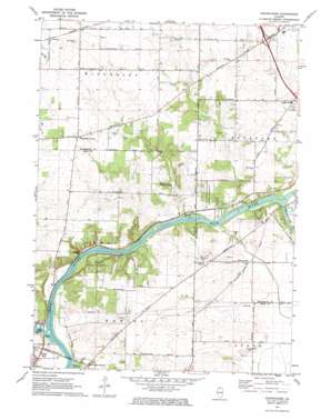
Kishwaukee Topo Map Illinois
To zoom in, hover over the map of Kishwaukee
USGS Topo Quad 42089b2 - 1:24,000 scale
| Topo Map Name: | Kishwaukee |
| USGS Topo Quad ID: | 42089b2 |
| Print Size: | ca. 21 1/4" wide x 27" high |
| Southeast Coordinates: | 42.125° N latitude / 89.125° W longitude |
| Map Center Coordinates: | 42.1875° N latitude / 89.1875° W longitude |
| U.S. State: | IL |
| Filename: | o42089b2.jpg |
| Download Map JPG Image: | Kishwaukee topo map 1:24,000 scale |
| Map Type: | Topographic |
| Topo Series: | 7.5´ |
| Map Scale: | 1:24,000 |
| Source of Map Images: | United States Geological Survey (USGS) |
| Alternate Map Versions: |
Kishwaukee IL 1971, updated 1973 Download PDF Buy paper map Kishwaukee IL 2012 Download PDF Buy paper map Kishwaukee IL 2015 Download PDF Buy paper map |
1:24,000 Topo Quads surrounding Kishwaukee
> Back to 42089a1 at 1:100,000 scale
> Back to 42088a1 at 1:250,000 scale
> Back to U.S. Topo Maps home
Kishwaukee topo map: Gazetteer
Kishwaukee: Lakes
Lake Louise elevation 205m 672′Kishwaukee: Parks
Douglas E Wade Nature Preserve elevation 237m 777′Hinchcliff Memorial Forest Preserve elevation 218m 715′
Howard D Colman Dells Nature Preserve elevation 247m 810′
Levi and Esther Fuller Forest Preserve elevation 238m 780′
Severson Dells Nature Preserve elevation 244m 800′
Severson-Dells Forest Preserve elevation 243m 797′
Kishwaukee: Populated Places
Alworth elevation 275m 902′Brewster Heights elevation 233m 764′
Cecka Mobile Home Park elevation 215m 705′
Grant View Heights elevation 232m 761′
Hickory Creek elevation 239m 784′
Kishwaukee elevation 225m 738′
Lindskolds Subdivision elevation 237m 777′
Loose Pulley Junction elevation 214m 702′
Motor Heights elevation 228m 748′
Rockford Mobile Home Park elevation 226m 741′
Westfield Corners elevation 260m 853′
Woodcrest elevation 239m 784′
Kishwaukee: Post Offices
Elida Post Office (historical) elevation 260m 853′Kishwaukee: Streams
Kishwaukee River elevation 208m 682′Stillman Creek elevation 207m 679′
Kishwaukee digital topo map on disk
Buy this Kishwaukee topo map showing relief, roads, GPS coordinates and other geographical features, as a high-resolution digital map file on DVD:
Northern Illinois, Northern Indiana & Southwestern Michigan
Buy digital topo maps: Northern Illinois, Northern Indiana & Southwestern Michigan


