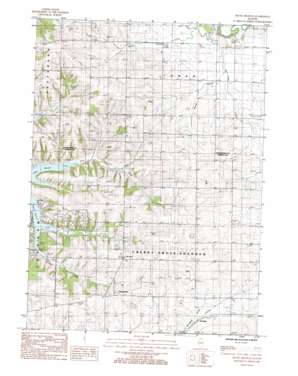
Boone Branch Topo Map Illinois
To zoom in, hover over the map of Boone Branch
USGS Topo Quad 42089b7 - 1:24,000 scale
| Topo Map Name: | Boone Branch |
| USGS Topo Quad ID: | 42089b7 |
| Print Size: | ca. 21 1/4" wide x 27" high |
| Southeast Coordinates: | 42.125° N latitude / 89.75° W longitude |
| Map Center Coordinates: | 42.1875° N latitude / 89.8125° W longitude |
| U.S. State: | IL |
| Filename: | o42089b7.jpg |
| Download Map JPG Image: | Boone Branch topo map 1:24,000 scale |
| Map Type: | Topographic |
| Topo Series: | 7.5´ |
| Map Scale: | 1:24,000 |
| Source of Map Images: | United States Geological Survey (USGS) |
| Alternate Map Versions: |
Boone Branch IL 1985, updated 1985 Download PDF Buy paper map Boone Branch IL 2012 Download PDF Buy paper map Boone Branch IL 2015 Download PDF Buy paper map |
1:24,000 Topo Quads surrounding Boone Branch
> Back to 42089a1 at 1:100,000 scale
> Back to 42088a1 at 1:250,000 scale
> Back to U.S. Topo Maps home
Boone Branch topo map: Gazetteer
Boone Branch: Airports
Block Airport elevation 247m 810′Kenneth Moll Airport elevation 267m 875′
Plum Creek Farm Airport elevation 252m 826′
Swan Valley Farm Airport elevation 279m 915′
Boone Branch: Mines
Hasselman Quarry elevation 267m 875′Sturtz Quarry elevation 263m 862′
Boone Branch: Populated Places
Georgetown elevation 277m 908′Kittredge elevation 259m 849′
Zier Cors elevation 278m 912′
Boone Branch: Streams
Boone Branch elevation 246m 807′Lost Creek elevation 243m 797′
Spring Branch elevation 244m 800′
Boone Branch digital topo map on disk
Buy this Boone Branch topo map showing relief, roads, GPS coordinates and other geographical features, as a high-resolution digital map file on DVD:
Northern Illinois, Northern Indiana & Southwestern Michigan
Buy digital topo maps: Northern Illinois, Northern Indiana & Southwestern Michigan


