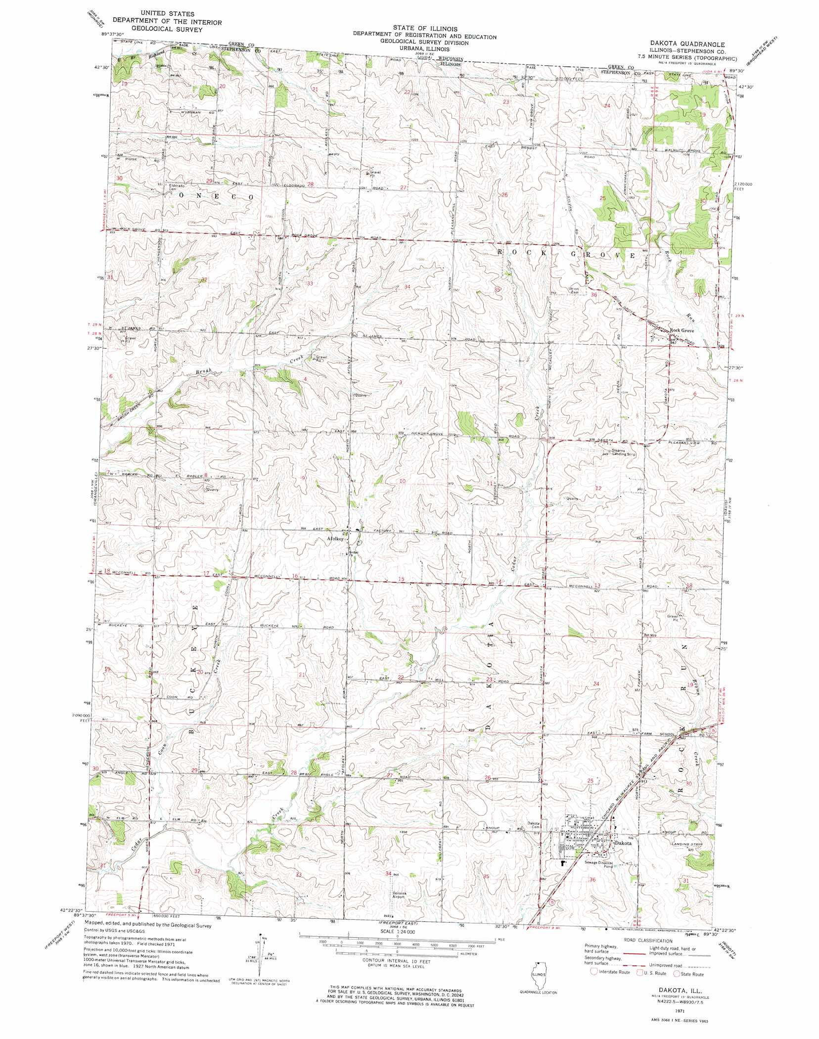
Dakota Topo Map Illinois
To zoom in, hover over the map of Dakota
USGS Topo Quad 42089d5 - 1:24,000 scale
| Topo Map Name: | Dakota |
| USGS Topo Quad ID: | 42089d5 |
| Print Size: | ca. 21 1/4" wide x 27" high |
| Southeast Coordinates: | 42.375° N latitude / 89.5° W longitude |
| Map Center Coordinates: | 42.4375° N latitude / 89.5625° W longitude |
| U.S. State: | IL |
| Filename: | o42089d5.jpg |
| Download Map JPG Image: | Dakota topo map 1:24,000 scale |
| Map Type: | Topographic |
| Topo Series: | 7.5´ |
| Map Scale: | 1:24,000 |
| Source of Map Images: | United States Geological Survey (USGS) |
| Alternate Map Versions: |
Dakota IL 1971, updated 1974 Download PDF Buy paper map Dakota IL 2012 Download PDF Buy paper map Dakota IL 2015 Download PDF Buy paper map |
1:24,000 Topo Quads surrounding Dakota
Argyle |
Monroe Nw |
Monticello |
Albany |
Orfordville |
Browntown |
Monroe |
Juda |
Brodhead West |
Brodhead East |
Lena |
Orangeville |
Dakota |
Davis |
Durand |
Pearl City |
Freeport West |
Freeport East |
Ridott |
Pecatonica |
Boone Branch |
Shannon |
Forreston North |
German Valley |
Seward |
> Back to 42089a1 at 1:100,000 scale
> Back to 42088a1 at 1:250,000 scale
> Back to U.S. Topo Maps home
Dakota topo map: Gazetteer
Dakota: Airports
Ronald K Dornink Airport elevation 287m 941′Stearns Landing Strip elevation 283m 928′
Dakota: Mines
Monte Quarry elevation 269m 882′Dakota: Parks
Wirth Prairie Nature Preserve elevation 277m 908′Dakota: Populated Places
Afolkey elevation 277m 908′Dakota elevation 288m 944′
Rock Grove elevation 288m 944′
Dakota: Post Offices
Dakota Post Office elevation 288m 944′Fountain Creek Post Office (historical) elevation 276m 905′
Dakota: Streams
Coon Creek elevation 244m 800′Dakota digital topo map on disk
Buy this Dakota topo map showing relief, roads, GPS coordinates and other geographical features, as a high-resolution digital map file on DVD:
Northern Illinois, Northern Indiana & Southwestern Michigan
Buy digital topo maps: Northern Illinois, Northern Indiana & Southwestern Michigan