Wacker Topo Map Illinois
To zoom in, hover over the map of Wacker
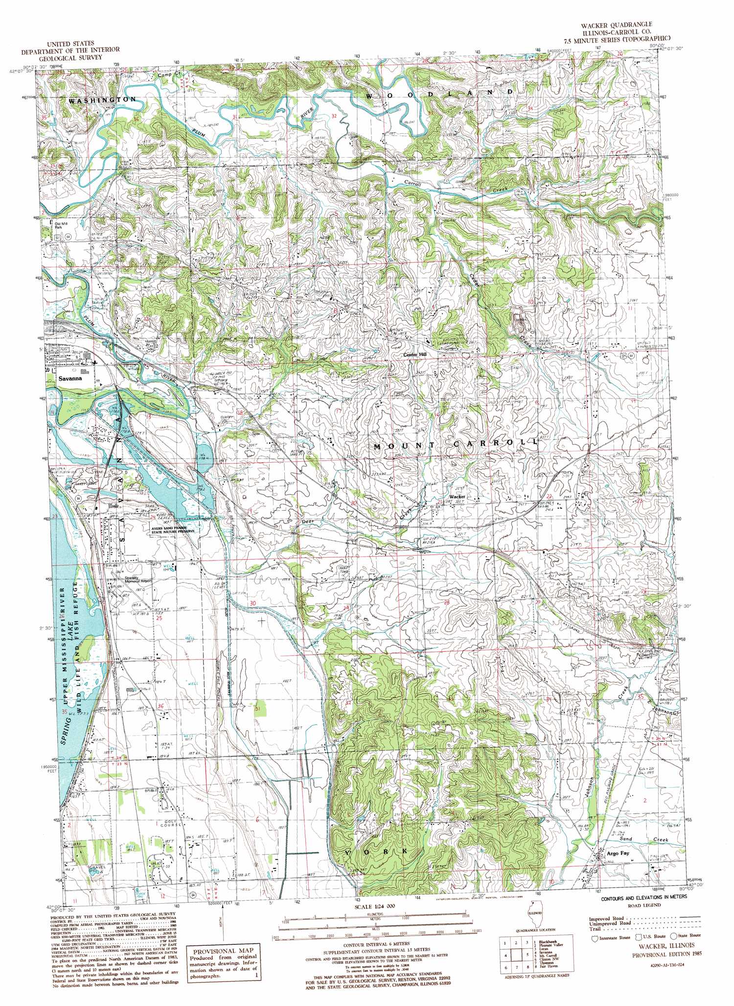
USGS Topo Quad 42090a1 - 1:24,000 scale
| Topo Map Name: | Wacker |
| USGS Topo Quad ID: | 42090a1 |
| Print Size: | ca. 21 1/4" wide x 27" high |
| Southeast Coordinates: | 42° N latitude / 90° W longitude |
| Map Center Coordinates: | 42.0625° N latitude / 90.0625° W longitude |
| U.S. State: | IL |
| Filename: | o42090a1.jpg |
| Download Map JPG Image: | Wacker topo map 1:24,000 scale |
| Map Type: | Topographic |
| Topo Series: | 7.5´ |
| Map Scale: | 1:24,000 |
| Source of Map Images: | United States Geological Survey (USGS) |
| Alternate Map Versions: |
Wacker IL 1985, updated 1986 Download PDF Buy paper map Wacker IL 2012 Download PDF Buy paper map Wacker IL 2015 Download PDF Buy paper map |
1:24,000 Topo Quads surrounding Wacker
Hanover |
Elizabeth |
Stockton |
Kent |
Pearl City |
Green Island |
Blackhawk |
Pleasant Valley |
Loran |
Boone Branch |
Miles |
Savanna |
Wacker |
Mount Carroll |
Lanark |
Andover |
Clinton Nw |
Thomson |
Fairhaven |
Milledgeville |
Camanche |
Clinton |
Union Grove |
Morrison |
Como |
> Back to 42090a1 at 1:100,000 scale
> Back to 42090a1 at 1:250,000 scale
> Back to U.S. Topo Maps home
Wacker topo map: Gazetteer
Wacker: Airports
Tri-Township Airport elevation 187m 613′Wacker: Lakes
Dysons Lake (historical) elevation 178m 583′Wacker: Mines
Lawrence Quarry elevation 189m 620′Mount Carroll Quarry elevation 219m 718′
Wacker: Parks
Ayers Sand Prairie State Nature Preserve elevation 186m 610′Old Mill Park elevation 186m 610′
Wacker: Populated Places
Argo Fay elevation 197m 646′Ayers elevation 186m 610′
Burke elevation 229m 751′
Center Hill elevation 265m 869′
Hickory Grove elevation 210m 688′
Wacker elevation 217m 711′
Wacker: Streams
Camp Creek elevation 181m 593′Carroll Creek elevation 186m 610′
East Johnson Creek elevation 199m 652′
Sand Creek elevation 196m 643′
Wacker digital topo map on disk
Buy this Wacker topo map showing relief, roads, GPS coordinates and other geographical features, as a high-resolution digital map file on DVD: