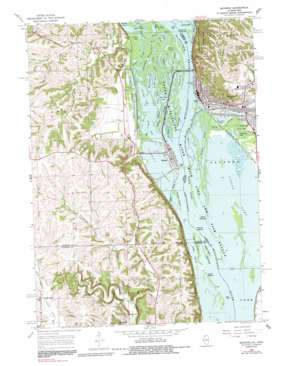
Savanna Topo Map Iowa
To zoom in, hover over the map of Savanna
USGS Topo Quad 42090a2 - 1:24,000 scale
| Topo Map Name: | Savanna |
| USGS Topo Quad ID: | 42090a2 |
| Print Size: | ca. 21 1/4" wide x 27" high |
| Southeast Coordinates: | 42° N latitude / 90.125° W longitude |
| Map Center Coordinates: | 42.0625° N latitude / 90.1875° W longitude |
| U.S. States: | IA, IL |
| Filename: | o42090a2.jpg |
| Download Map JPG Image: | Savanna topo map 1:24,000 scale |
| Map Type: | Topographic |
| Topo Series: | 7.5´ |
| Map Scale: | 1:24,000 |
| Source of Map Images: | United States Geological Survey (USGS) |
| Alternate Map Versions: |
Savanna IL 1967, updated 1968 Download PDF Buy paper map Savanna IL 1967, updated 1983 Download PDF Buy paper map Savanna IL 1967, updated 1991 Download PDF Buy paper map Savanna IL 1967, updated 1991 Download PDF Buy paper map Savanna IL 2011 Download PDF Buy paper map Savanna IL 2012 Download PDF Buy paper map Savanna IL 2015 Download PDF Buy paper map |
1:24,000 Topo Quads surrounding Savanna
> Back to 42090a1 at 1:100,000 scale
> Back to 42090a1 at 1:250,000 scale
> Back to U.S. Topo Maps home
Savanna topo map: Gazetteer
Savanna: Airports
Savanna City Hospital Heliport elevation 242m 793′Savanna: Bays
Savanna Bay elevation 179m 587′Sheepshead Bay elevation 179m 587′
Savanna: Bends
Cavanaugh Bottom elevation 179m 587′Savanna: Bridges
Savanna - Sabula Bridge elevation 178m 583′Savanna-Sabula Bridge elevation 178m 583′
Savanna: Cliffs
Wantea Point elevation 182m 597′Savanna: Islands
Big Cook Island elevation 178m 583′Boy Scout Islands elevation 179m 587′
Cook Island elevation 178m 583′
Dixie Islands elevation 178m 583′
Eldridge Island elevation 179m 587′
Hubbel Island elevation 178m 583′
Island 266 elevation 179m 587′
Little Cook Island elevation 178m 583′
Mound Island elevation 178m 583′
Riprap Island elevation 179m 587′
Savanna Islands elevation 178m 583′
Sweeney Islands elevation 179m 587′
Savanna: Lakes
Alligator Lake elevation 179m 587′Bards Lake elevation 179m 587′
Big Keller Lake elevation 179m 587′
Big Sieber Lake elevation 179m 587′
Bowens Lake elevation 178m 583′
Dead Lake elevation 179m 587′
Doc Wood Lake elevation 179m 587′
Edick Lake elevation 178m 583′
Israel Day Lake elevation 179m 587′
Joe Day Lake elevation 178m 583′
Little Keller Lake elevation 179m 587′
Lower Y Lake elevation 179m 587′
Misquakee Lake elevation 178m 583′
Sabula Lakes elevation 178m 583′
Sieber Lake elevation 179m 587′
Spring Lake elevation 178m 583′
Sunfish Lake elevation 179m 587′
Town Lake elevation 179m 587′
Upper Y Lake elevation 179m 587′
Savanna: Parks
Maquette Park elevation 178m 583′South Sabula Lakes Park elevation 179m 587′
Savanna: Populated Places
Hauntown elevation 184m 603′Sabula elevation 181m 593′
Samoa elevation 189m 620′
Savanna elevation 182m 597′
Teeds Grove elevation 211m 692′
Savanna: Post Offices
Sabula Post Office elevation 181m 593′Teeds Grove Post Office (historical) elevation 211m 692′
Savanna: Streams
Beaver Creek elevation 180m 590′Cook Slough elevation 178m 583′
Dark Chute elevation 178m 583′
East Fork Sabula Slough elevation 179m 587′
Eldridge Slough elevation 179m 587′
Esmay Slough elevation 179m 587′
Hubbel Slough elevation 178m 583′
L Esmay Slough elevation 179m 587′
North Branch Elk River elevation 204m 669′
Plum River elevation 178m 583′
Sabula Slough elevation 179m 587′
Savanna Slough elevation 178m 583′
Schramling Creek elevation 180m 590′
Upper West Fork West Sabula Slough elevation 179m 587′
Savanna digital topo map on disk
Buy this Savanna topo map showing relief, roads, GPS coordinates and other geographical features, as a high-resolution digital map file on DVD:


