Andrew Topo Map Iowa
To zoom in, hover over the map of Andrew
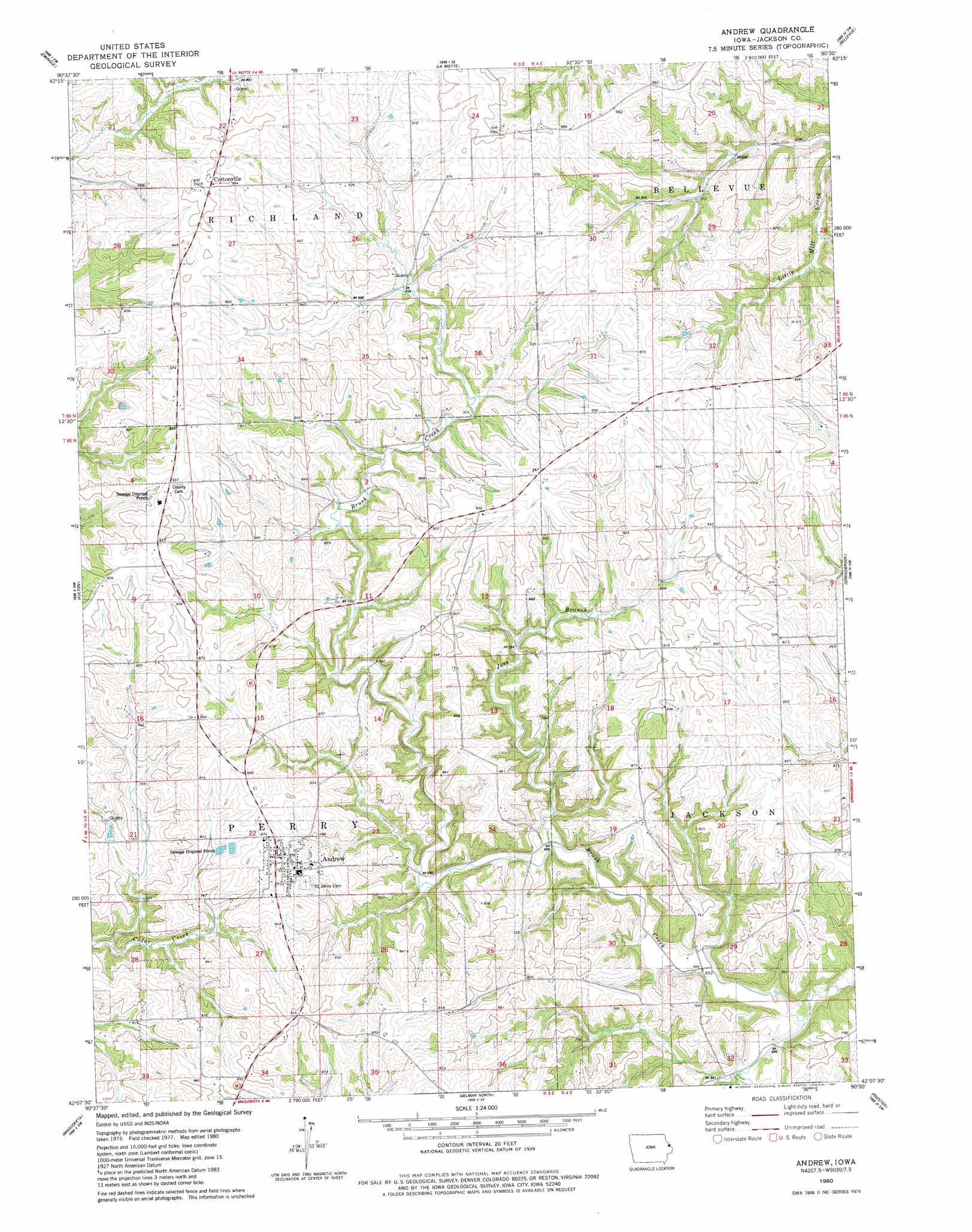
USGS Topo Quad 42090b5 - 1:24,000 scale
| Topo Map Name: | Andrew |
| USGS Topo Quad ID: | 42090b5 |
| Print Size: | ca. 21 1/4" wide x 27" high |
| Southeast Coordinates: | 42.125° N latitude / 90.5° W longitude |
| Map Center Coordinates: | 42.1875° N latitude / 90.5625° W longitude |
| U.S. State: | IA |
| Filename: | o42090b5.jpg |
| Download Map JPG Image: | Andrew topo map 1:24,000 scale |
| Map Type: | Topographic |
| Topo Series: | 7.5´ |
| Map Scale: | 1:24,000 |
| Source of Map Images: | United States Geological Survey (USGS) |
| Alternate Map Versions: |
Andrew IA 1980, updated 1981 Download PDF Buy paper map Andrew IA 2010 Download PDF Buy paper map Andrew IA 2013 Download PDF Buy paper map Andrew IA 2015 Download PDF Buy paper map |
1:24,000 Topo Quads surrounding Andrew
Peosta |
Dubuque South |
Menominee |
Galena |
Scales Mound West |
Bernard |
Zwingle |
La Motte |
Bellevue |
Hanover |
Leisure Lake |
Fulton |
Andrew |
Springbrook |
Green Island |
Baldwin |
Maquoketa |
Delmar North |
Preston |
Miles |
Lost Nation |
Elwood |
Delmar South |
Goose Lake |
Andover |
> Back to 42090a1 at 1:100,000 scale
> Back to 42090a1 at 1:250,000 scale
> Back to U.S. Topo Maps home
Andrew topo map: Gazetteer
Andrew: Parks
Lawrence Van Hook Historical Marker elevation 267m 875′Andrew: Populated Places
Andrew elevation 269m 882′Cottonville elevation 305m 1000′
Andrew: Post Offices
Andrew Post Office elevation 269m 882′Cottonville Post Office (historical) elevation 305m 1000′
Hickory Grove Post Office (historical) elevation 272m 892′
Andrew: Streams
Jess Branch elevation 199m 652′Andrew digital topo map on disk
Buy this Andrew topo map showing relief, roads, GPS coordinates and other geographical features, as a high-resolution digital map file on DVD: