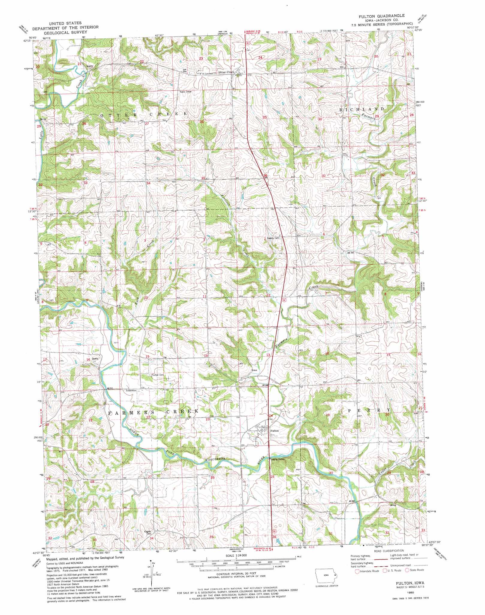
Fulton Topo Map Iowa
To zoom in, hover over the map of Fulton
USGS Topo Quad 42090b6 - 1:24,000 scale
| Topo Map Name: | Fulton |
| USGS Topo Quad ID: | 42090b6 |
| Print Size: | ca. 21 1/4" wide x 27" high |
| Southeast Coordinates: | 42.125° N latitude / 90.625° W longitude |
| Map Center Coordinates: | 42.1875° N latitude / 90.6875° W longitude |
| U.S. State: | IA |
| Filename: | o42090b6.jpg |
| Download Map JPG Image: | Fulton topo map 1:24,000 scale |
| Map Type: | Topographic |
| Topo Series: | 7.5´ |
| Map Scale: | 1:24,000 |
| Source of Map Images: | United States Geological Survey (USGS) |
| Alternate Map Versions: |
Fulton IA 1980, updated 1981 Download PDF Buy paper map Fulton IA 2010 Download PDF Buy paper map Fulton IA 2013 Download PDF Buy paper map Fulton IA 2015 Download PDF Buy paper map |
1:24,000 Topo Quads surrounding Fulton
Epworth |
Peosta |
Dubuque South |
Menominee |
Galena |
Fillmore |
Bernard |
Zwingle |
La Motte |
Bellevue |
Canton |
Leisure Lake |
Fulton |
Andrew |
Springbrook |
Wyoming East |
Baldwin |
Maquoketa |
Delmar North |
Preston |
Oxford Junction |
Lost Nation |
Elwood |
Delmar South |
Goose Lake |
> Back to 42090a1 at 1:100,000 scale
> Back to 42090a1 at 1:250,000 scale
> Back to U.S. Topo Maps home
Fulton topo map: Gazetteer
Fulton: Mines
Iron Hill Quarry elevation 213m 698′Fulton: Populated Places
East Iron Hills elevation 249m 816′Fulton elevation 217m 711′
Otter Creek elevation 311m 1020′
Fulton: Post Offices
Fulton Post Office (historical) elevation 217m 711′New Castle Post Office (historical) elevation 234m 767′
Ottercreek Post Office (historical) elevation 311m 1020′
Fulton: Streams
Buck Creek elevation 212m 695′Cedar Creek elevation 204m 669′
Farmers Creek elevation 204m 669′
Tarecoat Creek elevation 215m 705′
Fulton digital topo map on disk
Buy this Fulton topo map showing relief, roads, GPS coordinates and other geographical features, as a high-resolution digital map file on DVD: