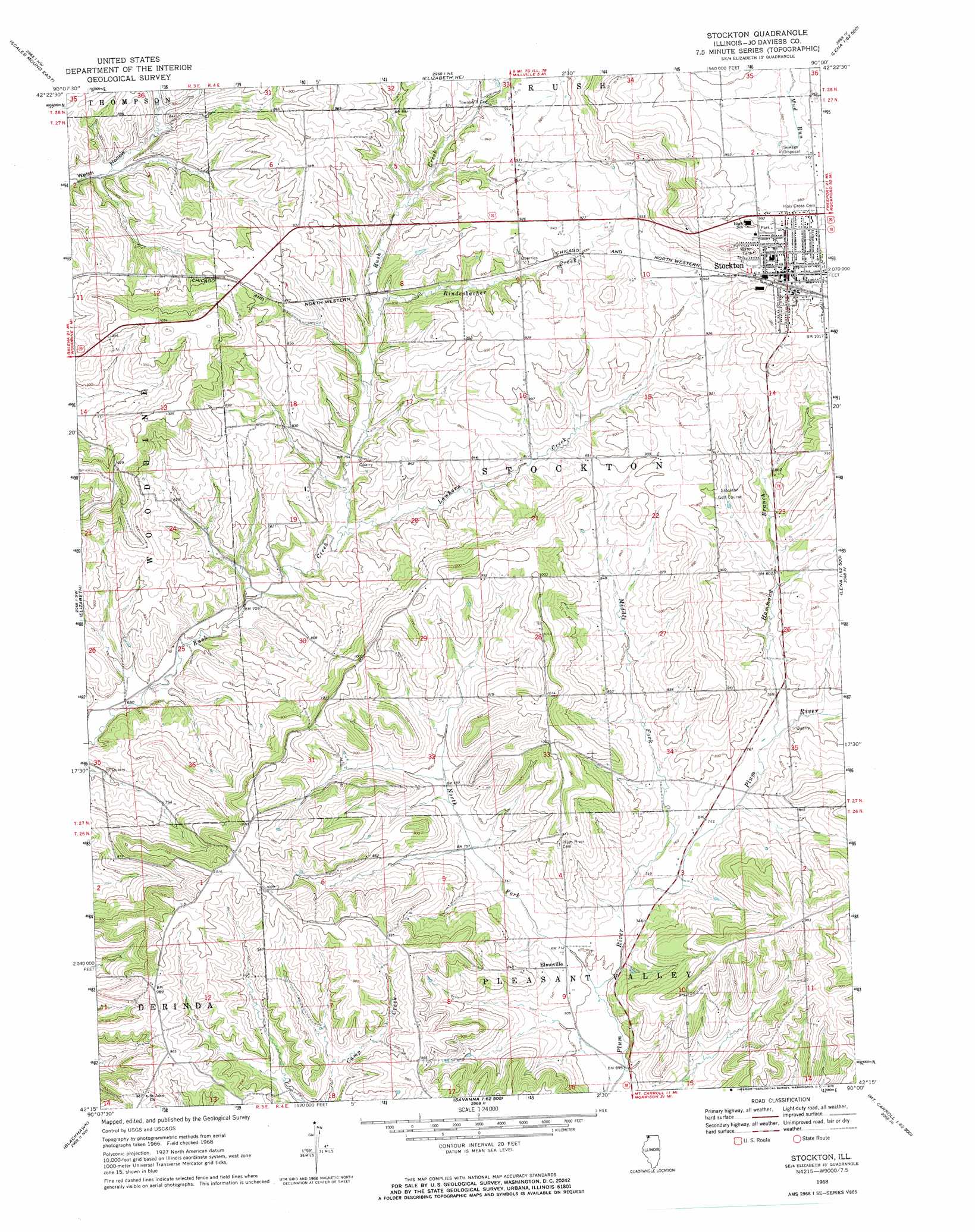
Stockton Topo Map Illinois
To zoom in, hover over the map of Stockton
USGS Topo Quad 42090c1 - 1:24,000 scale
| Topo Map Name: | Stockton |
| USGS Topo Quad ID: | 42090c1 |
| Print Size: | ca. 21 1/4" wide x 27" high |
| Southeast Coordinates: | 42.25° N latitude / 90° W longitude |
| Map Center Coordinates: | 42.3125° N latitude / 90.0625° W longitude |
| U.S. State: | IL |
| Filename: | o42090c1.jpg |
| Download Map JPG Image: | Stockton topo map 1:24,000 scale |
| Map Type: | Topographic |
| Topo Series: | 7.5´ |
| Map Scale: | 1:24,000 |
| Source of Map Images: | United States Geological Survey (USGS) |
| Alternate Map Versions: |
Stockton IL 1968, updated 1970 Download PDF Buy paper map Stockton IL 2012 Download PDF Buy paper map Stockton IL 2015 Download PDF Buy paper map |
1:24,000 Topo Quads surrounding Stockton
New Diggings |
Shullsburg |
Apple River |
South Wayne |
Browntown |
Scales Mound West |
Scales Mound East |
Elizabeth Ne |
Warren |
Lena |
Hanover |
Elizabeth |
Stockton |
Kent |
Pearl City |
Green Island |
Blackhawk |
Pleasant Valley |
Loran |
Boone Branch |
Miles |
Savanna |
Wacker |
Mount Carroll |
Lanark |
> Back to 42090a1 at 1:100,000 scale
> Back to 42090a1 at 1:250,000 scale
> Back to U.S. Topo Maps home
Stockton topo map: Gazetteer
Stockton: Mines
Millershone Quarry elevation 230m 754′Stockton: Populated Places
Elmoville elevation 219m 718′Pitcherville (historical) elevation 293m 961′
Stockton elevation 303m 994′
Stockton: Post Offices
Derinda Post Office (historical) elevation 312m 1023′Rush Post Office (historical) elevation 288m 944′
Winters Post Office (historical) elevation 263m 862′
Yankee Hollow Post Office (historical) elevation 232m 761′
Stockton: Streams
Hammond Branch elevation 229m 751′Lawhorn Creek elevation 221m 725′
Middle Fork Plum River elevation 217m 711′
North Fork Plum River elevation 211m 692′
Rindesbacher Creek elevation 236m 774′
Stockton digital topo map on disk
Buy this Stockton topo map showing relief, roads, GPS coordinates and other geographical features, as a high-resolution digital map file on DVD: