La Motte Topo Map Iowa
To zoom in, hover over the map of La Motte
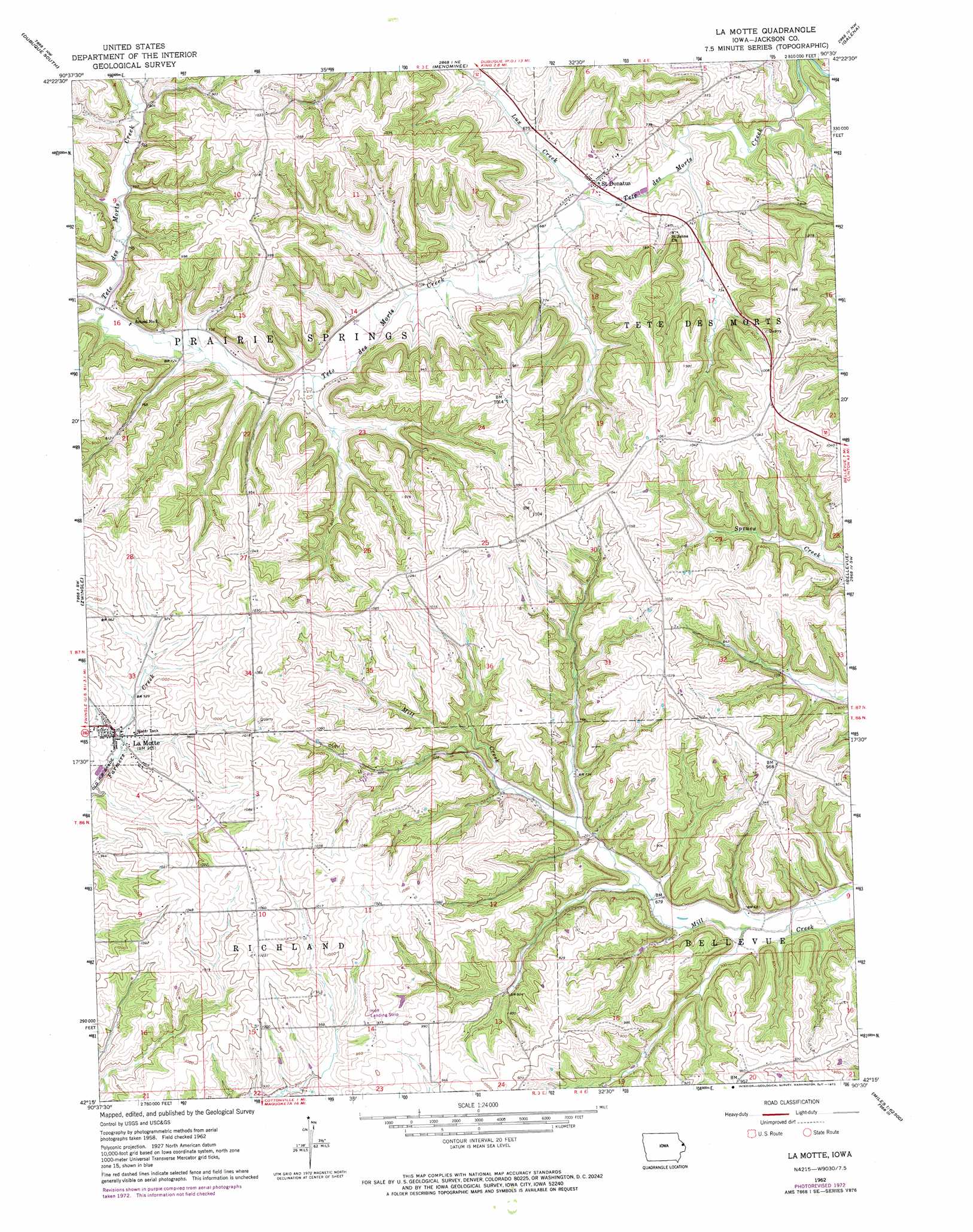
USGS Topo Quad 42090c5 - 1:24,000 scale
| Topo Map Name: | La Motte |
| USGS Topo Quad ID: | 42090c5 |
| Print Size: | ca. 21 1/4" wide x 27" high |
| Southeast Coordinates: | 42.25° N latitude / 90.5° W longitude |
| Map Center Coordinates: | 42.3125° N latitude / 90.5625° W longitude |
| U.S. State: | IA |
| Filename: | o42090c5.jpg |
| Download Map JPG Image: | La Motte topo map 1:24,000 scale |
| Map Type: | Topographic |
| Topo Series: | 7.5´ |
| Map Scale: | 1:24,000 |
| Source of Map Images: | United States Geological Survey (USGS) |
| Alternate Map Versions: |
La Motte IA 1962, updated 1964 Download PDF Buy paper map La Motte IA 1962, updated 1973 Download PDF Buy paper map La Motte IA 2010 Download PDF Buy paper map La Motte IA 2013 Download PDF Buy paper map La Motte IA 2015 Download PDF Buy paper map |
1:24,000 Topo Quads surrounding La Motte
Sherrill |
Dubuque North |
Kieler |
Cuba City |
New Diggings |
Peosta |
Dubuque South |
Menominee |
Galena |
Scales Mound West |
Bernard |
Zwingle |
La Motte |
Bellevue |
Hanover |
Leisure Lake |
Fulton |
Andrew |
Springbrook |
Green Island |
Baldwin |
Maquoketa |
Delmar North |
Preston |
Miles |
> Back to 42090a1 at 1:100,000 scale
> Back to 42090a1 at 1:250,000 scale
> Back to U.S. Topo Maps home
La Motte topo map: Gazetteer
La Motte: Airports
Freedom Field elevation 313m 1026′Hoff Airport elevation 304m 997′
La Motte: Areas
Big Mill Creek Public Hunting Area elevation 205m 672′La Motte: Populated Places
La Motte elevation 282m 925′Saint Donatus elevation 204m 669′
La Motte: Post Offices
La Motte Post Office elevation 280m 918′Saint Donatus Post Office elevation 204m 669′
Tete De Mort Post Office (historical) elevation 204m 669′
La Motte: Streams
Lux Creek elevation 195m 639′La Motte digital topo map on disk
Buy this La Motte topo map showing relief, roads, GPS coordinates and other geographical features, as a high-resolution digital map file on DVD: