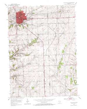
Platteville Topo Map Wisconsin
To zoom in, hover over the map of Platteville
USGS Topo Quad 42090f4 - 1:24,000 scale
| Topo Map Name: | Platteville |
| USGS Topo Quad ID: | 42090f4 |
| Print Size: | ca. 21 1/4" wide x 27" high |
| Southeast Coordinates: | 42.625° N latitude / 90.375° W longitude |
| Map Center Coordinates: | 42.6875° N latitude / 90.4375° W longitude |
| U.S. State: | WI |
| Filename: | o42090f4.jpg |
| Download Map JPG Image: | Platteville topo map 1:24,000 scale |
| Map Type: | Topographic |
| Topo Series: | 7.5´ |
| Map Scale: | 1:24,000 |
| Source of Map Images: | United States Geological Survey (USGS) |
| Alternate Map Versions: |
Platteville WI 1952, updated 1954 Download PDF Buy paper map Platteville WI 1952, updated 1974 Download PDF Buy paper map Platteville WI 2010 Download PDF Buy paper map Platteville WI 2013 Download PDF Buy paper map Platteville WI 2016 Download PDF Buy paper map |
1:24,000 Topo Quads surrounding Platteville
> Back to 42090e1 at 1:100,000 scale
> Back to 42090a1 at 1:250,000 scale
> Back to U.S. Topo Maps home
Platteville topo map: Gazetteer
Platteville: Airports
Grant County Airport elevation 308m 1010′Platteville: Mines
Acme Mine elevation 299m 980′Homestead Mine elevation 296m 971′
Rasque Mine elevation 307m 1007′
Platteville: Parks
City Hall Park elevation 303m 994′Ipswich Prairie State Natural Area elevation 314m 1030′
Legion Park elevation 316m 1036′
Smith Park elevation 314m 1030′
Platteville: Populated Places
Bigpatch elevation 282m 925′Elk Grove elevation 307m 1007′
Elmo elevation 309m 1013′
Ipswich elevation 315m 1033′
Platteville elevation 300m 984′
Platteville: Post Offices
Platteville Post Office elevation 303m 994′Platteville: Streams
Pats Creek elevation 262m 859′Platteville digital topo map on disk
Buy this Platteville topo map showing relief, roads, GPS coordinates and other geographical features, as a high-resolution digital map file on DVD:


