Ellenboro Topo Map Wisconsin
To zoom in, hover over the map of Ellenboro
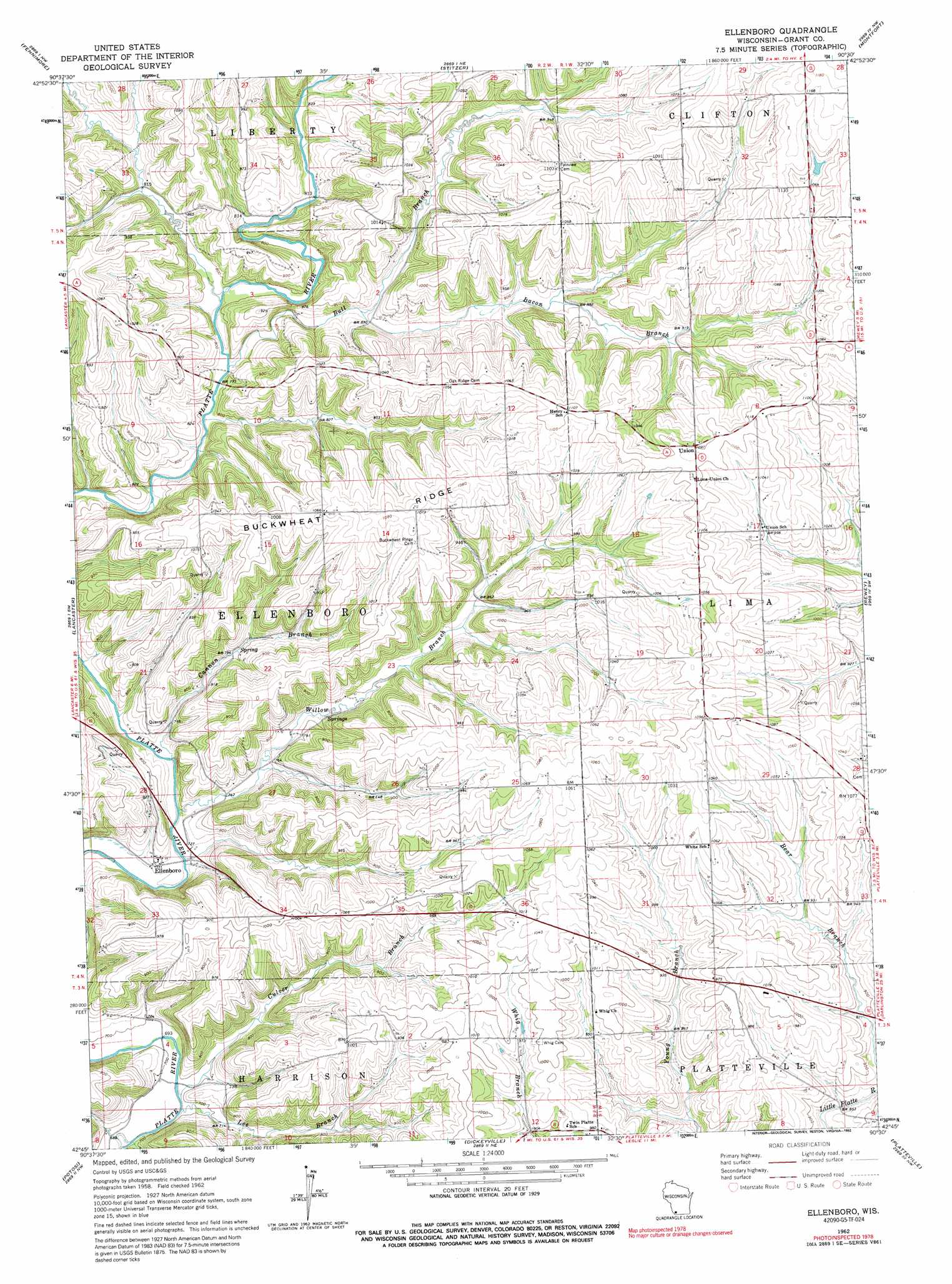
USGS Topo Quad 42090g5 - 1:24,000 scale
| Topo Map Name: | Ellenboro |
| USGS Topo Quad ID: | 42090g5 |
| Print Size: | ca. 21 1/4" wide x 27" high |
| Southeast Coordinates: | 42.75° N latitude / 90.5° W longitude |
| Map Center Coordinates: | 42.8125° N latitude / 90.5625° W longitude |
| U.S. State: | WI |
| Filename: | o42090g5.jpg |
| Download Map JPG Image: | Ellenboro topo map 1:24,000 scale |
| Map Type: | Topographic |
| Topo Series: | 7.5´ |
| Map Scale: | 1:24,000 |
| Source of Map Images: | United States Geological Survey (USGS) |
| Alternate Map Versions: |
Ellenboro WI 1962, updated 1964 Download PDF Buy paper map Ellenboro WI 1962, updated 1992 Download PDF Buy paper map Ellenboro WI 2010 Download PDF Buy paper map Ellenboro WI 2013 Download PDF Buy paper map Ellenboro WI 2016 Download PDF Buy paper map |
1:24,000 Topo Quads surrounding Ellenboro
Wauzeka East |
Long Hollow |
Castle Rock |
Highland West |
Highland East |
Mount Hope |
Fennimore |
Stitzer |
Montfort |
Linden |
Hurricane |
Lancaster |
Ellenboro |
Rewey |
Mifflin |
Balltown |
Potosi |
Dickeyville |
Platteville |
Belmont |
Sherrill |
Dubuque North |
Kieler |
Cuba City |
New Diggings |
> Back to 42090e1 at 1:100,000 scale
> Back to 42090a1 at 1:250,000 scale
> Back to U.S. Topo Maps home
Ellenboro topo map: Gazetteer
Ellenboro: Airports
Martin Fierro Airport elevation 304m 997′Ellenboro: Bridges
Baker Ford Bridge elevation 207m 679′Ellenboro: Populated Places
Ellenboro elevation 227m 744′Union elevation 335m 1099′
Ellenboro: Ridges
Buckwheat Ridge elevation 327m 1072′Ellenboro: Streams
Bacon Branch elevation 247m 810′Bull Branch elevation 234m 767′
Cannon Branch elevation 219m 718′
Culver Branch elevation 207m 679′
Lee Branch elevation 207m 679′
Willow Branch elevation 218m 715′
Ellenboro digital topo map on disk
Buy this Ellenboro topo map showing relief, roads, GPS coordinates and other geographical features, as a high-resolution digital map file on DVD: