Beetown Topo Map Wisconsin
To zoom in, hover over the map of Beetown
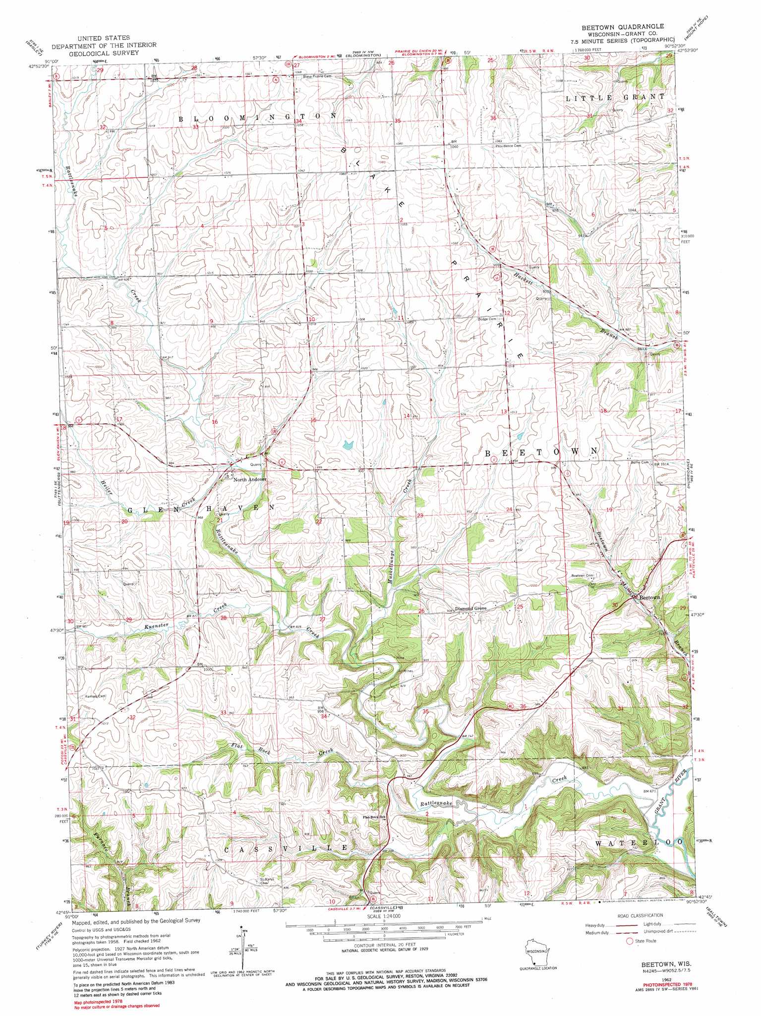
USGS Topo Quad 42090g8 - 1:24,000 scale
| Topo Map Name: | Beetown |
| USGS Topo Quad ID: | 42090g8 |
| Print Size: | ca. 21 1/4" wide x 27" high |
| Southeast Coordinates: | 42.75° N latitude / 90.875° W longitude |
| Map Center Coordinates: | 42.8125° N latitude / 90.9375° W longitude |
| U.S. State: | WI |
| Filename: | o42090g8.jpg |
| Download Map JPG Image: | Beetown topo map 1:24,000 scale |
| Map Type: | Topographic |
| Topo Series: | 7.5´ |
| Map Scale: | 1:24,000 |
| Source of Map Images: | United States Geological Survey (USGS) |
| Alternate Map Versions: |
Beetown WI 1962, updated 1964 Download PDF Buy paper map Beetown WI 1962, updated 1981 Download PDF Buy paper map Beetown WI 2010 Download PDF Buy paper map Beetown WI 2013 Download PDF Buy paper map Beetown WI 2016 Download PDF Buy paper map |
1:24,000 Topo Quads surrounding Beetown
Prairie Du Chien |
Bridgeport |
Wauzeka West |
Wauzeka East |
Long Hollow |
Clayton |
Bagley |
Bloomington |
Mount Hope |
Fennimore |
Garnavillo |
Guttenberg |
Beetown |
Hurricane |
Lancaster |
Colesburg |
Turkey River |
Cassville |
Balltown |
Potosi |
Petersburg |
New Vienna |
Holy Cross |
Sherrill |
Dubuque North |
> Back to 42090e1 at 1:100,000 scale
> Back to 42090a1 at 1:250,000 scale
> Back to U.S. Topo Maps home
Beetown topo map: Gazetteer
Beetown: Flats
Blake Prairie elevation 325m 1066′Beetown: Populated Places
Beetown elevation 247m 810′Diamond Grove elevation 306m 1003′
North Andover elevation 266m 872′
Beetown: Streams
Flat Rock Creek elevation 215m 705′Heiler Creek elevation 261m 856′
Kuenster Creek elevation 249m 816′
Muskellunge Creek elevation 241m 790′
Rattlesnake Creek elevation 201m 659′
Beetown digital topo map on disk
Buy this Beetown topo map showing relief, roads, GPS coordinates and other geographical features, as a high-resolution digital map file on DVD: