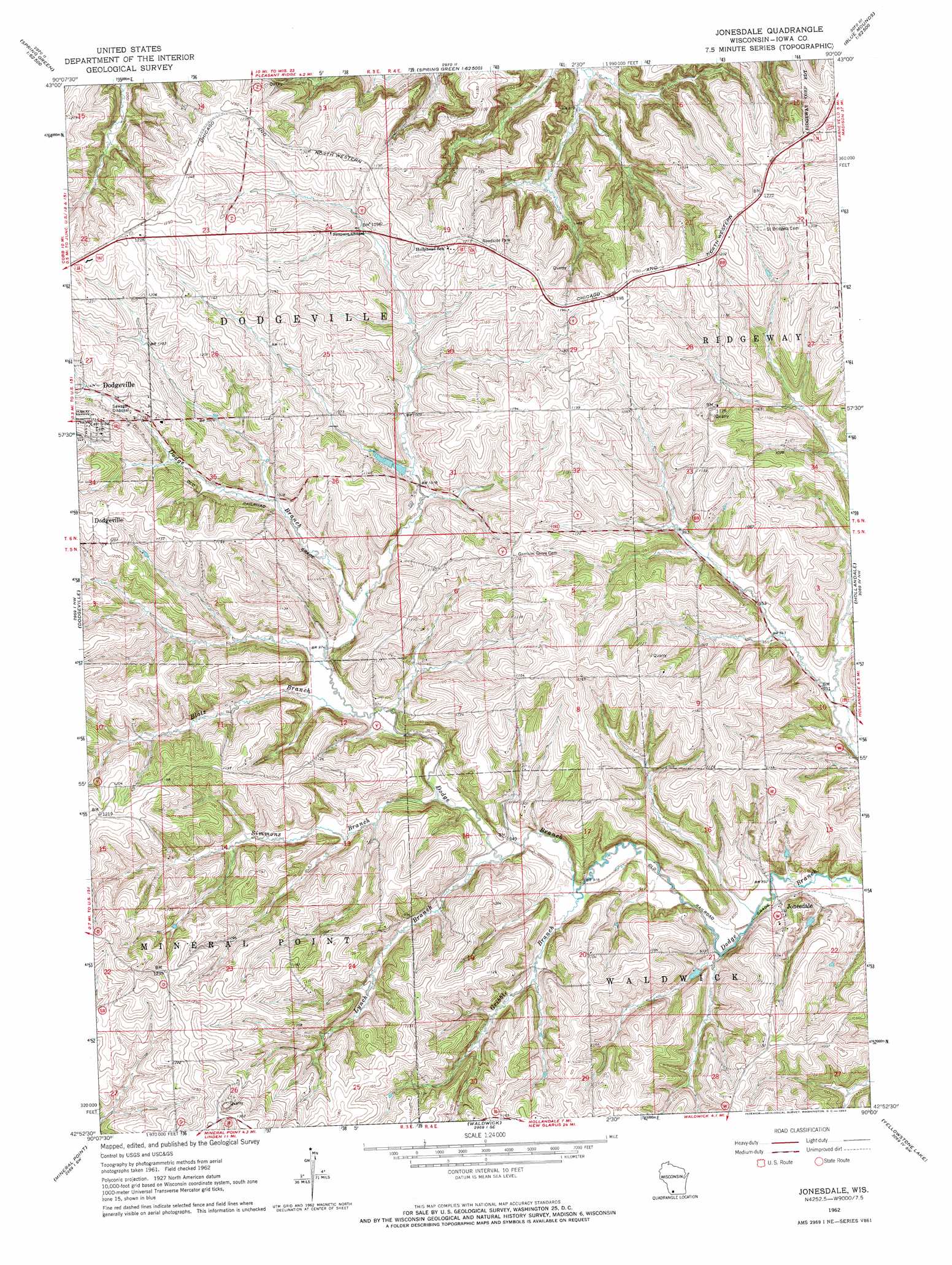
Jonesdale Topo Map Wisconsin
To zoom in, hover over the map of Jonesdale
USGS Topo Quad 42090h1 - 1:24,000 scale
| Topo Map Name: | Jonesdale |
| USGS Topo Quad ID: | 42090h1 |
| Print Size: | ca. 21 1/4" wide x 27" high |
| Southeast Coordinates: | 42.875° N latitude / 90° W longitude |
| Map Center Coordinates: | 42.9375° N latitude / 90.0625° W longitude |
| U.S. State: | WI |
| Filename: | o42090h1.jpg |
| Download Map JPG Image: | Jonesdale topo map 1:24,000 scale |
| Map Type: | Topographic |
| Topo Series: | 7.5´ |
| Map Scale: | 1:24,000 |
| Source of Map Images: | United States Geological Survey (USGS) |
| Alternate Map Versions: |
Jonesdale WI 1962, updated 1964 Download PDF Buy paper map Jonesdale WI 2010 Download PDF Buy paper map Jonesdale WI 2013 Download PDF Buy paper map Jonesdale WI 2016 Download PDF Buy paper map |
1:24,000 Topo Quads surrounding Jonesdale
Avoca |
Lone Rock |
Spring Green |
Arena |
Mazomanie |
Highland East |
Clyde |
Pleasant Ridge |
Barneveld |
Blue Mounds |
Linden |
Dodgeville |
Jonesdale |
Hollandale |
Daleyville |
Mifflin |
Mineral Point |
Waldwick |
Yellowstone Lake |
Blanchardville |
Belmont |
Calamine |
Darlington |
Wiota |
Argyle |
> Back to 42090e1 at 1:100,000 scale
> Back to 42090a1 at 1:250,000 scale
> Back to U.S. Topo Maps home
Jonesdale topo map: Gazetteer
Jonesdale: Airports
Tuschen Airport elevation 326m 1069′Jonesdale: Mines
Iowa County Quarry elevation 368m 1207′Jonesdale: Populated Places
Jonesdale elevation 283m 928′Jonesdale: Streams
Blotz Branch elevation 293m 961′Gribble Branch elevation 278m 912′
Ley Creek elevation 280m 918′
Lynch Branch elevation 283m 928′
Simmons Branch elevation 289m 948′
Jonesdale digital topo map on disk
Buy this Jonesdale topo map showing relief, roads, GPS coordinates and other geographical features, as a high-resolution digital map file on DVD: