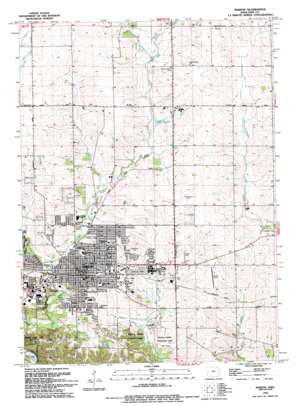
Marion Topo Map Iowa
To zoom in, hover over the map of Marion
USGS Topo Quad 42091a5 - 1:24,000 scale
| Topo Map Name: | Marion |
| USGS Topo Quad ID: | 42091a5 |
| Print Size: | ca. 21 1/4" wide x 27" high |
| Southeast Coordinates: | 42° N latitude / 91.5° W longitude |
| Map Center Coordinates: | 42.0625° N latitude / 91.5625° W longitude |
| U.S. State: | IA |
| Filename: | o42091a5.jpg |
| Download Map JPG Image: | Marion topo map 1:24,000 scale |
| Map Type: | Topographic |
| Topo Series: | 7.5´ |
| Map Scale: | 1:24,000 |
| Source of Map Images: | United States Geological Survey (USGS) |
| Alternate Map Versions: |
Marion IA 1968, updated 1970 Download PDF Buy paper map Marion IA 1968, updated 1976 Download PDF Buy paper map Marion IA 1968, updated 1983 Download PDF Buy paper map Marion IA 1994, updated 1994 Download PDF Buy paper map Marion IA 2010 Download PDF Buy paper map Marion IA 2013 Download PDF Buy paper map Marion IA 2015 Download PDF Buy paper map |
1:24,000 Topo Quads surrounding Marion
> Back to 42091a1 at 1:100,000 scale
> Back to 42090a1 at 1:250,000 scale
> Back to U.S. Topo Maps home
Marion topo map: Gazetteer
Marion: Airports
Marion Airport elevation 262m 859′Marion: Lakes
Robbins Lake elevation 247m 810′Marion: Parks
Boyson Park elevation 237m 777′Daniels and the Old Dubuque Road Historical Marker elevation 263m 862′
Donnelly Park elevation 236m 774′
Eagle Ridge Park elevation 245m 803′
Elza Park elevation 252m 826′
Hanna Park elevation 243m 797′
Legion Park elevation 263m 862′
Lininger Park elevation 239m 784′
Marion Football Field elevation 239m 784′
South Landfill Park elevation 240m 787′
Squaw Creek Regional Park elevation 234m 767′
Starry Park elevation 253m 830′
Tauher Park elevation 259m 849′
Thomas Park elevation 234m 767′
Willow Park elevation 238m 780′
Willowood Park elevation 253m 830′
Marion: Populated Places
Eagle Ridge Community elevation 247m 810′Marion elevation 259m 849′
Marion Mobile Home Park elevation 254m 833′
Squaw Creek Village elevation 255m 836′
Marion: Post Offices
Dry Creek Post Office (historical) elevation 265m 869′Marion Post Office elevation 256m 839′
Rural Post Office (historical) elevation 273m 895′
Marion: Streams
Berrys Run elevation 243m 797′Dry Creek elevation 237m 777′
East Indian Creek elevation 251m 823′
Marion digital topo map on disk
Buy this Marion topo map showing relief, roads, GPS coordinates and other geographical features, as a high-resolution digital map file on DVD:


