Prairieburg Topo Map Iowa
To zoom in, hover over the map of Prairieburg
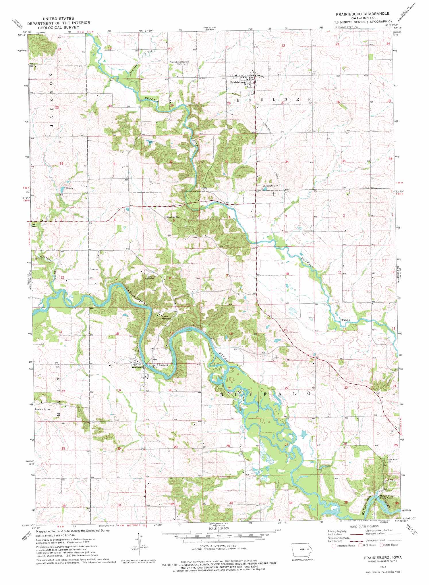
USGS Topo Quad 42091b4 - 1:24,000 scale
| Topo Map Name: | Prairieburg |
| USGS Topo Quad ID: | 42091b4 |
| Print Size: | ca. 21 1/4" wide x 27" high |
| Southeast Coordinates: | 42.125° N latitude / 91.375° W longitude |
| Map Center Coordinates: | 42.1875° N latitude / 91.4375° W longitude |
| U.S. State: | IA |
| Filename: | o42091b4.jpg |
| Download Map JPG Image: | Prairieburg topo map 1:24,000 scale |
| Map Type: | Topographic |
| Topo Series: | 7.5´ |
| Map Scale: | 1:24,000 |
| Source of Map Images: | United States Geological Survey (USGS) |
| Alternate Map Versions: |
Prairieburg IA 1973, updated 1977 Download PDF Buy paper map Prairieburg IA 2010 Download PDF Buy paper map Prairieburg IA 2013 Download PDF Buy paper map Prairieburg IA 2015 Download PDF Buy paper map |
1:24,000 Topo Quads surrounding Prairieburg
Winthrop |
Masonville |
Manchester |
Earlville |
Dyersville West |
Troy Mills |
Coggon |
Ryan |
Hopkinton West |
Hopkinton East |
Lafayette |
Central City |
Prairieburg |
Anamosa Ne |
Monticello |
Cedar Rapids North |
Marion |
Springville |
Anamosa |
Morley |
Cedar Rapids South |
Bertram |
Mount Vernon |
Mechanicsville |
Stanwood |
> Back to 42091a1 at 1:100,000 scale
> Back to 42090a1 at 1:250,000 scale
> Back to U.S. Topo Maps home
Prairieburg topo map: Gazetteer
Prairieburg: Bridges
Matsell Bridge elevation 241m 790′Prairieburg: Parks
Jay G Sigmund Park elevation 244m 800′Matsell Bridge Public Access elevation 240m 787′
Prairieburg: Populated Places
Jordans Grove elevation 298m 977′Paris (historical) elevation 272m 892′
Prairieburg elevation 305m 1000′
Waubeek elevation 255m 836′
Prairieburg: Post Offices
Cousins Post Office (historical) elevation 286m 938′Flemingville Post Office (historical) elevation 270m 885′
Necot Post Office (historical) elevation 277m 908′
Prairieburg Post Office elevation 305m 1000′
Waubeek Post Office (historical) elevation 255m 836′
Prairieburg: Streams
Boulder Creek elevation 262m 859′Heatons Creek elevation 247m 810′
Prairieburg digital topo map on disk
Buy this Prairieburg topo map showing relief, roads, GPS coordinates and other geographical features, as a high-resolution digital map file on DVD: