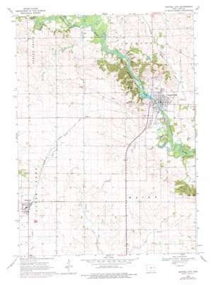
Central City Topo Map Iowa
To zoom in, hover over the map of Central City
USGS Topo Quad 42091b5 - 1:24,000 scale
| Topo Map Name: | Central City |
| USGS Topo Quad ID: | 42091b5 |
| Print Size: | ca. 21 1/4" wide x 27" high |
| Southeast Coordinates: | 42.125° N latitude / 91.5° W longitude |
| Map Center Coordinates: | 42.1875° N latitude / 91.5625° W longitude |
| U.S. State: | IA |
| Filename: | o42091b5.jpg |
| Download Map JPG Image: | Central City topo map 1:24,000 scale |
| Map Type: | Topographic |
| Topo Series: | 7.5´ |
| Map Scale: | 1:24,000 |
| Source of Map Images: | United States Geological Survey (USGS) |
| Alternate Map Versions: |
Central City IA 1968, updated 1970 Download PDF Buy paper map Central City IA 1968, updated 1976 Download PDF Buy paper map Central City IA 2010 Download PDF Buy paper map Central City IA 2013 Download PDF Buy paper map Central City IA 2015 Download PDF Buy paper map |
1:24,000 Topo Quads surrounding Central City
> Back to 42091a1 at 1:100,000 scale
> Back to 42090a1 at 1:250,000 scale
> Back to U.S. Topo Maps home
Central City topo map: Gazetteer
Central City: Airports
Petes Patch Airport elevation 276m 905′Wassmer Landing Strip elevation 287m 941′
Central City: Bridges
Upper Paris Bridge elevation 251m 823′Central City: Parks
Eakpicada County Park elevation 247m 810′Pinicon Ridge County Park elevation 259m 849′
Wakpicada County Park elevation 248m 813′
Central City: Populated Places
Alburnett elevation 269m 882′Central City elevation 254m 833′
Paris elevation 261m 856′
Rogers elevation 281m 921′
Central City: Post Offices
Alburnett Post Office elevation 270m 885′Central City Post Office elevation 253m 830′
Elmont Post Office (historical) elevation 271m 889′
Paris Post Office (historical) elevation 258m 846′
Rogers Post Office (historical) elevation 281m 921′
Torah Post Office (historical) elevation 289m 948′
Wapsa Post Office (historical) elevation 249m 816′
Central City: Streams
Justins Creek elevation 253m 830′Walton Creek elevation 254m 833′
Central City digital topo map on disk
Buy this Central City topo map showing relief, roads, GPS coordinates and other geographical features, as a high-resolution digital map file on DVD:


