Winthrop Topo Map Iowa
To zoom in, hover over the map of Winthrop
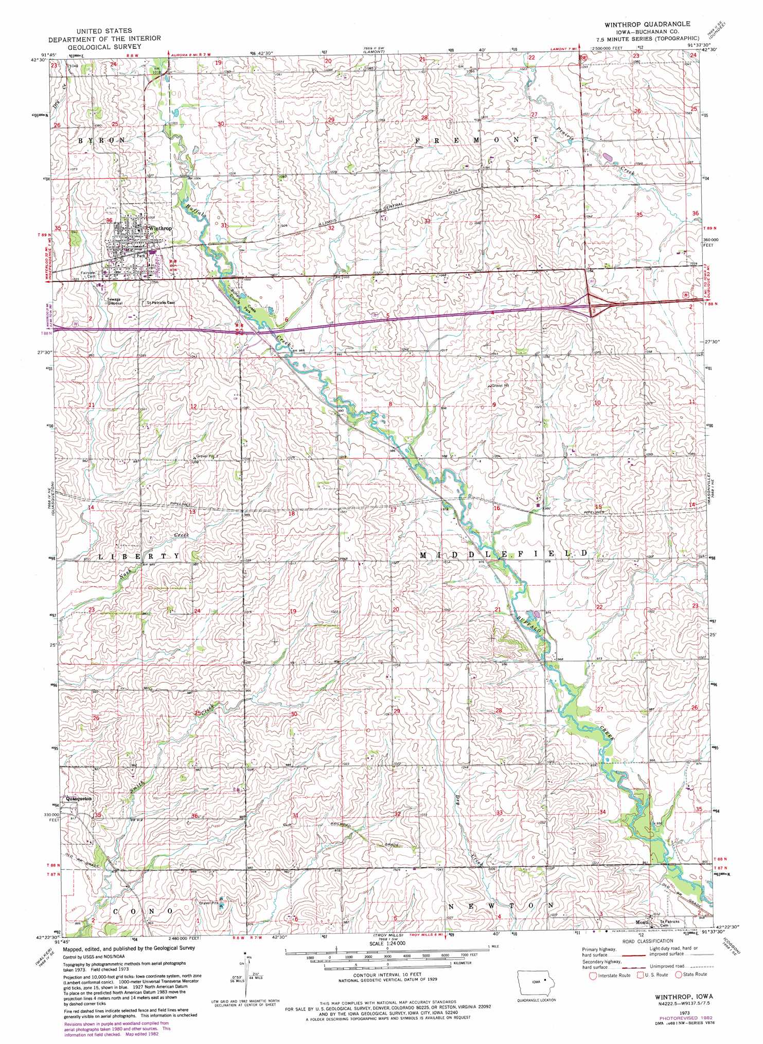
USGS Topo Quad 42091d6 - 1:24,000 scale
| Topo Map Name: | Winthrop |
| USGS Topo Quad ID: | 42091d6 |
| Print Size: | ca. 21 1/4" wide x 27" high |
| Southeast Coordinates: | 42.375° N latitude / 91.625° W longitude |
| Map Center Coordinates: | 42.4375° N latitude / 91.6875° W longitude |
| U.S. State: | IA |
| Filename: | o42091d6.jpg |
| Download Map JPG Image: | Winthrop topo map 1:24,000 scale |
| Map Type: | Topographic |
| Topo Series: | 7.5´ |
| Map Scale: | 1:24,000 |
| Source of Map Images: | United States Geological Survey (USGS) |
| Alternate Map Versions: |
Winthrop IA 1973, updated 1977 Download PDF Buy paper map Winthrop IA 1973, updated 1983 Download PDF Buy paper map Winthrop IA 2010 Download PDF Buy paper map Winthrop IA 2013 Download PDF Buy paper map Winthrop IA 2015 Download PDF Buy paper map |
1:24,000 Topo Quads surrounding Winthrop
Oelwein |
Stanley |
Arlington |
Strawberry Point |
Edgewood |
Hazleton |
Oelwein Se |
Lamont |
Dundee |
Thorpe |
Independence |
Quasqueton |
Winthrop |
Masonville |
Manchester |
Cheney |
Walker |
Troy Mills |
Coggon |
Ryan |
Center Point Nw |
Center Point |
Lafayette |
Central City |
Prairieburg |
> Back to 42091a1 at 1:100,000 scale
> Back to 42090a1 at 1:250,000 scale
> Back to U.S. Topo Maps home
Winthrop topo map: Gazetteer
Winthrop: Parks
Buffalo Creek Access Area elevation 309m 1013′Buffalo Creek County Park elevation 302m 990′
Buffalo Creek Wildlife Area elevation 292m 958′
Winthrop: Populated Places
Monti elevation 305m 1000′Winthrop elevation 321m 1053′
Winthrop: Post Offices
Kiene Post Office (historical) elevation 317m 1040′Middlefield Post Office (historical) elevation 318m 1043′
Monti Post Office (historical) elevation 305m 1000′
Winthrop Post Office elevation 320m 1049′
Winthrop digital topo map on disk
Buy this Winthrop topo map showing relief, roads, GPS coordinates and other geographical features, as a high-resolution digital map file on DVD: