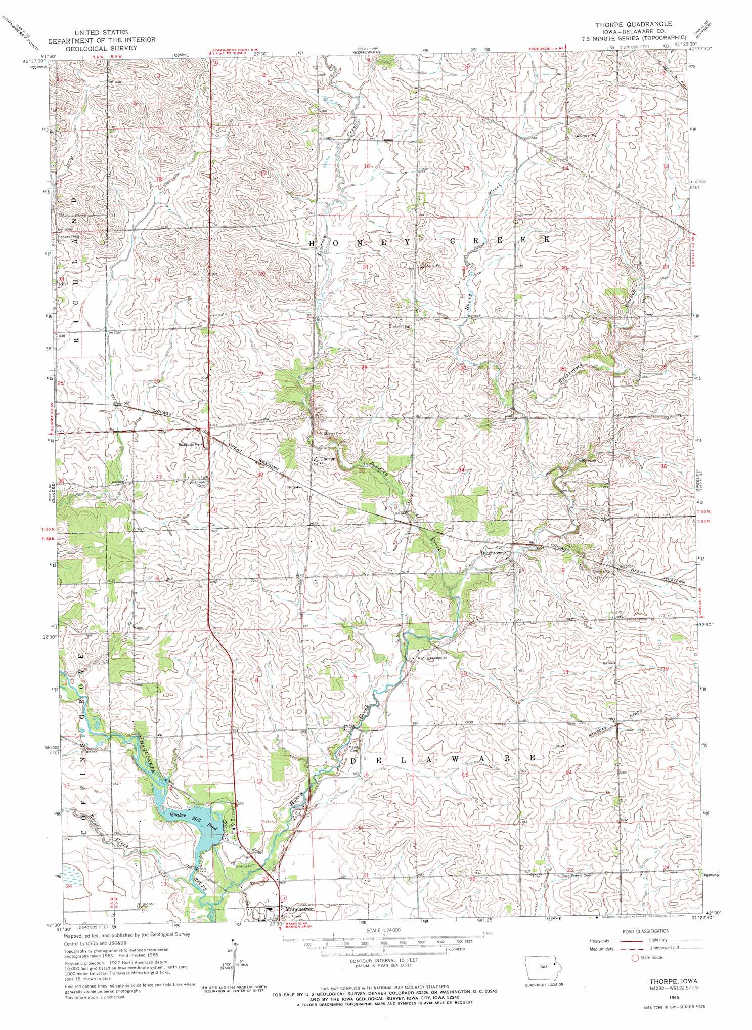
Thorpe Topo Map Iowa
To zoom in, hover over the map of Thorpe
USGS Topo Quad 42091e4 - 1:24,000 scale
| Topo Map Name: | Thorpe |
| USGS Topo Quad ID: | 42091e4 |
| Print Size: | ca. 21 1/4" wide x 27" high |
| Southeast Coordinates: | 42.5° N latitude / 91.375° W longitude |
| Map Center Coordinates: | 42.5625° N latitude / 91.4375° W longitude |
| U.S. State: | IA |
| Filename: | o42091e4.jpg |
| Download Map JPG Image: | Thorpe topo map 1:24,000 scale |
| Map Type: | Topographic |
| Topo Series: | 7.5´ |
| Map Scale: | 1:24,000 |
| Source of Map Images: | United States Geological Survey (USGS) |
| Alternate Map Versions: |
Thorpe IA 1965, updated 1966 Download PDF Buy paper map Thorpe IA 2010 Download PDF Buy paper map Thorpe IA 2013 Download PDF Buy paper map Thorpe IA 2015 Download PDF Buy paper map |
1:24,000 Topo Quads surrounding Thorpe
Wadena |
Volga |
Elkader |
Littleport |
Garnavillo |
Arlington |
Strawberry Point |
Edgewood |
Garber |
Colesburg |
Lamont |
Dundee |
Thorpe |
Greeley |
Petersburg |
Winthrop |
Masonville |
Manchester |
Earlville |
Dyersville West |
Troy Mills |
Coggon |
Ryan |
Hopkinton West |
Hopkinton East |
> Back to 42091e1 at 1:100,000 scale
> Back to 42090a1 at 1:250,000 scale
> Back to U.S. Topo Maps home
Thorpe topo map: Gazetteer
Thorpe: Parks
Seibert Park elevation 290m 951′Thorpe: Populated Places
Dutchtown elevation 301m 987′Thorpe elevation 311m 1020′
Thorpe: Post Offices
Amarill Post Office (historical) elevation 313m 1026′Cold Water Post Office (historical) elevation 323m 1059′
Eads' Grove Post Office (historical) elevation 331m 1085′
Eads Post Office (historical) elevation 305m 1000′
Thorpe Post Office (historical) elevation 311m 1020′
Thorpe: Reservoirs
Quaker Mill Pond elevation 288m 944′Thorpe: Streams
Honey Creek elevation 282m 925′Lindsey Creek elevation 297m 974′
Rieger Creek elevation 283m 928′
Routherford Branch elevation 311m 1020′
Thorpe digital topo map on disk
Buy this Thorpe topo map showing relief, roads, GPS coordinates and other geographical features, as a high-resolution digital map file on DVD: