Lamont Topo Map Iowa
To zoom in, hover over the map of Lamont
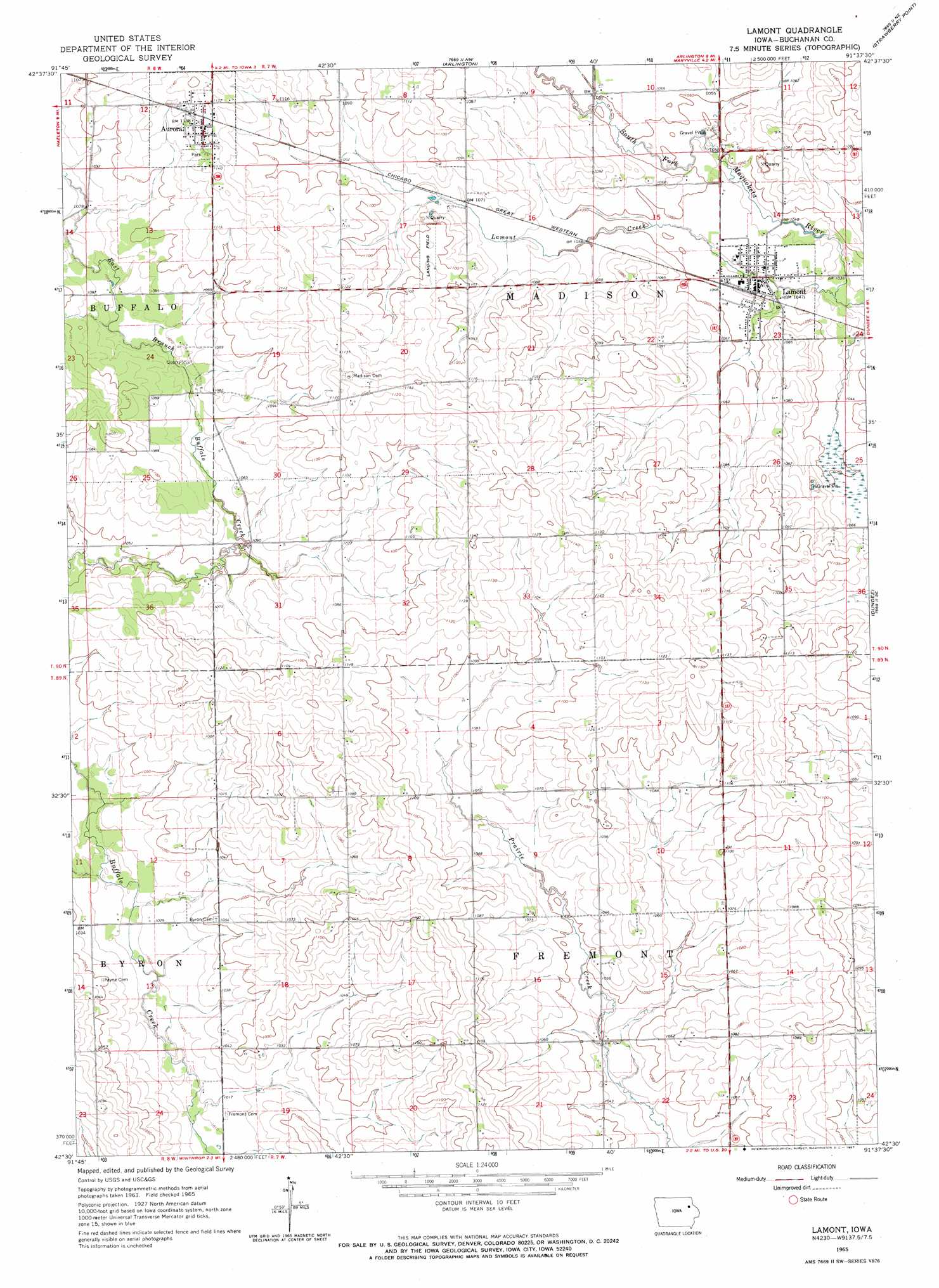
USGS Topo Quad 42091e6 - 1:24,000 scale
| Topo Map Name: | Lamont |
| USGS Topo Quad ID: | 42091e6 |
| Print Size: | ca. 21 1/4" wide x 27" high |
| Southeast Coordinates: | 42.5° N latitude / 91.625° W longitude |
| Map Center Coordinates: | 42.5625° N latitude / 91.6875° W longitude |
| U.S. State: | IA |
| Filename: | o42091e6.jpg |
| Download Map JPG Image: | Lamont topo map 1:24,000 scale |
| Map Type: | Topographic |
| Topo Series: | 7.5´ |
| Map Scale: | 1:24,000 |
| Source of Map Images: | United States Geological Survey (USGS) |
| Alternate Map Versions: |
Lamont IA 1965, updated 1967 Download PDF Buy paper map Lamont IA 1965, updated 1967 Download PDF Buy paper map Lamont IA 2010 Download PDF Buy paper map Lamont IA 2013 Download PDF Buy paper map Lamont IA 2015 Download PDF Buy paper map |
1:24,000 Topo Quads surrounding Lamont
Maynard |
Fayette |
Wadena |
Volga |
Elkader |
Oelwein |
Stanley |
Arlington |
Strawberry Point |
Edgewood |
Hazleton |
Oelwein Se |
Lamont |
Dundee |
Thorpe |
Independence |
Quasqueton |
Winthrop |
Masonville |
Manchester |
Cheney |
Walker |
Troy Mills |
Coggon |
Ryan |
> Back to 42091e1 at 1:100,000 scale
> Back to 42090a1 at 1:250,000 scale
> Back to U.S. Topo Maps home
Lamont topo map: Gazetteer
Lamont: Parks
Jakway Forest County Park elevation 329m 1079′Lamont: Populated Places
Aurora elevation 347m 1138′Lamont elevation 317m 1040′
Lamont: Post Offices
Aurora Post Office elevation 347m 1138′Buffalo Grove Post Office (historical) elevation 328m 1076′
Castleville Post Office (historical) elevation 321m 1053′
Lamont Post Office elevation 317m 1040′
Wards Corners Post Office (historical) elevation 323m 1059′
Lamont: Streams
Lamont Creek elevation 312m 1023′Lamont digital topo map on disk
Buy this Lamont topo map showing relief, roads, GPS coordinates and other geographical features, as a high-resolution digital map file on DVD: