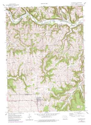
Colesburg Topo Map Iowa
To zoom in, hover over the map of Colesburg
USGS Topo Quad 42091f2 - 1:24,000 scale
| Topo Map Name: | Colesburg |
| USGS Topo Quad ID: | 42091f2 |
| Print Size: | ca. 21 1/4" wide x 27" high |
| Southeast Coordinates: | 42.625° N latitude / 91.125° W longitude |
| Map Center Coordinates: | 42.6875° N latitude / 91.1875° W longitude |
| U.S. State: | IA |
| Filename: | o42091f2.jpg |
| Download Map JPG Image: | Colesburg topo map 1:24,000 scale |
| Map Type: | Topographic |
| Topo Series: | 7.5´ |
| Map Scale: | 1:24,000 |
| Source of Map Images: | United States Geological Survey (USGS) |
| Alternate Map Versions: |
Colesburg IA 1957, updated 1959 Download PDF Buy paper map Colesburg IA 1957, updated 1980 Download PDF Buy paper map Colesburg IA 2010 Download PDF Buy paper map Colesburg IA 2013 Download PDF Buy paper map Colesburg IA 2015 Download PDF Buy paper map |
1:24,000 Topo Quads surrounding Colesburg
> Back to 42091e1 at 1:100,000 scale
> Back to 42090a1 at 1:250,000 scale
> Back to U.S. Topo Maps home
Colesburg topo map: Gazetteer
Colesburg: Bridges
Osterdock Bridge elevation 192m 629′Colesburg: Parks
Ram Hollow - Hoffman Wildlife Area elevation 317m 1040′Colesburg: Populated Places
Colesburg elevation 352m 1154′Fairview elevation 357m 1171′
Osterdock elevation 195m 639′
Snefs elevation 259m 849′
Updegraff elevation 347m 1138′
Colesburg: Post Offices
Colesburg Post Office elevation 352m 1154′Osterdock Post Office (historical) elevation 195m 639′
Pecks Ferry Post Office (historical) elevation 193m 633′
Updegraff Post Office (historical) elevation 347m 1138′
Viola Post Office (historical) elevation 241m 790′
Colesburg: Streams
Bloody Run elevation 234m 767′Carlan Creek elevation 191m 626′
Joles Creek elevation 190m 623′
Mill Creek elevation 197m 646′
Peck Creek elevation 187m 613′
Price Branch elevation 192m 629′
South Cedar Creek elevation 192m 629′
Colesburg: Valleys
Devils Hollow elevation 237m 777′Ram Hollow elevation 256m 839′
Rock Hollow elevation 253m 830′
White Pine Hollow elevation 231m 757′
Colesburg digital topo map on disk
Buy this Colesburg topo map showing relief, roads, GPS coordinates and other geographical features, as a high-resolution digital map file on DVD:


