Stanley Topo Map Iowa
To zoom in, hover over the map of Stanley
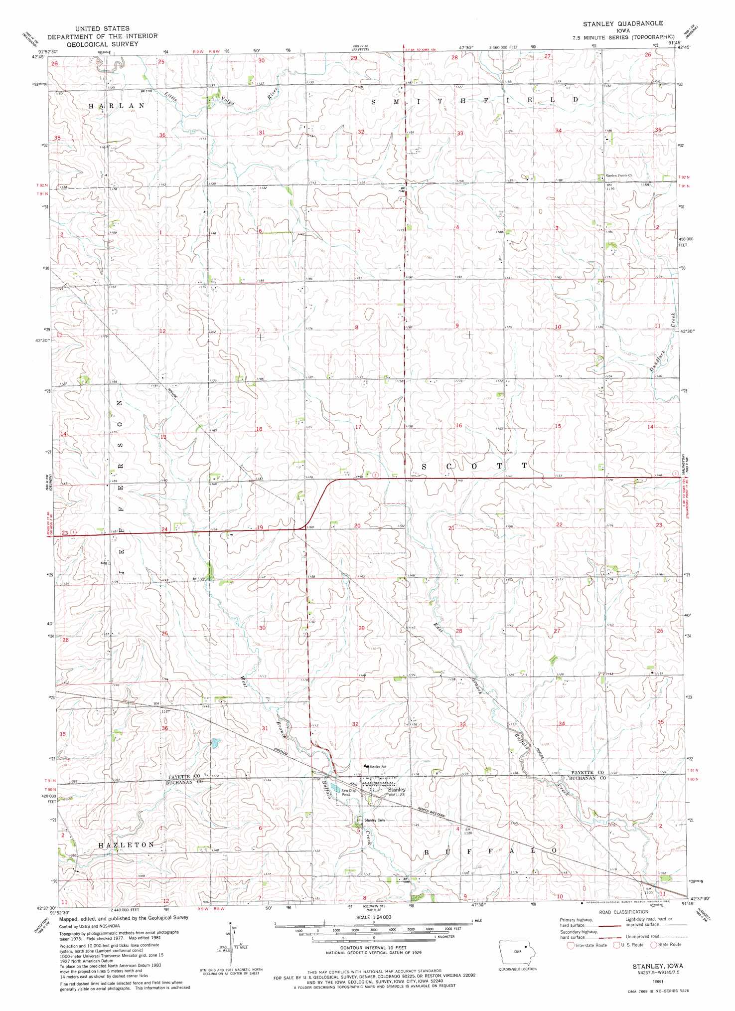
USGS Topo Quad 42091f7 - 1:24,000 scale
| Topo Map Name: | Stanley |
| USGS Topo Quad ID: | 42091f7 |
| Print Size: | ca. 21 1/4" wide x 27" high |
| Southeast Coordinates: | 42.625° N latitude / 91.75° W longitude |
| Map Center Coordinates: | 42.6875° N latitude / 91.8125° W longitude |
| U.S. State: | IA |
| Filename: | o42091f7.jpg |
| Download Map JPG Image: | Stanley topo map 1:24,000 scale |
| Map Type: | Topographic |
| Topo Series: | 7.5´ |
| Map Scale: | 1:24,000 |
| Source of Map Images: | United States Geological Survey (USGS) |
| Alternate Map Versions: |
Stanley IA 1981, updated 1982 Download PDF Buy paper map Stanley IA 2010 Download PDF Buy paper map Stanley IA 2013 Download PDF Buy paper map Stanley IA 2015 Download PDF Buy paper map |
1:24,000 Topo Quads surrounding Stanley
Alpha |
Hawkeye |
West Union |
Elgin |
Gunder |
Sumner |
Maynard |
Fayette |
Wadena |
Volga |
Fairbank |
Oelwein |
Stanley |
Arlington |
Strawberry Point |
Littleton |
Hazleton |
Oelwein Se |
Lamont |
Dundee |
Jesup |
Independence |
Quasqueton |
Winthrop |
Masonville |
> Back to 42091e1 at 1:100,000 scale
> Back to 42090a1 at 1:250,000 scale
> Back to U.S. Topo Maps home
Stanley topo map: Gazetteer
Stanley: Populated Places
Scott elevation 351m 1151′Stanley elevation 340m 1115′
Stanley: Post Offices
Scott Center Post Office (historical) elevation 362m 1187′Scott Post Office (historical) elevation 352m 1154′
Seaton Post Office (historical) elevation 345m 1131′
Stanley Post Office elevation 340m 1115′
Stanley digital topo map on disk
Buy this Stanley topo map showing relief, roads, GPS coordinates and other geographical features, as a high-resolution digital map file on DVD: