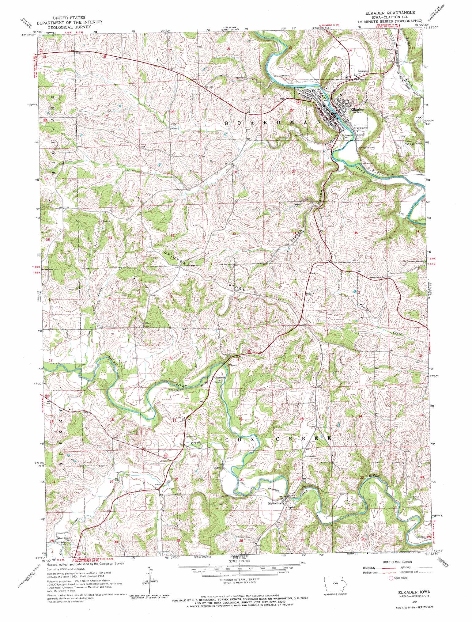
Elkader Topo Map Iowa
To zoom in, hover over the map of Elkader
USGS Topo Quad 42091g4 - 1:24,000 scale
| Topo Map Name: | Elkader |
| USGS Topo Quad ID: | 42091g4 |
| Print Size: | ca. 21 1/4" wide x 27" high |
| Southeast Coordinates: | 42.75° N latitude / 91.375° W longitude |
| Map Center Coordinates: | 42.8125° N latitude / 91.4375° W longitude |
| U.S. State: | IA |
| Filename: | o42091g4.jpg |
| Download Map JPG Image: | Elkader topo map 1:24,000 scale |
| Map Type: | Topographic |
| Topo Series: | 7.5´ |
| Map Scale: | 1:24,000 |
| Source of Map Images: | United States Geological Survey (USGS) |
| Alternate Map Versions: |
Elkader IA 1964, updated 1967 Download PDF Buy paper map Elkader IA 2010 Download PDF Buy paper map Elkader IA 2013 Download PDF Buy paper map Elkader IA 2015 Download PDF Buy paper map |
1:24,000 Topo Quads surrounding Elkader
Castalia |
Postville |
Monona |
Giard |
Prairie Du Chien |
Elgin |
Gunder |
Saint Olaf |
Farmersburg |
Clayton |
Wadena |
Volga |
Elkader |
Littleport |
Garnavillo |
Arlington |
Strawberry Point |
Edgewood |
Garber |
Colesburg |
Lamont |
Dundee |
Thorpe |
Greeley |
Petersburg |
> Back to 42091e1 at 1:100,000 scale
> Back to 42090a1 at 1:250,000 scale
> Back to U.S. Topo Maps home
Elkader topo map: Gazetteer
Elkader: Airports
Central Community Hospital Heliport elevation 281m 921′Elkader Municipal Airport elevation 283m 928′
Elkader: Bridges
Elkader Bridge elevation 221m 725′Keystone Bridge elevation 221m 725′
Meaderville Bridge elevation 215m 705′
Elkader: Parks
Ardell Kader City Park elevation 223m 731′Chicken Ridge Scenic Overlook Park elevation 353m 1158′
Elkader City Park elevation 219m 718′
Lovers Leap Park elevation 231m 757′
Riverside Park elevation 218m 715′
Table Rock Site of July 4 1838 Celebration Historical Marker elevation 219m 718′
Turkey River Park elevation 218m 715′
Elkader: Populated Places
Elkader elevation 223m 731′Mederville elevation 242m 793′
Osborne elevation 236m 774′
Elkader: Post Offices
Cox Creek Post Office (historical) elevation 246m 807′Elkader Post Office elevation 221m 725′
Mederville Post Office (historical) elevation 242m 793′
Osborne Post Office (historical) elevation 236m 774′
Elkader: Streams
Coon Creek elevation 231m 757′Cox Creek elevation 220m 721′
Elkader: Summits
Chicken Ridge elevation 355m 1164′Elkader: Trails
Pony Hollow Trail elevation 218m 715′Elkader: Valleys
French Hollow elevation 216m 708′Elkader digital topo map on disk
Buy this Elkader topo map showing relief, roads, GPS coordinates and other geographical features, as a high-resolution digital map file on DVD: