Elberon Topo Map Iowa
To zoom in, hover over the map of Elberon
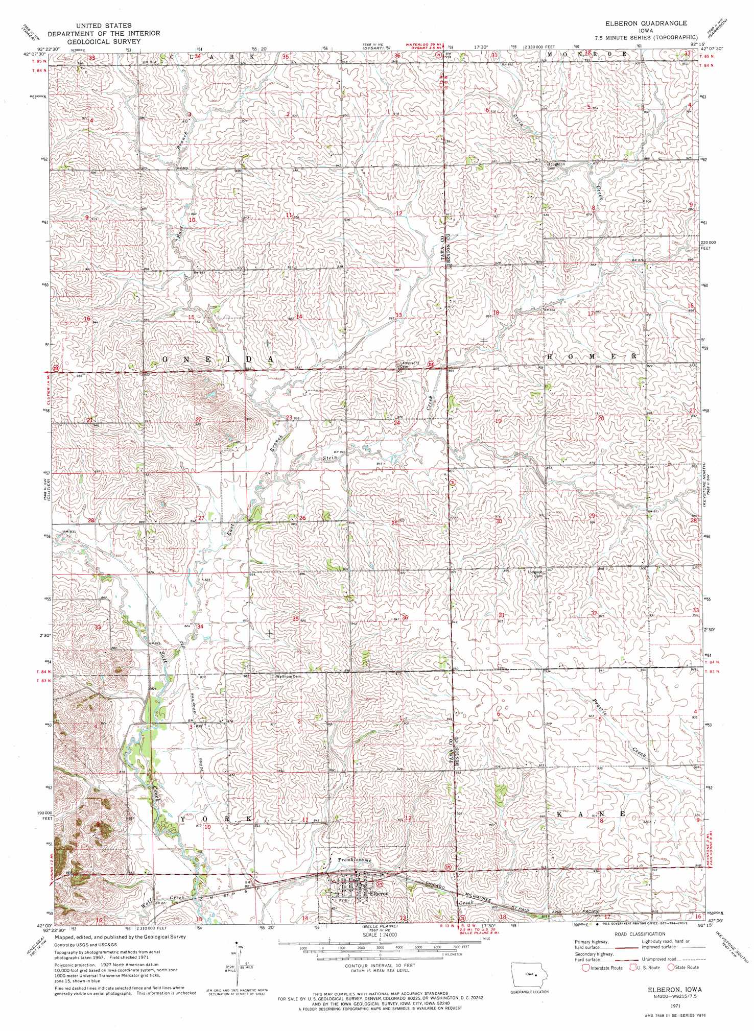
USGS Topo Quad 42092a3 - 1:24,000 scale
| Topo Map Name: | Elberon |
| USGS Topo Quad ID: | 42092a3 |
| Print Size: | ca. 21 1/4" wide x 27" high |
| Southeast Coordinates: | 42° N latitude / 92.25° W longitude |
| Map Center Coordinates: | 42.0625° N latitude / 92.3125° W longitude |
| U.S. State: | IA |
| Filename: | o42092a3.jpg |
| Download Map JPG Image: | Elberon topo map 1:24,000 scale |
| Map Type: | Topographic |
| Topo Series: | 7.5´ |
| Map Scale: | 1:24,000 |
| Source of Map Images: | United States Geological Survey (USGS) |
| Alternate Map Versions: |
Elberon IA 1971, updated 1973 Download PDF Buy paper map Elberon IA 2010 Download PDF Buy paper map Elberon IA 2013 Download PDF Buy paper map Elberon IA 2015 Download PDF Buy paper map |
1:24,000 Topo Quads surrounding Elberon
Reinbeck |
Buckingham |
Eagle Center |
La Porte City |
Brandon |
Gladbrook Ne |
Traer |
Dysart |
Garrison |
Vinton |
Gladbrook Se |
Clutier |
Elberon |
Keystone North |
Van Horne |
Tama |
Chelsea |
Belle Plaine |
Keystone South |
Blairstown |
Sheridan |
Belle Plaine Sw |
Hartwick |
Ladora |
Marengo |
> Back to 42092a1 at 1:100,000 scale
> Back to 42092a1 at 1:250,000 scale
> Back to U.S. Topo Maps home
Elberon topo map: Gazetteer
Elberon: Parks
Site of Former Waltham Historical Marker elevation 261m 856′Elberon: Populated Places
Elberon elevation 269m 882′Elberon: Post Offices
Dryden Post Office (historical) elevation 286m 938′Elberon Post Office elevation 269m 882′
Paul Post Office (historical) elevation 286m 938′
Waltham Post Office (historical) elevation 256m 839′
Elberon: Streams
East Branch Salt Creek elevation 247m 810′Stein Creek elevation 253m 830′
Wolf Creek elevation 247m 810′
Elberon digital topo map on disk
Buy this Elberon topo map showing relief, roads, GPS coordinates and other geographical features, as a high-resolution digital map file on DVD: