Vinton Topo Map Iowa
To zoom in, hover over the map of Vinton
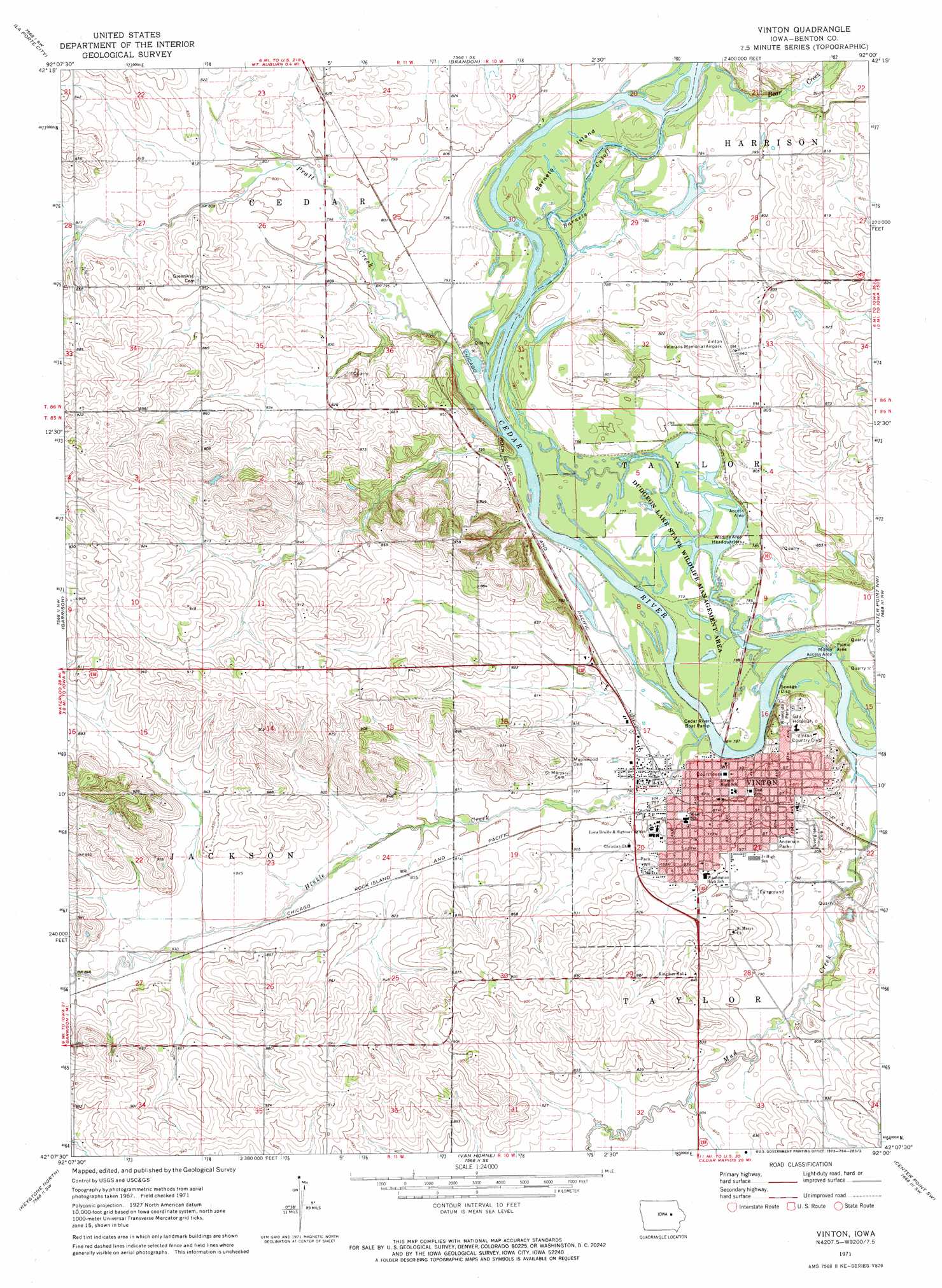
USGS Topo Quad 42092b1 - 1:24,000 scale
| Topo Map Name: | Vinton |
| USGS Topo Quad ID: | 42092b1 |
| Print Size: | ca. 21 1/4" wide x 27" high |
| Southeast Coordinates: | 42.125° N latitude / 92° W longitude |
| Map Center Coordinates: | 42.1875° N latitude / 92.0625° W longitude |
| U.S. State: | IA |
| Filename: | o42092b1.jpg |
| Download Map JPG Image: | Vinton topo map 1:24,000 scale |
| Map Type: | Topographic |
| Topo Series: | 7.5´ |
| Map Scale: | 1:24,000 |
| Source of Map Images: | United States Geological Survey (USGS) |
| Alternate Map Versions: |
Vinton IA 1971, updated 1973 Download PDF Buy paper map Vinton IA 2010 Download PDF Buy paper map Vinton IA 2013 Download PDF Buy paper map Vinton IA 2015 Download PDF Buy paper map |
1:24,000 Topo Quads surrounding Vinton
Waterloo South |
Gilbertville |
Jesup |
Independence |
Quasqueton |
Eagle Center |
La Porte City |
Brandon |
Cheney |
Walker |
Dysart |
Garrison |
Vinton |
Center Point Nw |
Center Point |
Elberon |
Keystone North |
Van Horne |
Center Point Sw |
Shellsburg |
Belle Plaine |
Keystone South |
Blairstown |
Newhall |
Fairfax |
> Back to 42092a1 at 1:100,000 scale
> Back to 42092a1 at 1:250,000 scale
> Back to U.S. Topo Maps home
Vinton topo map: Gazetteer
Vinton: Airports
Vinton Veterans Memorial Airpark elevation 251m 823′Virginia Gay Hospital Heliport elevation 252m 826′
Vinton: Bends
Barnets Cutoff elevation 236m 774′Vinton: Islands
Barnets Island elevation 238m 780′Vinton: Parks
Anderson Park elevation 241m 790′Dudgeon Lake State Wildlife Mgt Area elevation 236m 774′
Jackson Township Wildlife Area elevation 261m 856′
Milroy Access Area elevation 235m 770′
Red Fox Wildlife Area elevation 238m 780′
Riverside Park elevation 249m 816′
Vinton: Populated Places
Vinton elevation 240m 787′Vinton: Post Offices
Vinton Post Office elevation 243m 797′Vinton: Streams
Bear Creek elevation 236m 774′Hinkle Creek elevation 232m 761′
Prairie Creek elevation 233m 764′
Pratt Creek elevation 234m 767′
Vinton digital topo map on disk
Buy this Vinton topo map showing relief, roads, GPS coordinates and other geographical features, as a high-resolution digital map file on DVD: