Dysart Topo Map Iowa
To zoom in, hover over the map of Dysart
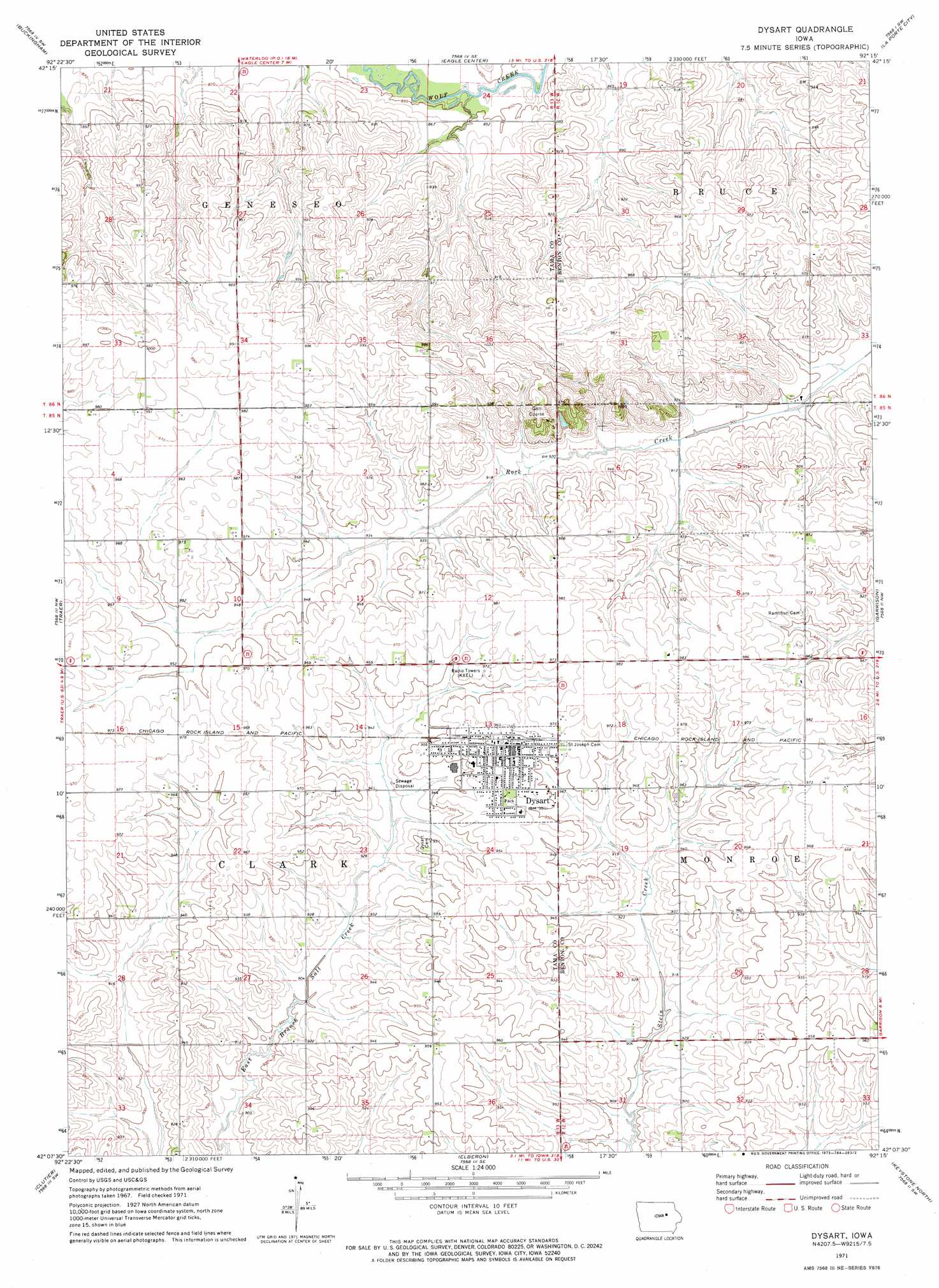
USGS Topo Quad 42092b3 - 1:24,000 scale
| Topo Map Name: | Dysart |
| USGS Topo Quad ID: | 42092b3 |
| Print Size: | ca. 21 1/4" wide x 27" high |
| Southeast Coordinates: | 42.125° N latitude / 92.25° W longitude |
| Map Center Coordinates: | 42.1875° N latitude / 92.3125° W longitude |
| U.S. State: | IA |
| Filename: | o42092b3.jpg |
| Download Map JPG Image: | Dysart topo map 1:24,000 scale |
| Map Type: | Topographic |
| Topo Series: | 7.5´ |
| Map Scale: | 1:24,000 |
| Source of Map Images: | United States Geological Survey (USGS) |
| Alternate Map Versions: |
Dysart IA 1971, updated 1973 Download PDF Buy paper map Dysart IA 2010 Download PDF Buy paper map Dysart IA 2013 Download PDF Buy paper map Dysart IA 2015 Download PDF Buy paper map |
1:24,000 Topo Quads surrounding Dysart
Zaneta |
Hudson |
Waterloo South |
Gilbertville |
Jesup |
Reinbeck |
Buckingham |
Eagle Center |
La Porte City |
Brandon |
Gladbrook Ne |
Traer |
Dysart |
Garrison |
Vinton |
Gladbrook Se |
Clutier |
Elberon |
Keystone North |
Van Horne |
Tama |
Chelsea |
Belle Plaine |
Keystone South |
Blairstown |
> Back to 42092a1 at 1:100,000 scale
> Back to 42092a1 at 1:250,000 scale
> Back to U.S. Topo Maps home
Dysart topo map: Gazetteer
Dysart: Parks
Site of Former Mooreville Historical Marker elevation 263m 862′Dysart: Populated Places
Dysart elevation 296m 971′Mooreville (historical) elevation 258m 846′
Dysart: Post Offices
Dysart Post Office elevation 295m 967′Evergreen Post Office (historical) elevation 278m 912′
Lelia Post Office (historical) elevation 270m 885′
Mooreville Post Office (historical) elevation 258m 846′
Dysart digital topo map on disk
Buy this Dysart topo map showing relief, roads, GPS coordinates and other geographical features, as a high-resolution digital map file on DVD: