New Hartford Topo Map Iowa
To zoom in, hover over the map of New Hartford
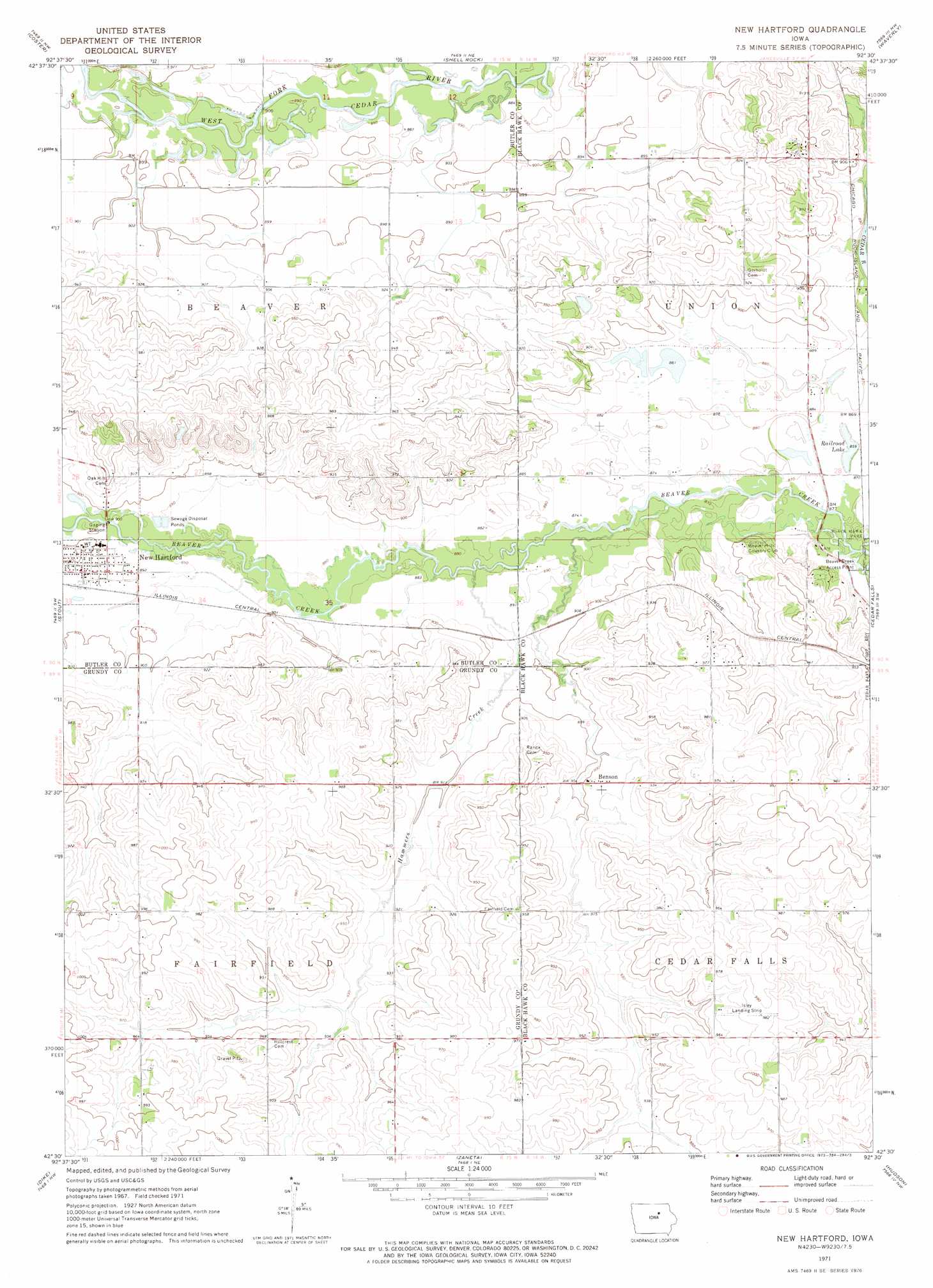
USGS Topo Quad 42092e5 - 1:24,000 scale
| Topo Map Name: | New Hartford |
| USGS Topo Quad ID: | 42092e5 |
| Print Size: | ca. 21 1/4" wide x 27" high |
| Southeast Coordinates: | 42.5° N latitude / 92.5° W longitude |
| Map Center Coordinates: | 42.5625° N latitude / 92.5625° W longitude |
| U.S. State: | IA |
| Filename: | o42092e5.jpg |
| Download Map JPG Image: | New Hartford topo map 1:24,000 scale |
| Map Type: | Topographic |
| Topo Series: | 7.5´ |
| Map Scale: | 1:24,000 |
| Source of Map Images: | United States Geological Survey (USGS) |
| Alternate Map Versions: |
New Hartford IA 1971, updated 1973 Download PDF Buy paper map New Hartford IA 2010 Download PDF Buy paper map New Hartford IA 2013 Download PDF Buy paper map New Hartford IA 2015 Download PDF Buy paper map |
1:24,000 Topo Quads surrounding New Hartford
Allison |
Clarksville |
Plainfield |
Bremer |
Tripoli |
Butler Center |
Coster |
Shell Rock |
Waverly |
Denver |
Parkersburg |
Stout |
New Hartford |
Cedar Falls |
Waterloo North |
Holland |
Dike |
Zaneta |
Hudson |
Waterloo South |
Grundy Center |
Lincoln |
Reinbeck |
Buckingham |
Eagle Center |
> Back to 42092e1 at 1:100,000 scale
> Back to 42092a1 at 1:250,000 scale
> Back to U.S. Topo Maps home
New Hartford topo map: Gazetteer
New Hartford: Airports
Bluebird Airport elevation 280m 918′Isley Field elevation 302m 990′
New Hartford: Lakes
Railroad Lake elevation 261m 856′New Hartford: Parks
Beaver Creek Access Point elevation 262m 859′New Hartford: Populated Places
Benson elevation 275m 902′New Hartford elevation 274m 898′
New Hartford: Post Offices
Benson Post Office (historical) elevation 275m 902′Elizabeth Post Office (historical) elevation 286m 938′
New Hartford Post Office elevation 273m 895′
New Hartford: Streams
Hammers Creek elevation 266m 872′New Hartford digital topo map on disk
Buy this New Hartford topo map showing relief, roads, GPS coordinates and other geographical features, as a high-resolution digital map file on DVD: